Parish of Delalah
Delalah Parish is a remote civil Parish, of the County of Delalah[1] a cadasteral division of New South Wales.[2]
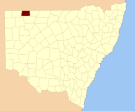
Delalah County
Geography
The Parish is located at 29°14′37″S 143°06′37″E. The topography of the parish is the flat and arid with a Köppen climate classification of BWh (Hot semi arid).[3]
The economy in the parish is based on broad acre agriculture, mainly Cattle, and somesheep. There are no towns in the parish and the nearest settlement is Tibooburra, New South Wales.
History
The parish is on the traditional land of the Karrengappa people. The first Europeans through the area were Burke and Wills and in the 1890s was included in the Albert Goldfields.
gollark: There are ways to hide the source at least, but you cannot do "copy protection".
gollark: <@356209633313947648> Don't have proprietary software on CC? Proprietary bad.
gollark: It's JSON. Which is very space-inefficient.
gollark: <@114827439070248961> 8KB area at tape start.
gollark: I made a thing to bulk-convert files to DFPWM and stick them on a tape, with metadata, so you can select tracks. The playback thing just randomly picks tracks, because UIs are hard.
References
- Map of the County of Delalah, Western Division, N.S.W., 1914 (Department of Lands, Sydney N.S.W, 1914).
- "Delalah". Geographical Names Register (GNR) of NSW. Geographical Names Board of New South Wales. Retrieved 4 August 2013.

- Peel, M. C.; Finlayson, B. L.; McMahon, T. A. (2007). "Updated world map of the Köppen–Geiger climate classification". Hydrol. Earth Syst. Sci. 11: 1633–1644. doi:10.5194/hess-11-1633-2007. ISSN 1027-5606. (direct: Final Revised Paper)
This article is issued from Wikipedia. The text is licensed under Creative Commons - Attribution - Sharealike. Additional terms may apply for the media files.