Palo Hincado, Barranquitas, Puerto Rico
Palo Hincado is a barrio in the municipality of Barranquitas, Puerto Rico. Its population in 2010 was 4,587.[3][4][5]
Palo Hincado | |
|---|---|
Barrio | |
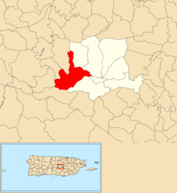 Location of Palo Hincado within the municipality of Barranquitas shown in red | |
 Palo Hincado Location of Puerto Rico | |
| Coordinates: 18°11′27″N 66°20′59″W[1] | |
| Commonwealth | |
| Municipality | |
| Area | |
| • Total | 5.44 sq mi (14.1 km2) |
| • Land | 5.44 sq mi (14.1 km2) |
| • Water | 0.00 sq mi (0.0 km2) |
| Elevation | 2,123 ft (647 m) |
| Population (2010) | |
| • Total | 4,587 |
| • Density | 323.7/sq mi (125.0/km2) |
| Source: 2010 Census | |
| Time zone | UTC−4 (AST) |
History
The United States took control of Puerto Rico from Spain in the aftermath of the Spanish-American War under the terms of the Treaty of Paris of 1898. In 1899, the United States conducted its first census of Puerto Rico finding that the population of Palo Hincado barrio was 1,299.[6]
Palo Hincado may have been the home of Taíno chief Orocobix in the early 16th century.[7]
gollark: You should suggest to them that they have unrealistic expectations.
gollark: Ooh, we could spread the Dino Game virally.
gollark: Anyway, I did this because it is *designed* for single user use.
gollark: The other strain is based on a different thing and even conveniently tells you which pages it just spread to.
gollark: Well, not really, that one is lost, but it's based on that.
See also
References
- "US Gazetteer 2019". US Census. US Government.
- U.S. Geological Survey Geographic Names Information System: Palo Hincado barrio
- Picó, Rafael; Buitrago de Santiago, Zayda; Berrios, Hector H. Nueva geografía de Puerto Rico: física, económica, y social, por Rafael Picó. Con la colaboración de Zayda Buitrago de Santiago y Héctor H. Berrios. San Juan Editorial Universitaria, Universidad de Puerto Rico,1969.
- Gwillim Law (20 May 2015). Administrative Subdivisions of Countries: A Comprehensive World Reference, 1900 through 1998. McFarland. p. 300. ISBN 978-1-4766-0447-3. Retrieved 25 December 2018.
- Puerto Rico:2010:population and housing unit counts.pdf (PDF). U.S. Dept. of Commerce, Economics and Statistics Administration, U.S. Census Bureau. 2010.
- Joseph Prentiss Sanger; Henry Gannett; Walter Francis Willcox (1900). Informe sobre el censo de Puerto Rico, 1899, United States. War Dept. Porto Rico Census Office (in Spanish). Imprenta del gobierno. p. 165.
- Rouse, I. (1952). Porto Rican Prehistory: Excavations in the Interior, South and East: Chronological Implications. Scientific survey of Porto Rico and the Virgin Islands. The Academy. Retrieved 11 April 2020.
Palo Hincado may have been the residence of chief Orocobix, the historic ruler of the district of Jatibonico. It corresponds well to the position usually given for his village (FIGURE 2:11).
This article is issued from Wikipedia. The text is licensed under Creative Commons - Attribution - Sharealike. Additional terms may apply for the media files.