Pakutia Union
Pakutia Union (Bengali: পাকুটিয়া ইউনিয়ন) is a union of Nagarpur Upazila, Tangail District, Bangladesh. It is situated 40 km southeast of Tangail city and 64 km northwest of Dhaka, The capital of Bangladesh.
Pakutia Union পাকুটিয়া ইউনিয়ন | |
|---|---|
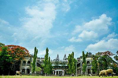 Pakutia Rajbari | |
 Pakutia Union Location of Pakutia in Bangladesh | |
| Coordinates: 24.020717864792935°N 89.98706370592117°E | |
| Country | Bangladesh |
| Division | Dhaka Division |
| District | Tangail District |
| Upazila | Nagarpur Upazila |
| Established on | 1984 |
| Government | |
| • Type | Union Council |
| • Chairman | Siddiqur Rahman(Bangladesh Nationalist Party) |
| Area | |
| • Total | 17.39 km2 (6.71 sq mi) |
| Elevation | 15 m (49 ft) |
| Population (2011) | |
| • Total | 18,184 |
| • Density | 1,000/km2 (2,700/sq mi) |
| Time zone | UTC+6 (BST) |
| Postal code | 1936 |
| Website | Official Website of Pakutia Union |
Demographics
According to Population Census 2011 performed by Bangladesh Bureau of Statistics, The total population of Pakutia union is 18,184 .There are households 4,290 in total.[1]
gollark: Also, RISC-V is more open than x86-64, which is... not.
gollark: Also, a phone is not comparable to a desktop and you seem to be conflating used and new hardware pricing.
gollark: <@202992030685724675> Binary size is basically a nonissue and most stuff will just be compiled for ARM using, you know, a compiler, involving little extra effort.
gollark: <@151391317740486657> install and use linux
gollark: It's quite telling.
See also
- Union Councils of Tangail District
References
- "Tangail Table C-01 : Area, Households, Population, Density by Residence and Community" (PDF). bbs.gov.bd. Archived from the original (PDF) on 2014-11-13. Retrieved 2016-03-01.
This article is issued from Wikipedia. The text is licensed under Creative Commons - Attribution - Sharealike. Additional terms may apply for the media files.