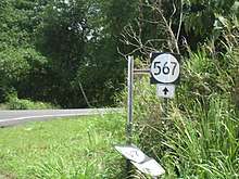
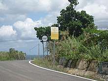
Puerto Rico Highway 567
Puerto Rico Highway 567 (PR-567) is a north–south rural road located between the municipalities of Orocovis and Morovis, Puerto Rico.[3] It extends from its junction with PR-157 on the Barros–Damián Arriba line in Orocovis,[4] passing through Vaga, Pasto and San Lorenzo barrios until its end at its intersection with PR-145 and PR-6622 in the Torrecillas–Morovis Norte line in Morovis.[5][6]
| ||||
|---|---|---|---|---|
| Route information | ||||
| Maintained by Puerto Rico DTPW | ||||
| Length | 16.3 km[1] (10.1 mi) | |||
| Existed | 1953[2]–present | |||
| Major junctions | ||||
| South end | ||||
| North end | ||||
| Location | ||||
| Municipalities | Orocovis, Morovis | |||
| Highway system | ||||
| ||||
Major intersections

PR-567 in Morovis
| Municipality | Location | km[1] | mi | Destinations | Notes |
|---|---|---|---|---|---|
| Orocovis | Barros–Damián Arriba line | 0.0 | 0.0 | Southern terminus of PR-567 | |
| Morovis | Pasto–Vaga line | 4.6 | 2.9 | ||
| Torrecillas–Morovis Norte line | 16.3 | 10.1 | Northern terminus of PR-567 | ||
| 1.000 mi = 1.609 km; 1.000 km = 0.621 mi | |||||
Related route
| |
|---|---|
| Location | Morovis |
| Length | 2.8 km[7] (1.7 mi) |
Puerto Rico Highway 5567 (PR-5567) is a spur route located in Morovis. It extends from PR-567 on the Pasto–Vaga line to Vaga barrio.[8]

PR-5567 heading to Vaga barrio in Morovis
The entire route is located in Morovis.
| Location | km[7] | mi | Destinations | Notes | |
|---|---|---|---|---|---|
| Pasto–Vaga line | 0.0 | 0.0 | Southern terminus of PR-5567 | ||
| Vaga | 2.8 | 1.7 | Barrio Vaga – Morovis | Northern terminus of PR-5567 | |
| 1.000 mi = 1.609 km; 1.000 km = 0.621 mi | |||||
gollark: Because the second one is apparently pretty practical with a cheap SDR and some antennas, I believe some people on here do it.
gollark: Do you mean actually meddle with them or just receive them?
gollark: Weird.
gollark: Nowadays, if someone came up with the idea of sending privileged system messages down something the user could easily read/write to, they would probably not be taken seriously, but it seems like they just... didn't think of the security implications? Or thought doing it differently would be too costly maybe.
gollark: It seems really bizarre that people came up with this whole in-band signalling system and thought it was a good idea.
See also
References
- Google (29 February 2020). "PR-567" (Map). Google Maps. Google. Retrieved 29 February 2020.
- "Morovis, Memoria Núm. 65" (PDF). Puerto Rico Planning Board (in Spanish). 1955. Retrieved 22 February 2020.
- Puerto Rico (fold out) (Map). National Geographic Adventure Map (Book 3107). 7 May 2011. ISBN 978-1566955188.
- "PR-567, Orocovis, Puerto Rico". geoview.info. Retrieved 22 February 2020.
- "Tránsito Promedio Diario (AADT)". Transit Data (Datos de Transito) (in Spanish). DTOP PR. p. 116.
- "PR-567, Morovis, Puerto Rico". geoview.info. Retrieved 22 February 2020.
- Google (22 March 2020). "PR-5567" (Map). Google Maps. Google. Retrieved 22 March 2020.
- "PR-5567, Morovis, Puerto Rico". geoview.info. Retrieved 22 March 2020.
External links
| Wikimedia Commons has media related to |
This article is issued from Wikipedia. The text is licensed under Creative Commons - Attribution - Sharealike. Additional terms may apply for the media files.
