Oude-Tonge
Oude-Tonge is a town in the Dutch province of South Holland. It is a part of the municipality of Goeree-Overflakkee, and lies about 16 km south of Hellevoetsluis. In 2015, the town of Oude-Tonge had 5,500 inhabitants. The built-up area of the town was 0.9 km², and contained 1,615 residences.[1] The wider statistical district "Oude-Tonge", which includes the surrounding countryside, has a population of around 5,500.[2]
Oude-Tonge | |
|---|---|
Town | |
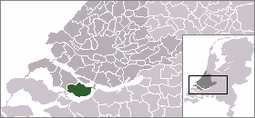 | |
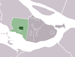 The town centre (darkgreen) and the statistical district (lightgreen) of Oude-Tonge in the former municipality of Oostflakkee. | |
| Coordinates: 51.6909725°N 4.2126986°E | |
| Country | Netherlands |
| Province | South Holland |
| Municipality | Goeree-Overflakkee |
| Population (1 January 2015) | 5,500 |
Oude-Tonge was a separate municipality until 1966, when it became part of Oostflakkee.[3] Last one has made part of the new municipality of Goeree-Overflakkee since 2013.
Gallery
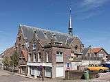 Catholic church: de kerk OLV Hemelvaart
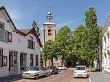 Reformed church in the street
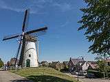 Windmill: korenmolen de Korenbloem
gollark: Time to go on an incubate spree and waste them all!
gollark: Okay, so not actually all...
gollark: Oh, hey, all mine are back now. Mostly.
gollark: Luck: Weird and Oscillating.
gollark: Wow! I caught my first Copper!
References
- Statistics Netherlands (CBS), Bevolkingskernen in Nederland 2001 . Statistics are for the continuous built-up area.
- Statistics Netherlands (CBS), Gemeente Op Maat 2004: Oostflakkee .
- Ad van der Meer and Onno Boonstra, Repertorium van Nederlandse gemeenten, KNAW, 2011.
External links
| Wikimedia Commons has media related to Oude-Tonge. |
- J. Kuyper, Gemeente Atlas van Nederland, 1865-1870, "Oude-Tonge". Map of the former municipality, around 1868.
This article is issued from Wikipedia. The text is licensed under Creative Commons - Attribution - Sharealike. Additional terms may apply for the media files.