Oregon Route 70
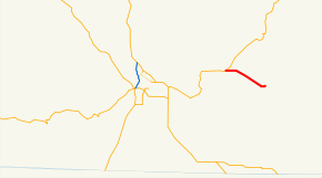
Oregon Route 70 is an Oregon state highway that runs between the towns of Dairy, and Bonanza in south-central Oregon The highway is known as the Dairy-Bonanza Highway No. 23 (see Oregon highways and routes) and is signed east-to-west.
| ||||
|---|---|---|---|---|
 | ||||
| Route information | ||||
| Maintained by ODOT | ||||
| Length | 6.97 mi[1] (11.22 km) | |||
| Existed | 1932–present | |||
| Major junctions | ||||
| West end | ||||
| East end | Market Street and Central Street in Bonanza | |||
| Highway system | ||||
| ||||
Route description
Oregon Route 70 begins (at its western terminus) at an intersection with Oregon Route 140 in the town of Dairy. It heads east-southeast for seven miles (11 km), ending in the city of Bonanza.
History
The Dairy-Bonanza Highway was established in 1917. When the Oregon route numbering system was introduced in 1932, the highway was assigned the number OR 70. There have been no major changes to the highway since its establishment.
Major intersections
The entire route is in Klamath County.
| Location | mi[1] | km | Destinations | Notes | |
|---|---|---|---|---|---|
| Dairy | 0.00 | 0.00 | |||
| Bonanza | 6.47 | 10.41 | Harpold Avenue to Poe Valley Road | ||
| 6.87 | 11.06 | Langell Valley Road – Lorella | |||
| 6.97 | 11.22 | Central Street, Market Street – Beatty, Lakeview | |||
| 1.000 mi = 1.609 km; 1.000 km = 0.621 mi | |||||
gollark: What is happening with Rust?
gollark: Is that just some green bløb?
gollark: What' sPHP?
gollark: What's happening to C++?
gollark: They are highly acidic. They have a pH of 2.
References
- Oregon Department of Transportation, Public Road Inventory Archived 2008-02-24 at the Wayback Machine (primarily the Digital Video Log), accessed April 2008
- Oregon Department of Transportation, Descriptions of US and Oregon Routes, https://web.archive.org/web/20051102084300/http://www.oregon.gov/ODOT/HWY/TRAFFIC/TEOS_Publications/PDF/Descriptions_of_US_and_Oregon_Routes.pdf, page 11.
- Oregon Highways, Dairy-Bonanza Highway #23 (Archive), https://web.archive.org/web/20050208055644/http://www.ylekot.com/orehwys/hwy-23.html
This article is issued from Wikipedia. The text is licensed under Creative Commons - Attribution - Sharealike. Additional terms may apply for the media files.
