Oregon Route 226
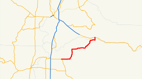
Oregon Route 226 is an Oregon state highway that runs between a point east of Albany in the Willamette Valley, and the town of Mehama along the Santiam River. The highway is also known as the Albany-Lyons Highway No. 211 (see Oregon highways and routes), and is 26 miles (42 km) long. It lies entirely within Linn County, except for the very northernmost segment in Mehama, which is in Marion County.
| ||||
|---|---|---|---|---|
 | ||||
| Route information | ||||
| Maintained by ODOT | ||||
| Length | 25.2 mi (40.6 km) | |||
| Highway system | ||||
| ||||

Route description
Oregon Route 226 begins (at its western terminus) at its junction with U.S. Route 20, several miles east of Albany. It heads in a general northeasterly direction, passing through the town of Scio, continuing to the east until it reaches the city of Lyons, on the south bank of the Santiam River. The highway then turns north, crossing the river into Mehama, and ending at an intersection with Oregon Route 22.
Intersections with other highways
- U.S. Route 20 east of Albany
- Oregon Route 22 in Mehama.