Oppdal (village)
![]()
Oppdal Auna | |
|---|---|
Village | |
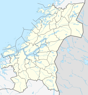
 Oppdal Location of the village  Oppdal Oppdal (Norway) | |
| Coordinates: 62.5943°N 09.6912°E | |
| Country | Norway |
| Region | Central Norway |
| County | Trøndelag |
| District | Dovre |
| Municipality | Oppdal |
| Area | |
| • Total | 3.58 km2 (1.38 sq mi) |
| Elevation | 545 m (1,788 ft) |
| Population (2018)[1] | |
| • Total | 4,310 |
| • Density | 1,204/km2 (3,120/sq mi) |
| Time zone | UTC+01:00 (CET) |
| • Summer (DST) | UTC+02:00 (CEST) |
| Post Code | 7340 Oppdal |
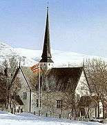
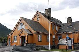
The village of Oppdal is the site of the municipal government services as well as a school, mall, hotel, stores and businesses as well as the historic Oppdal Church. The Dovrebanen railway line passes through the village, stopping at the Oppdal Station.[3]
Name
The village (originally the parish) is named after the old Oppdal farm, since that is where the Oppdal Church was located. The Old Norse form of the name was Uppdalr. The first element is upp which means "upper" and the last element is dalr which means "valley" or "dale". Historically, the name was also spelled Opdal.[4]
Media gallery
- Oppdal kulturhus
- Skifer hotel
- Domus shopping mall
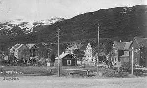
 Historic photo of the centre of Oppdal

References
- Statistisk sentralbyrå (1 January 2017). "Urban settlements. Population and area, by municipality".
- "Oppdal (Trøndelag)". yr.no. Retrieved 2018-01-22.
- Haugen, Morten, ed. (2017-07-14). "Oppdal – tettstedet". Store norske leksikon (in Norwegian). Kunnskapsforlaget. Retrieved 2018-01-22.
- Rygh, Oluf (1901). Norske gaardnavne: Søndre Trondhjems amt (in Norwegian) (14 ed.). Kristiania, Norge: W. C. Fabritius & sønners bogtrikkeri. p. 178.
External links
![]()