OpenCPN
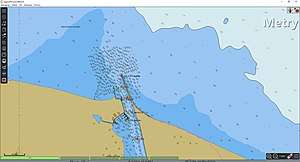
OpenCPN (Open Chart Plotter Navigator) is a free software project to create a concise chart plotter and navigation software, for use underway or as a planning tool. OpenCPN is developed by a team of active sailors using real world conditions for program testing and refinement.[3]
 | |
| Developer(s) | The OpenCPN Authors |
|---|---|
| Stable release | |
| Repository | |
| Written in | C, C++ |
| Operating system | Cross-platform |
| Type | Chart plotter and navigation |
| License | GPL v2[2] |
| Website | opencpn |
OpenCPN uses GPS input data to determine the ship's own position and data from an AIS receiver to plot the positions of ships in the neighborhood.
Notes
- "OpenCPN Download Directory". opencpn.org.
- "OpenCPN/OpenCPN". GitHub.
- "OpenCPN About". Retrieved 22 April 2018.
| Wikimedia Commons has media related to OpenCPN. |
gollark: Wait, how do you have *two*?
gollark: https://dragcave.net/lineage/Qhn4Ohttps://dragcave.net/lineage/1m7LjMore weird 3G SAltkins!
gollark: Ah. The evil TJ68, creator of the lagmonster.
gollark: https://dragcave.net/lineage/Gwx7P Omens!
gollark: https://dragcave.net/lineage/88wHI Name suggestions?
This article is issued from Wikipedia. The text is licensed under Creative Commons - Attribution - Sharealike. Additional terms may apply for the media files.