Onderbanken
Onderbanken (Dutch pronunciation: [ˈɔndərˌbɑŋkə(n)] (![]()
Onderbanken Óngerbenk | |
|---|---|
Former Municipality | |
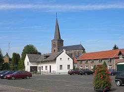 Church in Jabeek | |
 Flag  Coat of arms | |
.svg.png) Location in Limburg | |
| Coordinates: 50°58′N 5°59′E | |
| Country | Netherlands |
| Province | Limburg |
| Municipality | Beekdaelen |
| Established | 1 January 1982 |
| Government | |
| • Body | Municipal council |
| • Mayor | Odile Wolfs (acting) (PvdA) |
| Area | |
| • Total | 21.24 km2 (8.20 sq mi) |
| • Land | 21.18 km2 (8.18 sq mi) |
| • Water | 0.06 km2 (0.02 sq mi) |
| Elevation | 68 m (223 ft) |
| Time zone | UTC+1 (CET) |
| • Summer (DST) | UTC+2 (CEST) |
| Postcode | 6447–6456 |
| Area code | 045, 046 |
| Website | www |
Population centres
Bingelrade, Douvergenhout, Etzenrade, Jabeek, Merkelbeek, Op den Hering, Quabeek, Raath, Schinveld, Viel.
Topography
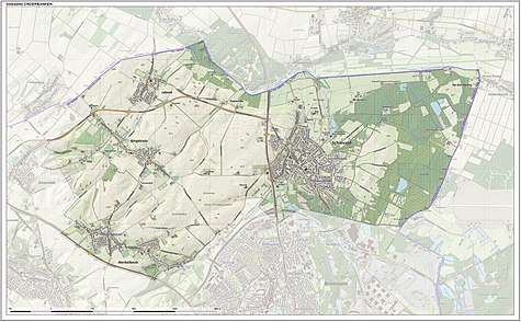
Dutch Topographic map of the municipality of Onderbanken, June 2015.
gollark: Plus the bedrock-on-fire nonsense.
gollark: "Congratulations; you got this machine! It's worse than useless and leaks power. You just need it to upgrade to the next tier"- Ender IO, latest version.
gollark: Parabolic flux coupler, arcane ensorcellator.
gollark: Does nobody know this?
gollark: TE has both!
References
- "Burgemeester en wethouders" [Mayor and aldermen] (in Dutch). Gemeente Onderbanken. Archived from the original on 28 July 2014. Retrieved 17 November 2013.
- "Kerncijfers wijken en buurten" [Key figures for neighbourhoods]. CBS Statline (in Dutch). CBS. 2 July 2013. Retrieved 12 March 2014.
- "Postcodetool for 6451EN". Actueel Hoogtebestand Nederland (in Dutch). Het Waterschapshuis. Retrieved 17 November 2013.
- "Gemeenteraad Beekdaelen beëdigd in gemeentehuis Nuth" [Town council of Beekdaelen sworn in at Nuth municipality office] (in Dutch). 1Limburg. Retrieved 2 March 2019.
External links

- Official website
This article is issued from Wikipedia. The text is licensed under Creative Commons - Attribution - Sharealike. Additional terms may apply for the media files.