Olst
Olst is a village in the Dutch province of Overijssel, about 8 km north of Deventer. It is located in the municipality of Olst-Wijhe,
Olst | |
|---|---|
 Coat of arms | |
| Coordinates: 52°20′16″N 6°6′39″E | |
| Country | Netherlands |
| Province | Overijssel |
| Municipality | Olst-Wijhe |
| Population (2019) | 8,205 |
Until 2002, Olst was the seat of the municipality of the same name. The municipality was merged with that of Wijhe in 2001, keeping the name of the largest constituent part (Olst), until it was renamed Olst-Wijhe a year later.[1]
Transportation
- Railway station: Olst
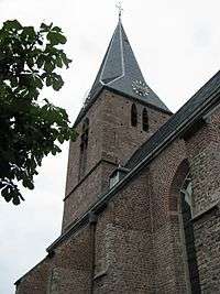 Protestant Church
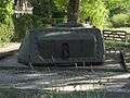 IJssellinie near Olst
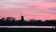 River IJssel near Olst
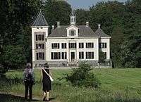 de Haere near Olst
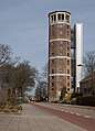 Watertower in Olst
gollark: I think a major problem with CraftOS is that it's not designed very extensibly, to be honest.
gollark: I should probably readd Polychoron's event preprocessor thing.
gollark: Some bits of the architecture are not great, but it's easy to run your own stuff on top of it.
gollark: CraftOS, I think, is basically fit for purpose, since it lets you run your own programs without much hassle. It could use a package manager but it's otherwise pretty great.
gollark: Well, it has a GUI (which I don't like personally, but meh), a package manager, and many useful libraries and programs.
References
- Ad van der Meer and Onno Boonstra, Repertorium van Nederlandse gemeenten, KNAW, 2011.
External links
- J. Kuyper, Gemeente Atlas van Nederland, 1865-1870, "Olst". Map of the former municipality, around 1868.
This article is issued from Wikipedia. The text is licensed under Creative Commons - Attribution - Sharealike. Additional terms may apply for the media files.