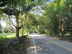
Old Connecticut Path
The Old Connecticut Path was the Native American trail that led westward from the area of Massachusetts Bay to the Connecticut River Valley, the first of the North American trails that led west from the settlements close to the Atlantic seacoast, towards the interior. The earliest colonists of Massachusetts Bay Colony used it, and rendered it wider by driving cattle along it. The old route is still followed, for part of its length, by Massachusetts Route 9 and Massachusetts Route 126.

in Wayland, Massachusetts
In lean years of the early 1630s, when the Massachusetts Bay Colony ran short of grain, Nipmuck farmers in the valley of the Connecticut River loaded some of their abundant surplus maize into birch-bark backpacks and trod a familiar route to the settlements at the mouth of the Charles River, where they traded food for European goods made of copper and iron and woollen cloth.[1] Fur traders and the exploratory party of John Oldham (1633) penetrated this first of the trails west into the continent's interior. In 1635, some settlers from Watertown took this route when they removed to Wethersfield, Connecticut.
In 1636, the outcast Thomas Hooker and a hundred of his congregation, with 160 cattle, whose milk they drank en route, followed the Old Connecticut Path in a two-weeks' journey to the Connecticut River. There they settled in a place the native Lenape people called Suckiaug, because of the blackness of its earth. They founded the English settlement of Hartford. By 1643, documents in the village of Sudbury called this trail the "Old Connecticut Path." In 1672, with the establishment of a postal system, it became the first colonial post road.
Long native usage had emphasized the easiest route,[2] skirting the water meadows of the river bottoms and crossing streams at the most dependable fords. The Path led west along the north bank of the Charles River from New Town (Cambridge) to newly settled Watertown and passed through what are now Waltham and Weston, curving southward where it entered the southeasterly section of the new town of Sudbury, now set apart as Wayland, where a section of the route[3] still bears the name "Old Connecticut Path". At Wayland, the Bay Path, later the Boston Post Road,[4] diverged from the Connecticut Path, headed west through Marlborough, Worcester and Brookfield straight toward the Connecticut River.[5] In Sudbury the Connecticut Path was known as "the road from Watertown to the Dunster Farm", for after passing along the north side of Cochituate Pond, it crossed the tract beyond that was granted to Henry Dunster, president of Harvard College, and the lands of Edmund Rice and Philemon Whale.[6] The trail crossed the Sudbury River at "Danforth's Farm", since 1700 incorporated as Framingham, where another section (Route 126) retains the name "Old Connecticut Path", threading past the northern shore of Lake Cochituate. The Connecticut Path headed west, threading between the Charles and Sudbury rivers on its way to the Connecticut River. "From Framingham the Old Connecticut Path runs southward through South Framingham, Ashland (Megunko), Hopkinton (Quansigamog), then through Westborough and over Fay Mountain, to the praying town of Grafton (Hassanamesit/Hassanamisco), through Sutton and then beyond to Woodstock, Conn.",[7] and west to the bank of the Connecticut River opposite Hartford. During the trip to Connecticut the Path crosses the Blackstone River, that crossing was known as the North Bridge and the Quinebaug River crossing was known as the South Bridge, both Northbridge and Southbridge were named after those well-known landmark locations.
Notes
- Ron McAdow, "The Old Connecticut Path"
- By collating early maps, documents and town histories with on-the-ground exploration, Harral Ayres established the route of the Old Connecticut Path and its byways, in The Great Trail of New England (Boston: Meador) 1940
- Route 126.
- Route 20 in Wayland retains its name as "Boston Post Road".
- The route of the Bay Path has been confused with the Old Connecticut Path, as by Archer Butler Hulbert, Indian Thoroughfares 1902:74, who mistakenly traces it through Marlborough to Albany, New York.
- Alfred Sereno Hudson, The History of Sudbury, Massachusetts. 1638-1889 1889:5f.
- Katharine Mixer Abbott, Old Paths and Legends of New England: Saunterings Over Historic Roads, 1903:274 note 2.