Oklahoma State Highway 164
State Highway 164 (abbreviated SH-164) is a state highway in north-central Oklahoma. It runs from SH-74 in Covington to U.S. Route 77 (US-77) west of Perry. SH-164 is 12.64 miles (20.34 km) long.[1][2] It has no lettered spur routes.
| ||||
|---|---|---|---|---|
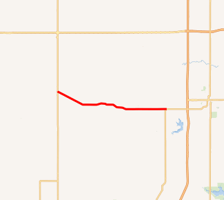
SH-164 highlighted in red | ||||
| Route information | ||||
| Maintained by ODOT | ||||
| Length | 12.64 mi[1][2] (20.34 km) | |||
| Existed | c. 1971[3]–present | |||
| Major junctions | ||||
| West end | ||||
| East end | ||||
| Highway system | ||||
Oklahoma State Highway System
| ||||

The route of SH-164 was initially served by US-64. The highway was assigned the SH-164 designation when US-64 was realigned around 1971.
Route description
SH-164 begins on the southern fringes of Covington at a junction with SH-74. The highway heads east-southeast from this point, paralleling a rail line. About three miles (4.8 km) away from the terminus, the highway breaks away from the railroad, heading on a more easterly course, bypassing Hayward to the north. The highway then crosses from Garfield County into Noble County. Just after entering Noble County, it runs along the north outskirts of Lucien. The road then continues on a due east course before ending at US-77 west of Perry.[4]
History
SH-164 was originally part of US-64. US-64 and SH-15 proceeded east out of Enid until reaching SH-74, where SH-15 turned north and US-64 turned south. After following SH-74 to Covington, US-64 turned east, following present-day SH-164 east to US-77. From there, it followed US-77 into Perry.[5]
By 1972, US-64 had been realigned, continuing due east from SH-74 rather than forming a concurrency with it. Instead, it continued east to I-35, following it south to Perry. The old alignment of US-64 between Perry and Covington then became SH-164.[3]
Junction list
| County | Location | mi[1][2] | km | Destinations | Notes |
|---|---|---|---|---|---|
| Garfield | Covington | 0.00 | 0.00 | Western terminus | |
| Noble | | 12.64 | 20.34 | Eastern terminus | |
| 1.000 mi = 1.609 km; 1.000 km = 0.621 mi | |||||
References
- Oklahoma Department of Transportation (n.d.). Control Section Maps: Garfield County (PDF) (Map). Scale not given. Oklahoma City: Oklahoma Department of Transportation. Retrieved April 20, 2010.
- Oklahoma Department of Transportation (n.d.). Control Section Maps: Noble County (PDF) (Map). Scale not given. Oklahoma City: Oklahoma Department of Transportation. Retrieved April 20, 2010.
- 1972 Highway Map of Oklahoma (PDF) (Map). Oklahoma Department of Highways. Retrieved February 22, 2014.
- Oklahoma Atlas and Gazetteer (Map). 1:200,000. DeLorme. 2006.
- Oklahoma 1971 (PDF) (Map). Oklahoma Department of Highways. Retrieved February 22, 2014.