Nuevo, Naranjito, Puerto Rico
Nuevo is a barrio in the municipality of Naranjito, Puerto Rico. Its population in 2010 was 4,004.[3][4][5]
Nuevo | |
|---|---|
Barrio | |
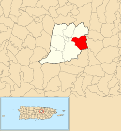 Location of Nuevo within the municipality of Naranjito shown in red | |
 Nuevo Location of Puerto Rico | |
| Coordinates: 18°17′12″N 66°13′25″W[1] | |
| Commonwealth | |
| Municipality | |
| Government | |
| • Mayor | Orlando Ortiz Chevres |
| Area | |
| • Total | 3.17 sq mi (8.2 km2) |
| • Land | 3.16 sq mi (8.2 km2) |
| • Water | 0.01 sq mi (0.03 km2) |
| Elevation | 981 ft (299 m) |
| Population (2010) | |
| • Total | 4,004 |
| • Density | 1,267.1/sq mi (489.2/km2) |
| Source: 2010 Census | |
| Time zone | UTC−4 (AST) |
| Zip code | 00719 |
History
The United States took control of Puerto Rico from Spain in the aftermath of the Spanish-American War under the terms of the Treaty of Paris of 1898. In 1899, the United States conducted its first census of Puerto Rico finding that the population of Nuevo barrio was 1,081.[6]
Sectors
Barrios (which are like minor civil divisions)[7] in turn are further subdivided into smaller local populated place areas/units called sectores (sectors in English). The types of sectores may vary, from normally sector to urbanización to reparto to barriada to residencial, among others.[8][9][10]
The following sectors are in Nuevo barrio:[11][12]
Camino Don Manolo, Camino González Mathews, Camino Los Matos, Eusebio Rivera, Parcelas Hevia, Sector Aponte, Sector Bernard, Sector Bunker Hills, Sector Cabrera, Sector Cintrón, Sector Cuadrado, Sector Doña Bacha, Sector Entrada Guadiana, Sector Febus, Sector Hevia, Sector Hogar Crea, Sector La Tosca, Sector Loma del Viento, Sector Martínez, Sector Matadero, Sector Mulitas, Sector Negrón, Sector Ortega, Sector Puente Plata, Sector Santa María (antes Villa Embrolla), Sector Siete Curvas, Sector Sostre, Urbanización Campo Bello, Urbanización Valle Verde, and Villa del Plata.
Hurricane Maria
After Hurricane Maria struck the island of Puerto Rico, residents of Nuevo barrio waited 7 to 8 months to have electrical power restored.[13]
References
- "US Gazetteer 2019". US Census. US Government.
- U.S. Geological Survey Geographic Names Information System: Nuevo barrio
- Picó, Rafael; Buitrago de Santiago, Zayda; Berrios, Hector H. Nueva geografía de Puerto Rico: física, económica, y social, por Rafael Picó. Con la colaboración de Zayda Buitrago de Santiago y Héctor H. Berrios. San Juan Editorial Universitaria, Universidad de Puerto Rico,1969.
- Gwillim Law (20 May 2015). Administrative Subdivisions of Countries: A Comprehensive World Reference, 1900 through 1998. McFarland. p. 300. ISBN 978-1-4766-0447-3. Retrieved 25 December 2018.
- Puerto Rico:2010:population and housing unit counts.pdf (PDF). U.S. Dept. of Commerce, Economics and Statistics Administration, U.S. Census Bureau. 2010.
- Joseph Prentiss Sanger; Henry Gannett; Walter Francis Willcox (1900). Informe sobre el censo de Puerto Rico, 1899, United States. War Dept. Porto Rico Census Office (in Spanish). Imprenta del gobierno. p. 162.
- "US Census Barrio-Pueblo definition". factfinder.com. US Census. Archived from the original on 13 May 2017. Retrieved 5 January 2019.
- "Agencia: Oficina del Coordinador General para el Financiamiento Socioeconómico y la Autogestión (Proposed 2016 Budget)". Puerto Rico Budgets (in Spanish). Retrieved 28 June 2019.
- Rivera Quintero, Marcia (2014), El vuelo de la esperanza: Proyecto de las Comunidades Especiales Puerto Rico, 1997-2004 (first ed.), San Juan, Puerto Rico Fundación Sila M. Calderón, ISBN 978-0-9820806-1-0
- "Leyes del 2001". Lex Juris Puerto Rico (in Spanish). Retrieved 24 June 2020.
- "Plan Territorial (2012)" (PDF). JP PR Gov (in Spanish). Gobierno Municipal de Naranjito -Oficina de Planificación y Ordenación Territorial. p. 43. Retrieved 26 June 2019.
- "PRECINTO ELECTORAL NARANJITO 073" (PDF). Comisión Estatal de Elecciones (in Spanish). PR Government. 26 September 2019. Retrieved 21 July 2020.
- "Eso es una fecha que no se me va a olvidar nunca". El Nuevo Día (in Spanish).