North Dakota Highway 67
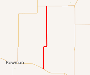
North Dakota Highway 67 (ND 67) is a 27.466-mile (44.202 km) north–south feeder highway in southwest North Dakota, United States. The southern terminus is at U.S. Route 12 (US 12) in Scranton and the northern terminus is at ND 21 near New England.
| ||||
|---|---|---|---|---|

ND 67 highlighted in red | ||||
| Route information | ||||
| Maintained by NDDOT | ||||
| Length | 27.466 mi[1] (44.202 km) | |||
| Existed | between 1950 and 1963–present | |||
| Major junctions | ||||
| South end | ||||
| North end | ||||
| Location | ||||
| Counties | ||||
| Highway system | ||||
| ||||
Route description
Major intersections
| County | Location | mi[1] | km | Destinations | Notes |
|---|---|---|---|---|---|
| Bowman | Scranton | 0.000 | 0.000 | Southern terminus | |
| Slope | | 27.466 | 44.202 | Northern terminus | |
| 1.000 mi = 1.609 km; 1.000 km = 0.621 mi | |||||
gollark: If you don't need burst power above 10kRF/t, it's probably unneeded.
gollark: Or just only turn on the reactor when power is needed.
gollark: Probably the most effective way to store power, though, is as... nuclear fuel, which you put into the reactor when more power is needed (automatically).
gollark: Well, what is your "modlist"?
gollark: Technically, you would be storing *energy*.
References
- Cartography Section, Planning/Asset Management Section (2015). Route and Mileage Map (PDF) (Map). c. 1:1,900,800. Bismarck: North Dakota Department of Transportation. Retrieved July 18, 2016.
External links
| Wikimedia Commons has media related to North Dakota Highway 67. |
- The North Dakota Highways Page by Chris Geelhart
This article is issued from Wikipedia. The text is licensed under Creative Commons - Attribution - Sharealike. Additional terms may apply for the media files.
.svg.png)