Nong Bun Mak District
Nong Bun Mak (Thai: หนองบุญมาก, pronounced [nɔ̌ːŋ būn mâːk]) is a district (amphoe) of Nakhon Ratchasima Province, northeastern Thailand.
Nong Bun Mak หนองบุญมาก | |
|---|---|
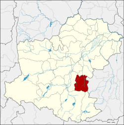 District location in Nakhon Ratchasima Province | |
| Coordinates: 14°44′23″N 102°21′57″E | |
| Country | Thailand |
| Province | Nakhon Ratchasima |
| Seat | Nong Hua Raet |
| Area | |
| • Total | 590.4 km2 (228.0 sq mi) |
| Population (2000) | |
| • Total | 56,287 |
| Time zone | UTC+7 (ICT) |
| Postal code | 30410 |
| Geocode | 3022 |
History
Nong Bunnak was created as a minor district (king amphoe) on 1 July 1983 by separating the three tambons, Nong Bunnak, Saraphi, and Thai Charoen, from Chok Chai District.[1] It was upgraded to a full district on 25 May 1989.[2] In 2003 the district was renamed from Nong Bunnak to Nong Bun Mak.[3]
Geography
Neighbouring districts are (from the east clockwise): Nong Ki of Buriram Province; Khon Buri, Chok Chai, and Chakkarat of Nakhon Ratchasima Province.
Administration
The district is divided into nine subdistricts (tambons), which are further subdivided into 104 villages (mubans). There are no municipal (thesaban) areas, and nine tambon administrative organisations (TAO).
| 1. | Nong Bunnak | หนองบุนนาก | |
| 2. | Saraphi | สารภี | |
| 3. | Thai Charoen | ไทยเจริญ | |
| 4. | Nong Hua Raet | หนองหัวแรต | |
| 5. | Laem Thong | แหลมทอง | |
| 6. | Nong Takai | หนองตะไก้ | |
| 7. | Lung Khwao | ลุงเขว้า | |
| 8. | Nong Mai Phai | หนองไม้ไผ่ | |
| 9. | Ban Mai | บ้านใหม่ |
References
- ประกาศกระทรวงมหาดไทย เรื่อง แบ่งท้องที่อำเภอโชคชัย จังหวัดนครราชสีมา ตั้งเป็นกิ่งอำเภอหนองบุนนาก (PDF). Royal Gazette (in Thai). 100 (109 ง): 2133. July 5, 1983.
- พระราชกฤษฎีกาตั้งอำเภอแวงใหญ่ อำเภอหนองบุนนาก อำเภอโพนทราย อำเภอท่าหลวง และอำเภอศรีรัตนะ พ.ศ. ๒๕๓๒ (PDF). Royal Gazette (in Thai). 106 (83 ก special): 249–251. May 25, 1989.
- พระราชกฤษฎีกาเปลี่ยนชื่ออำเภอหนองบุนนาก จังหวัดนครราชสีมา พ.ศ. ๒๕๔๖ (PDF). Royal Gazette (in Thai). 120 (36 ก): 7–8. May 1, 2003.