Nome-Council Highway
The Nome-Council Highway is a highway that runs for 71.970 miles (115.824 km) between the communities of Council and Nome in the Nome Census Area of the Unorganized Borough in the U.S. state of Alaska. The road travels east from Nome, following the shore of the Bering Sea until it reaches the ghost town of Solomon. From there, the route travels northeast through the interior of the Seward Peninsula before it terminates on the south bank of the Niukluk River, south of Council. One of three highways traveling from Nome to surrounding communities, the highway is disconnected from the rest of the Alaska Highway System. The route is unpaved for its entire length and becomes impassable for automobiles in the winter outside of a short portion immediately outside of Nome. The portion of the road between Nome and Solomon is part of the Iditarod Trail and the highway passes several historic sites associated with the trail and the area's gold mining history.
| Nome-Council Highway | |
|---|---|
| Council Road | |
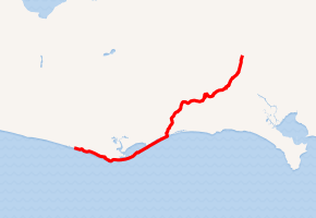
Nome-Council Highway highlighted in red | |
| Route information | |
| Maintained by Alaska DOT&PF | |
| Length | 71.970 mi[1] (115.824 km) |
| Existed | 1906–present |
| Tourist routes | Iditarod National Historic Trail |
| Major junctions | |
| West end | Nome Bypass Road / Front Street in Nome |
| Kougarok Road in Nome | |
| East end | Dead end at Niukluk River in Council |
| Location | |
| Boroughs | Nome Census Area |
| Highway system | |
| |
The route began as a collection of informal trails connecting Nome with mining communities established on the peninsula at the beginning of the 20th century. In 1906, the Alaska Road Commission constructed a wagon road along most of the length of the trails from Nome to Council. Because of the value of the gold coming from the Council area, this road quickly became the main artery for the region and the Road Commission spent significant amounts of money improving and maintaining the route into the 1930s. However, the road had fallen below state standards by the 1960s and 70s and projects were undertaken to update the highway and replace river-crossing ferries with bridges. The road has been studied since the 1950s as part of a potential Fairbanks-Nome Highway; the expected cost of such a project has consistently prevented any development.
Route description
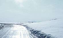
The Nome-Council Highway begins at a T intersection with Nome Bypass Road and Front Street; the former route travels north from the intersection and forms a partial loop around the main built-up area of Nome, while the latter extends westward from the intersection along the Nome seawall into the city. The highway travels southeastward from this intersection, parallel to the Bering Sea. For the first mile, the route passes East End Park Ponds to the north, a city park which contains the Swanberg Dredge and is an important point for bird migration.[2][3] After approximately 1.3 miles (2.1 km), the highway intersects Kougarok Road, another state highway, which travels 85 miles (137 km) northward to the Kougarok River south of the community of Taylor.[1] After milepost 2, the road bends northeastward around the mouth of the Nome River. On the east bank of the river, the route intersects West Fork Road, East Fork Road, and Fort Davis Road, all of which lead to the former site of Fort Davis, a U.S. Army facility operated during the Nome Gold Rush. The area now hosts scattered houses and fishing huts.[2][3] The roadway returns to following the coastline for a few miles, before it bends and continues slightly inland. Along this stretch, the highway passes a few quarries. Between miles 12 and 14, the road again follows the shore, traveling around Cape Nome, a large headland.[2][4]
Historic sites
There are four important landmarks that are listed in the United States National Register of Historic Places within the Nome Census Area.
- This National Park Service list is complete through NPS recent listings posted August 14, 2020.[5]
| [6] | Name on the Register[7] | Image | Date listed[8] | Location | City or town | Description |
|---|---|---|---|---|---|---|
| 1 | Swanberg Dredge | 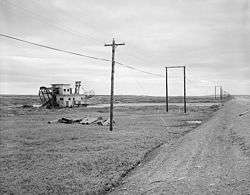 Swanberg Dredge |
March 12, 2001 (#01000232) |
Mile 1 of the Nome-Council Highway 64°29′33″N 165°21′58″W |
Nome | |
| 2 | Cape Nome Roadhouse | 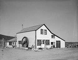 Cape Nome Roadhouse |
December 12, 1976 (#76000361) |
Mile 14 of the Nome-Council Highway 64°26′33″N 164°58′38″W |
Nome | |
| 3 | Council City and Solomon River Railroad | 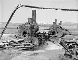 Council City and Solomon River Railroad |
March 2, 2001 (#01000109) |
Mile 31 of the Nome-Council Highway 64°32′46″N 164°26′12″W |
Solomon | |
| 4 | Solomon Roadhouse | 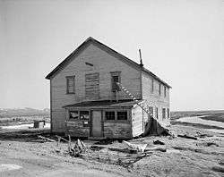 Solomon Roadhouse |
September 17, 1980 (#80000760) |
Mile 32 of the Nome-Council Highway 64°33′31″N 164°26′34″W |
Solomon |
Major intersections
The entire route is in Unorganized Borough.
| Location | mi[1] | km | Destinations | Notes | |
|---|---|---|---|---|---|
| Nome | 0.000 | 0.000 | Nome Bypass Road / Front Street | Western terminus | |
| 1.297 | 2.087 | Kougarok Road (Nome-Taylor Higway) | Southern terminus of Kougarok Road | ||
| | 2.802 | 4.509 | West Fork Road | ||
| 2.910 | 4.683 | East Fork Road / Antenna Road | |||
| 3.252 | 5.234 | Fort Davis Road | |||
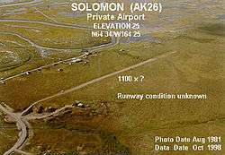
| Solomon | 32.888 | 52.928 | Solomon townsite | Access to Solomon State Field Airport | |
| | 41.377 | 66.590 | Big Hurrah Road | ||
| Council | 71.970 | 115.824 | Dead end at Niukluk River | Eastern terminus | |
| 1.000 mi = 1.609 km; 1.000 km = 0.621 mi | |||||
References
- Alaska DOT&PF Roadway Data (Map). Cartography by Transportation Geographic Information Section. Alaska Department of Transportation & Public Facilities. Retrieved September 30, 2018.
- Google (September 30, 2018). "Overview Map of Nome-Council Highway" (Map). Google Maps. Google. Retrieved September 30, 2018.
- Alaska Department of Fish and Game (2018). "Mile 0–4 Nome to Nome River Bridge". Nome-Council Highway. State of Alaska. Retrieved September 30, 2018.
- Alaska Department of Fish and Game (2018). "Milepost 4–14 Nome River to Cape Nome". Nome-Council Highway. State of Alaska. Retrieved September 30, 2018.
- "National Register of Historic Places: Weekly List Actions". National Park Service, United States Department of the Interior. Retrieved on August 14, 2020.
- Numbers represent an ordering by significant words. Various colorings, defined here, differentiate National Historic Landmarks and historic districts from other NRHP buildings, structures, sites or objects.
- "National Register Information System". National Register of Historic Places. National Park Service. April 24, 2008.
- The eight-digit number below each date is the number assigned to each location in the National Register Information System database, which can be viewed by clicking the number.