Njunis
Njunis is a mountain in the interior of southern Troms og Finnmark county, Norway. The mountain lies in Målselv Municipality. With a peak at 1,713 metres (5,620 ft), it is the highest mountain in this part of the county, and has Norway's thirteenth largest prominence. The tree line (downy birch) reaches to 700 metres (2,300 ft) elevation on the southern slope of the mountain, the highest tree line in Troms. This forest is part of the Øvre Dividal National Park. At the peak, NATO has a radar centre.[2]
| Njunis | |
|---|---|
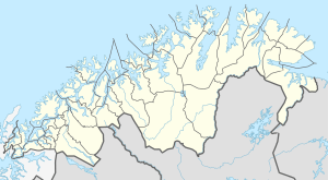 Njunis Location of the mountain  Njunis Njunis (Norway) | |
| Highest point | |
| Elevation | 1,713 m (5,620 ft) |
| Prominence | 1,305 m (4,281 ft) |
| Isolation | 59.4 to 59.6 km (36.9 to 37.0 mi) |
| Listing | #13 in Norway |
| Coordinates | 68.7494°N 19.4886°E [1] |
| Geography | |
| Location | Troms og Finnmark, Norway |
| Topo map | 1532 I Dividalen 1532 II Altevatn |
Name
The name is from the word in the Northern Sami language njunis which means "prominent nose of a mountain".[2]
gollark: [REDACTED]
gollark: https://www.servethehome.com/apple-macos-server-formally-discontinued/
gollark: This is only a problem if you go outside in intense sunlight.
gollark: Hello.
gollark: Hilarious.
References
- "Njunis, Målselv (Troms)" (in Norwegian). yr.no. Retrieved 2018-08-15.
- Store norske leksikon. "Njunis" (in Norwegian). Retrieved 2010-04-09.
This article is issued from Wikipedia. The text is licensed under Creative Commons - Attribution - Sharealike. Additional terms may apply for the media files.