Nevada State Route 760
State Route 760 (SR 760) is a short state highway in Douglas County, Nevada, United States. It connects Nevada Beach to U.S. Route 50 (US 50). The route was established in 1976.
| ||||
|---|---|---|---|---|
| Elks Point Road | ||||
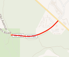
SR 760 highlighted in red | ||||
| Route information | ||||
| Maintained by NDOT | ||||
| Length | 0.475 mi[1] (0.764 km) | |||
| Existed | 1976–present | |||
| Major junctions | ||||
| West end | Nevada Beach | |||
| East end | ||||
| Highway system | ||||
| ||||

Route description
_in_Douglas_County%2C_Nevada.jpg)
The route begins just southeast of Elk Point on Lake Tahoe at the intersection of Elk Avenue and the entrance to Nevada Beach, a National Forest Service beach and campground. From there, the route heads easterly along Elks Point Road 0.475 miles (0.764 km) to its terminus at US 50 in Round Hill Village just south of Zephyr Cove.[1][2]
History
SR 760 was originally designated along Elks Point Road on July 1, 1976.[3] In 2001, Nevada Department of Transportation listed SR 760 as "Nevada Beach Road" with a length of 0.603 miles (0.970 km);[3] by October 2012, the current name and length were listed (no route changes were made).[4]
Major intersections
The entire route is in Douglas County.
| Location | mi[1] | km | Destinations | Notes | |
|---|---|---|---|---|---|
| | 0.000 | 0.000 | Nevada Beach Campground entrance | Western terminus; Roadway continues northerly as Elks Avenue | |
| Round Hill Village | 0.475 | 0.764 | Eastern terminus; Elks Point Road continues easterly beyond terminus | ||
| 1.000 mi = 1.609 km; 1.000 km = 0.621 mi | |||||
See also


References
- Nevada Department of Transportation (January 2017). "State Maintained Highways of Nevada: Descriptions and Maps". Retrieved 2017-01-17.
- Google (December 7, 2014). "Overview of SR 760" (Map). Google Maps. Google. Retrieved December 7, 2014.
- Nevada State Maintained Highways: Descriptions, Index and Maps. Nevada Department of Transportation. January 2001.
- State Maintained Highways of Nevada: Descriptions and Maps (Quarterly Changes: July, August, September 2012). Nevada Department of Transportation. October 2012.
| Wikimedia Commons has media related to Nevada State Route 760. |