Negra Point
Negra Point is the ice-free tipped point on the southwest coast of Robert Island in the South Shetland Islands, Antarctica forming the southeast side of the entrance to Mitchell Cove. The area was visited by early 19th century sealers.

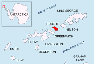
Location of Robert Island in the South Shetland Islands.

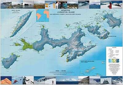
Topographic map of Livingston Island, Greenwich, Robert, Snow and Smith Islands.
The feature was named descriptively by one of the Chilean Antarctic expeditions.
Location
The point is located at 62°24′34″S 59°37′34″W which is 6.43 km northeast of Spark Point, Greenwich Island, 2.8 km southeast of Debelyanov Point, 4.5 km northwest of Beron Point and 8.84 km northwest of Edwards Point (Chilean mapping in 1975, British mapping in 1968, and Bulgarian in 2005 and 2009).
gollark: I think this (https://www.rock7.com/products/rockblock-iridium-9602-satellite-modem) might have been what I was looking at. Like I said, really expensive.
gollark: Except on the moon.
gollark: I was looking at satellite modules for... stuff... and it's something like £200 for a satellite transceiver thing, £12 a month to keep an activated subscription, and a few cents per kilobyte of data.
gollark: Aren't those *insanely expensive*/
gollark: Because more money.
See also
- Robert Island
- South Shetland Islands
Maps
- L.L. Ivanov et al. Antarctica: Livingston Island and Greenwich Island, South Shetland Islands. Scale 1:100000 topographic map. Sofia: Antarctic Place-names Commission of Bulgaria, 2005.
- L.L. Ivanov. Antarctica: Livingston Island and Greenwich, Robert, Snow and Smith Islands. Scale 1:120000 topographic map. Troyan: Manfred Wörner Foundation, 2009. ISBN 978-954-92032-6-4
This article is issued from Wikipedia. The text is licensed under Creative Commons - Attribution - Sharealike. Additional terms may apply for the media files.