Nauchene Nunatak
Nauchene Nunatak (Bulgarian: нунатак Научене, ‘Nunatak Nauchene’ \'nu-na-tak na-'u-che-ne\) is the mostly ice-covered rocky ridge extending 1.2 km in northwest-southeast direction, 600 m wide and rising to 800 m in lower Rickmers Glacier in the west foothills of Bruce Plateau on Graham Coast in Graham Land, Antarctica. It is named after the settlement of Nauchene in Southeastern Bulgaria.
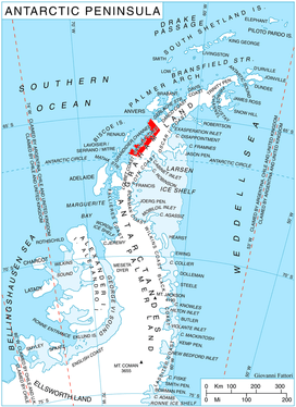
Location of Graham Coast on the Antarctic Peninsula.
Location
Nauchene Nunatak is located at 66°13′05″S 64°55′46″W, which is 3.5 km south-southwest of Dodunekov Peak and 2.6 km northeast of Ezerets Knoll. British mapping in 1976.
Maps
- Antarctic Digital Database (ADD). Scale 1:250000 topographic map of Antarctica. Scientific Committee on Antarctic Research (SCAR). Since 1993, regularly upgraded and updated.
- British Antarctic Territory. Scale 1:200000 topographic map. DOS 610 Series, Sheet W 66 64. Directorate of Overseas Surveys, Tolworth, UK, 1976.
gollark: Skill issue: just sync your clocks off GPS.
gollark: I agree. Since I wrote a Macron interpreter using Codex it's been fully solved.
gollark: You might have to do things like, I don't even know, gradient descent.
gollark: Just assume the nonlinear things are linear. Nobody will notice.
gollark: Poorly!
References
- Bulgarian Antarctic Gazetteer. Antarctic Place-names Commission. (details in Bulgarian, basic data in English)
- Nauchene Nunatak. SCAR Composite Antarctic Gazetteer
External links
- Nauchene Nunatak. Copernix satellite image
This article includes information from the Antarctic Place-names Commission of Bulgaria which is used with permission.
This article is issued from Wikipedia. The text is licensed under Creative Commons - Attribution - Sharealike. Additional terms may apply for the media files.