Natrampalli
Natrampalli is a selection grade panchayat town and Taluk in Tirupattur district in the Indian state of Tamil Nadu. The Natrampalli block is a revenue block in the Tirupattur district of Tamil Nadu, India. It has a total of 26 panchayat villages. It is a small satellite town where many people go for work to places like Hosur, Vaniyambadi, Tirupattur Ambur and Pallikonda.
Natrampalli | |
|---|---|
Town | |
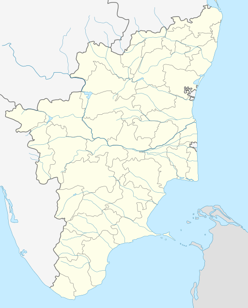 Natrampalli Location in Tamil Nadu, India | |
| Coordinates: 12.59°N 78.55°E | |
| Country | |
| State | Tamil Nadu |
| District | Tirupattur district |
| Elevation | 196 m (643 ft) |
| Population (2001) | |
| • Total | 9,076 |
| Languages | |
| • Official | Tamil |
| Time zone | UTC+5:30 (IST) |
| PIN | 635852 |
| Telephone code | 04179 |
| Vehicle registration | TN-83 |
| Nearest city | Tirupattur |
| Lok Sabha constituency | Thiruvannamalai |
| Vidhan Sabha constituency | Jolarpet |
Demographics
As of 2001 India census,[1] Natrampalli had a population of 9076. Males constitute 49% of the population and females 51%. Natrampalli has an average literacy rate of 71%, higher than the national average of 59.5%: male literacy is 77%, and female literacy is 64%. In Natrampalli, 12% of the population is under 6 years of age.
The main job source is Agriculture, Tobacco (Beedi) industry and allied works. It has two Govt Hr. Sec schools, 4 High schools. It Ramakrishna Vidyala Mutt, which is next bigger to Mylapore Mutt in Tamil Nadu. It runs a charitable hospital which benefits many villages in around Natrampalli village. From 1971 to 2010 it is a constituency for (state assembly) but due to population jolarpettai which is 7 kilometres (4.3 mi) away from Natrampalli got constituency now recently (2011). The Assembly constituency for Nattarampalli has been renamed as Jolarpet constituency.K.C.Veeramani (AIADMK) is MLA now.
Villages around Natrampalli
Natrampalli town is surrounded by cluster of villages some of them are Nearby villages are Thoppalagunda, Katheri, Vettapattu, Bandarapalli, Athurkuppam, Kandili, Thasiriyapanur, Nayanacheruvu, Sorakalnatham, Kalnarsampatti, Pudupet, Agraharam, Mallapalli, sunnambukuttai, Velakkalnattham, Jangalapuram, Patchur,Mallagunda Kothur.Kurubavanigunda,Velakalnatham
Topography
Almost the whole of Natrampalli consists of flat terrain. The general slope is towards southeast and situated in the banks of tributary of the Palar river. It is situated at an altitude of 195.75 metres (642.2 ft) above mean sea level. The wind direction is predominant towards southwest for the whole of the year. However, during summer it is from southwest to northeast.
Climate and weather
The seasonal climate conditions are moderate. Weather is colder during winter and hotter in summer due to hills and forests surrounding the town. The seasons are classified as follows:
| Cold Weather | Hot Weather | South West Monsoon | North East Monsoon |
| Mid December to end of February | March, April and May | June to mid October | Mid October to mid December |
The average maximum and minimum temperature are 43 °C (109 °F) and 16 °C (61 °F) respectively. The town typically receives a maximum rainfall of 34 cm (13 in), 36 cm (14 in) during the September, October and November. Light moderate rainfall of 11 to 30 cm (4.3 to 11.8 in) occurs during the months of June, July & August.
Tourist places
- Yelagiri hills, 14 kilometres (8.7 mi)
- Sri Samundeswari Temple 1.6 kilometres (0.99 mi)
- Kavalur observatory-near alangayam
- sri devi pudevi srinivasaperumal temple-Sunnambukuttai (6 km)
- Sunnambukuttai hills-perumal temple- 7 km
- Pachur hills -Murugan temple, 8 kilometres (5.0 mi)
- Kothur- famous for grape orchard.
- Sri Araavamutha Perumal Temple3 kilometres (1.9 mi)
- Sri PuthuMariyamman Temple8 kilometres (5.0 mi)
- Mariyamman Temple - SORAKAYAL NATHAM -5 kilometres (3.1 mi)
- Sri Jawathu Kali Amman - Karunanithi Street Nattrampalli (4 km)
- simmakukkai perumalappan temple, nayanacheruvu,malaiyadivaram (7 km)
- kanaganachiyamman temple in pallaru (14 km)
- Nandeshwaran temple in Velakalnatham(9 km)
- Naresh Home and Garden Nursery - Velakalnatham
- Sri kathiravan malai kalyana murugar -palakalBavi(10 km)
- Sri samundeswari amman temple mallagunda(10 km)
Politics
- State assembly constituency (Jolarpettai).
- Natrampalli assembly constituency is part of Tiruvannamalai (Lok Sabha constituency).[2]
Education schools and colleges
$ Government higher secondary school, kethandapatti, natrampalli
$ Panchayat Union Middle School,Kuniganoor,Koothandakuppam
- Government higher secondary school, dasiriyappanoor, natrampalli
- Green Valley Public School-CBSE, Jangalapuram, Natrampalli.
- Panchayat Union Elementary School Natrampalli,
- Ramakrishna vidalaya matriculation school, Natrampalli
- Dewan Mohammed higher secondary school, kethandapatti, natrampalli
- Brindavan matriculation higher secondary School Natrampalli,
- SSV matriculation school Natrampalli,
- Government boys higher secondary school,Pudupettai
- Government girls higher secondary school, pudupettai
- Government Boys higher secondary school, Natrampalli
- Government Girls Higher secondary School Natrampalli
- SRI KALAIMAGAL College Of Education, Atturkuppam Village, Natrampalli.
- BHARATHIDASAN Engineering College, bandarapalli, Natrampalli.
- VANAVIL arts and science college, sommanayakampatti, Natrampalli.
- Panchayat Union Elementary School, Jangalapuram, Natrampalli.
- Government High school, Jangalapuram, Natrampalli
- Govt high school - Velakalnatham
Transport
Roadways
Natrampalli is well connected by road. It is situated on (NH 46- Krishnagiri- Bargur- Natrampalli). The town lies on the highway (NH 46) of the Bangalore-Chennai section which is part of the Golden Quadrilateral Highways Project. Natrampalli is located at a distance of 76.2 km (47.3 mi) from Vellore and 196 km (122 mi) from Chennai. It is 120 km (75 mi) from Bangalore. The nearest big town is Tirupattur which is 17 km (11 mi) from Natrampalli. Jolarpettai is 7 km (4.3 mi) from Natrampalli. People here speak Tamil, Telugu and Kannada languages. Buses are there frequently to Kuppam through Kothur a small hilly area.
Railways
The nearest railway station is Somanayakampatti where only Passenger & Jolarpetti Express trains halt. But people prefer Jolarpettai Junction through which 121 trains pass per day.
Temples
$$ Shree Puthumariyamman Temple - Puthukoil, ( SKM Group's ) Chennai to Bangalore Highway NH-48 .
The Goddess is very powerful and very graceful. The temple is situated on the banks of Palar river. Many devotees come from the Tirupattur district to worship the Goddess.
$$ Shree Mariyamman Temple - Kuniganoor ( SKM Group's )
$$ Shree Vengatesha Perumal Temple Koothandakuppam ( SKM Group's )
Shri Shamundeeshwari Amman temple
SHRI SHAMUNDEESHWARI AMMAN TEMPLE: The Goddess is very powerful and very graceful. The temple is situated on the banks of Palar river. Many devotees come from the Tirupattur district to worship the Goddess.
MAHABHARATA TEMPLE, Jangalapuram - The Mahabharata is an epic narrative of the Kurukshetra War and the fates of the Kaurava and the Pandava princes
Ramakrishna Mutt
It is the second mutt started in India after Mylapore Chennai. The mutt was started in 1908. It runs a school as well as a hospital for poor people. The mutt has been sanctified by the stay of Swami Shivananda (once in 1924 and again in 1926), Swami Ramakrishnananda (in 1926) and Swami Abhedananda (in 1906), direct disciples of Sri Ramakrishna. Gandhiji had visited the mutt in 1933. http://www.srkmnattarampalli.org.in/
Periyandavar Temple
The God is the mother god for most of the people in Natrampalli. The Goddess is very powerful and very graceful. The temple is situated on the banks of Palar river. Every New Moon day Amavasai Pooja will celebrated very grandly.
Mariyamman Temple
From Sorakayal Natham Village Mariyamman Temple The Goddess is very powerful and very graceful. The temple is situated on the banks of Palar river. Many devotees come from the Vellore district to worship the Goddess.
Sri Jawathu Kali Amman Temple
Sri Jawathu Kali Amman is very powerful as well as graceful to fulfill devotes wish the temple is located in karunanithi street.
Industries
- Mahindra food products (mango pulp industry).
- Government sugar mill, kethandapatti, natrampalli.
- Thirunavukarasu Agarbathi Factory, Annasagaram (village) Mallapalli (panchayat), Natrampalli.
sri venkateswaragarments anna street samundeswarinagar natrampalli
- Freshara picklz exports - Velakalnatham
Hospitals
- Government Medical hospital.
- Ramakrishna mutt medical hospital.
- * Government Medical hospital. Pudupettai, Natrampalli.
References
- "Census of India 2001: Data from the 2001 Census, including cities, villages and towns (Provisional)". Census Commission of India. Archived from the original on 16 June 2004. Retrieved 1 November 2008.
- "List of Parliamentary and Assembly Constituencies" (PDF). Tamil Nadu. Election Commission of India. Archived from the original (PDF) on 31 October 2008. Retrieved 8 October 2008.