National Register of Historic Places listings in Washoe County, Nevada
Contents: List of Registered Historic Places in Washoe County, Nevada, USA:
The locations of National Register properties and districts (at least for all showing latitude and longitude coordinates below), may be seen in an online map by clicking on "Map of all coordinates".[1]
- This National Park Service list is complete through NPS recent listings posted August 14, 2020.[2]
Current listings
| [3] | Name on the Register | Image | Date listed[4] | Location | City or town | Description |
|---|---|---|---|---|---|---|
| 1 | 1872 California-Nevada State Boundary Marker | 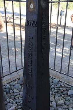 1872 California-Nevada State Boundary Marker |
August 27, 1981 (#81000387) |
Northwest of Verdi on the California/Nevada border 39°31′28″N 120°00′07″W |
Verdi | |
| 2 | 20th Century Club | 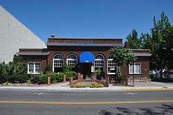 20th Century Club |
April 21, 1983 (#83001113) |
335 W. 1st St. 39°31′29″N 119°49′02″W |
Reno | |
| 3 | Alamo Ranchhouse | 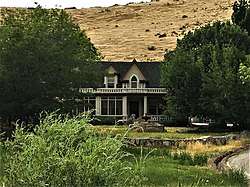 Alamo Ranchhouse |
November 23, 1979 (#79001466) |
Southwest of Steamboat at 20205 S. Virginia St. 39°21′51″N 119°45′18″W |
Steamboat | |
| 4 | Alpha Tau Omega Fraternity House | 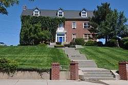 Alpha Tau Omega Fraternity House |
January 28, 2004 (#03001508) |
205 University Terrace 39°32′08″N 119°49′10″W |
Reno | |
| 5 | Applegate-Lassen Trail | December 18, 1978 (#78001722) |
Trail extends from Rye Patch northwest to the California state line 41°11′45″N 119°16′36″W |
High Rock Canyon | ||
| 6 | Bank of Sparks |  Bank of Sparks |
September 28, 2007 (#07001013) |
948 Victorian Ave. 39°32′06″N 119°45′20″W |
Sparks | |
| 7 | W.E. Barnard House |  W.E. Barnard House |
August 22, 2002 (#02000874) |
950 Joaquin Miller Dr. 39°30′47″N 119°49′09″W |
Reno | |
| 8 | Bethel AME Church |  Bethel AME Church |
June 12, 2001 (#01000587) |
220 Bell St. 39°31′34″N 119°49′13″W |
Reno | |
| 9 | Benson Dillon Billinghurst House |  Benson Dillon Billinghurst House |
November 8, 1974 (#74001151) |
729 Evans Ave. 39°31′51″N 119°48′49″W |
Reno | |
| 10 | Borland-Clifford House |  Borland-Clifford House |
March 7, 1983 (#83001114) |
339 Ralston St. 39°31′42″N 119°49′11″W |
Reno | |
| 11 | Bowers Mansion |  Bowers Mansion |
January 31, 1976 (#76001143) |
19 miles (31 km) south of Reno off U.S. Route 395 39°17′04″N 119°50′26″W |
Reno | |
| 12 | Peleg Brown Ranch |  Peleg Brown Ranch |
December 23, 1994 (#94001471) |
12945 Old Virginia Rd. 39°24′43″N 119°44′57″W |
Reno | |
| 13 | Charles H. Burke House |  Charles H. Burke House |
May 31, 1984 (#84002077) |
36 Steward St. 39°31′16″N 119°48′31″W |
Reno | |
| 14 | Burke-Berryman House |  Burke-Berryman House |
September 15, 2004 (#04000984) |
418 Cheney St. 39°31′06″N 119°48′06″W |
Reno | |
| 15 | Cal-Vada Lodge Hotel | June 3, 1994 (#94000551) |
Junction of Stateline Rd. and State Route 28 39°13′38″N 120°00′16″W |
Crystal Bay | ||
| 16 | California Building |  California Building |
September 23, 1992 (#92001257) |
1000 Cowan Dr., Idlewild Park 39°31′19″N 119°50′00″W |
Reno | |
| 17 | Walter Cliff Ranch District | September 16, 1985 (#85002428) |
7635 Old U.S. Route 395 39°13′29″N 119°48′42″W |
Washoe Valley | ||
| 18 | Derby Diversion Dam | 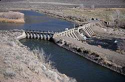 Derby Diversion Dam |
April 26, 1978 (#78001727) |
19 miles (31 km) east of Sparks on Interstate 80 39°35′09″N 119°26′49″W |
Sparks | Extends into Storey County |
| 19 | El Cortez Hotel | 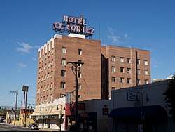 El Cortez Hotel |
June 13, 1984 (#84002078) |
239 W. 2nd St. 39°31′36″N 119°48′57″W |
Reno | |
| 20 | Field Matron's Cottage | 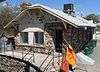 Field Matron's Cottage |
May 16, 2003 (#03000416) |
1995 E. 2nd St. 39°31′40″N 119°47′11″W |
Reno | |
| 21 | First Church of Christ, Scientist | 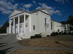 First Church of Christ, Scientist |
August 20, 1999 (#99000939) |
501 Riverside Dr. 39°31′27″N 119°49′06″W |
Reno | |
| 22 | First United Methodist Church | 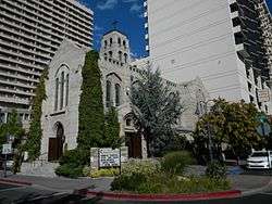 First United Methodist Church |
February 24, 1983 (#83001115) |
W. 1st and West Sts. 39°31′31″N 119°48′53″W |
Reno | |
| 23 | Fleischmann Atmospherium Planetarium | 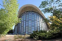 Fleischmann Atmospherium Planetarium |
September 22, 1994 (#94001148) |
N. Virginia St. on the University of Nevada, Reno campus 39°32′46″N 119°49′07″W |
Reno | |
| 24 | Francovich House | 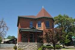 Francovich House |
April 25, 1983 (#83001116) |
557 Washington St. 39°31′41″N 119°49′10″W |
Reno | |
| 25 | Frey Ranch | 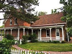 Frey Ranch |
March 5, 1999 (#99000267) |
1140 W. Peckham Ln. 39°29′14″N 119°48′27″W |
Reno | |
| 26 | Galena Creek Schoolhouse |  Galena Creek Schoolhouse |
May 4, 2011 (#11000255) |
16000 Callahan Rd. 39°21′39″N 119°49′06″W |
Reno | School Buildings in Nevada MPS |
| 27 | Luella Garvey House | 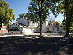 Luella Garvey House |
January 28, 2004 (#03001510) |
589-599 California Ave. 39°31′14″N 119°49′08″W |
Reno | |
| 28 | Gerlach Water Tower | 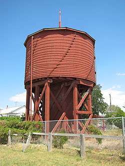 Gerlach Water Tower |
October 29, 1981 (#81000385) |
Main St. 40°39′05″N 119°21′13″W |
Gerlach | |
| 29 | Joseph Giraud House | 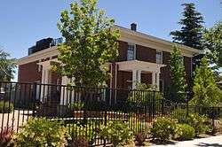 Joseph Giraud House |
April 5, 1984 (#84002079) |
442 Flint St. 39°31′13″N 119°48′49″W |
Reno | |
| 30 | Glendale School | 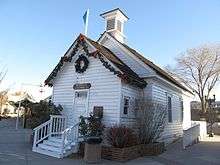 Glendale School |
January 30, 1978 (#78001729) |
Victorian Square[5] 39°28′58″N 119°47′25″W |
Sparks | |
| 31 | William J. Graham House |  William J. Graham House |
March 7, 1983 (#83001117) |
548 California Ave. 39°31′12″N 119°49′03″W |
Reno | |
| 32 | Joseph H. Gray House | 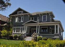 Joseph H. Gray House |
November 20, 1987 (#87001472) |
457 Court St. 39°31′22″N 119°49′04″W |
Reno | |
| 33 | Greystone Castle | 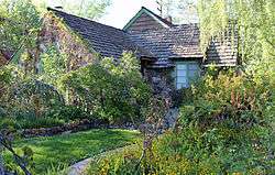 Greystone Castle |
August 22, 2002 (#02000875) |
970 Joaquin Miller Dr. 39°30′47″N 119°49′11″W |
Reno | |
| 34 | Hawkins House | 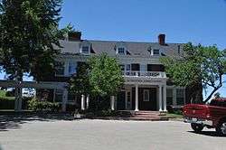 Hawkins House |
December 17, 1979 (#79001465) |
549 Court St. 39°31′19″N 119°49′07″W |
Reno | |
| 35 | Humphrey House | 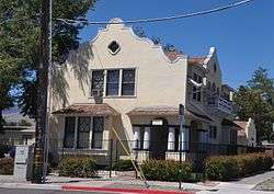 Humphrey House |
March 7, 1983 (#83001118) |
467 Ralston St. 39°31′47″N 119°49′13″W |
Reno | |
| 36 | Immaculate Conception Church | _from_NW_2.JPG) Immaculate Conception Church |
December 23, 1992 (#92001700) |
528 Pyramid Way[6] 39°32′18″N 119°45′09″W |
Sparks | |
| 37 | J. Clarence Kind House | 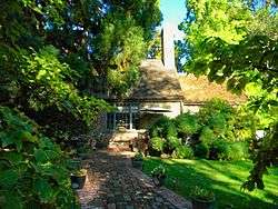 J. Clarence Kind House |
October 5, 2005 (#05001121) |
751 Marsh Ave. 39°31′06″N 119°49′18″W |
Reno | |
| 38 | Lake Mansion | 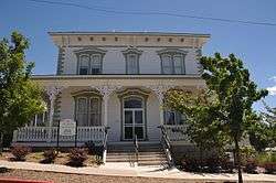 Lake Mansion |
June 29, 1972 (#72000767) |
250 Court Street 39°31′21″N 119°48′57″W |
Reno | |
| 39 | Landrum's Hamburger System No. 1 | 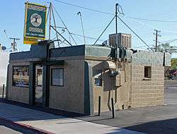 Landrum's Hamburger System No. 1 |
October 30, 1998 (#98001303) |
1300 S. Virginia St. 39°30′42″N 119°48′17″W |
Reno | |
| 40 | Levy House | 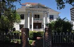 Levy House |
February 24, 1983 (#83001119) |
111-121 California Ave. 39°31′14″N 119°48′40″W |
Reno | |
| 41 | MacKay School of Mines Building | 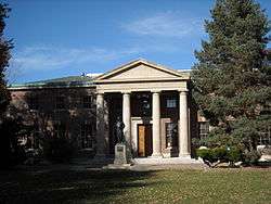 MacKay School of Mines Building |
April 1, 1982 (#82003258) |
University of Nevada, Reno campus 39°32′22″N 119°48′48″W |
Reno | |
| 42 | Marlette Lake Water System | 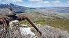 Marlette Lake Water System |
September 16, 1992 (#92001162) |
Roughly from Marlette Lake east to State Route 80 39°13′15″N 119°49′17″W |
Virginia City | |
| 43 | McCarthy-Platt House |  McCarthy-Platt House |
May 31, 1984 (#84002080) |
1000 Plumas St. 39°30′54″N 119°48′42″W |
Reno | |
| 44 | McKinley Park School | 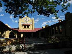 McKinley Park School |
September 16, 1985 (#85002406) |
Riverside Dr. and Keystone Ave. 39°31′19″N 119°49′26″W |
Reno | |
| 45 | Miller-Rowe-Holgate House | 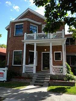 Miller-Rowe-Holgate House |
May 26, 2005 (#05000470) |
18 Winter St. 39°31′20″N 119°49′16″W |
Reno | |
| 46 | Morrill Hall, University of Nevada/Reno | 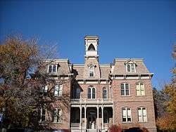 Morrill Hall, University of Nevada/Reno |
May 1, 1974 (#74001152) |
University of Nevada, Reno campus 39°32′15″N 119°48′46″W |
Reno | Italianate building |
| 47 | Mount Rose Elementary School |  Mount Rose Elementary School |
November 25, 1977 (#77000841) |
915 Lander St. 39°30′56″N 119°48′53″W |
Reno | |
| 48 | Nevada-California-Oregon Railroad Depot | 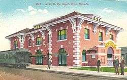 Nevada-California-Oregon Railroad Depot |
February 8, 1980 (#80002469) |
325 E. 4th St. 39°31′52″N 119°48′34″W |
Reno | |
| 49 | Nevada-California-Oregon Railway Locomotive House and Machine Shop | Nevada-California-Oregon Railway Locomotive House and Machine Shop |
May 9, 1983 (#83001120) |
401 E. 4th St. 39°31′52″N 119°48′32″W |
Reno | |
| 50 | Newlands Historic District |  Newlands Historic District |
December 27, 2016 (#16000912) |
Bounded by the Truckee River and Marsh/Keystone Aves., and Arlington and Monroe Sts. 39°30′57″N 119°49′16″W |
Reno | |
| 51 | Senator Francis G. Newlands House | .jpg) Senator Francis G. Newlands House |
October 15, 1966 (#66000459) |
17 Elm Ct. 39°31′17″N 119°49′10″W |
Reno | |
| 52 | Mary Lee Nichols School | Mary Lee Nichols School |
October 31, 2002 (#02001277) |
400-406 Pyramid Way 39°32′13″N 119°45′09″W |
Sparks | |
| 53 | Nortonia Boarding House | 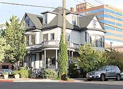 Nortonia Boarding House |
February 24, 1983 (#83001121) |
150 Ridge St. 39°31′19″N 119°48′46″W |
Reno | |
| 54 | Nystrom Guest House | 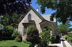 Nystrom Guest House |
April 6, 2000 (#00000339) |
333 Ralston St. 39°31′41″N 119°49′11″W |
Reno | |
| 55 | Old Winters Ranch/Winters Mansion |  Old Winters Ranch/Winters Mansion |
July 30, 1974 (#74001150) |
North of Carson City 39°18′43″N 119°49′18″W |
New Washoe City | |
| 56 | Patrick Ranch House |  Patrick Ranch House |
May 16, 2003 (#03000417) |
1225 Gordon Ave. 39°30′44″N 119°49′04″W |
Reno | |
| 57 | Peavine Ranch | Peavine Ranch |
April 6, 2000 (#00000337) |
11220 N. Virginia St. 39°37′46″N 119°55′13″W |
Reno | |
| 58 | Pincolini Hotel | 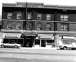 Pincolini Hotel |
October 11, 1984 (#84000086) |
214 Lake St. 39°32′11″N 119°48′35″W |
Reno | |
| 59 | Pioneer Theater-Auditorium | 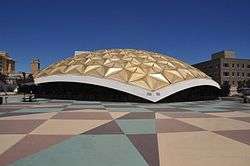 Pioneer Theater-Auditorium |
January 19, 2005 (#04001528) |
100 S. Virginia St. 39°31′27″N 119°48′37″W |
Reno | |
| 60 | Rainier Brewing Company Bottling Plant | March 26, 1980 (#80002470) |
310 Spokane St. 39°31′54″N 119°47′57″W |
Reno | ||
| 61 | Reno National Bank-First Interstate Bank | 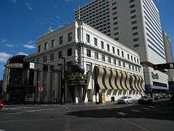 Reno National Bank-First Interstate Bank |
August 6, 1986 (#86002257) |
204 N. Virginia St. 39°31′30″N 119°48′20″W |
Reno | |
| 62 | Reno Southern Pacific Railroad Depot | 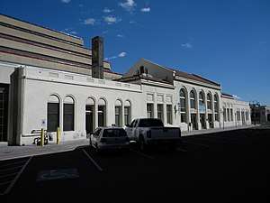 Reno Southern Pacific Railroad Depot |
November 14, 2012 (#12000929) |
280 Commercial Row 39°31′43″N 119°48′37″W |
Reno | |
| 63 | Riverside Hotel | .JPG) Riverside Hotel |
August 6, 1986 (#86002256) |
17 S. Virginia St. 39°31′28″N 119°48′41″W |
Reno | |
| 64 | Robison House | _from_E_1.JPG) Robison House |
September 29, 2006 (#06000895) |
409 13th St. 39°32′14″N 119°45′35″W |
Sparks | |
| 65 | Southside School | 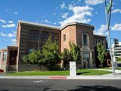 Southside School |
August 5, 1993 (#93000683) |
190 E. Liberty 39°31′20″N 119°48′29″W |
Reno | |
| 66 | Twaddle Mansion | 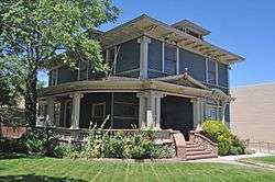 Twaddle Mansion |
March 7, 1983 (#83001122) |
485 W. 5th St. 39°31′49″N 119°49′12″W |
Reno | |
| 67 | Twaddle-Pedroli Ranch | 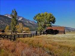 Twaddle-Pedroli Ranch |
April 6, 2000 (#00000340) |
4970 Susan Lee Circle 39°16′04″N 119°50′06″W |
Washoe Valley | |
| 68 | Tyson House | 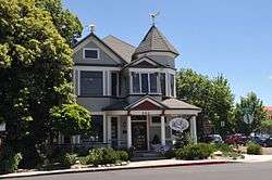 Tyson House |
February 24, 1983 (#83001123) |
242 W. Liberty St. 39°31′15″N 119°48′50″W |
Reno | |
| 69 | University of Nevada Reno Historic District | 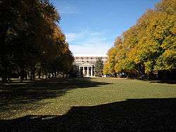 University of Nevada Reno Historic District |
February 25, 1987 (#87000135) |
Virginia St. 39°32′18″N 119°48′50″W |
Reno | |
| 70 | Pearl Upson House | 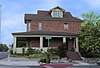 Pearl Upson House |
August 14, 2003 (#03000749) |
937 Jones St. 39°31′20″N 119°49′25″W |
Reno | |
| 71 | US Post Office-Reno Main | 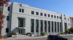 US Post Office-Reno Main |
February 28, 1990 (#90000135) |
50 S. Virginia St. 39°31′29″N 119°48′39″W |
Reno | |
| 72 | Vachina Apartments-California Apartments | 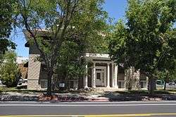 Vachina Apartments-California Apartments |
August 6, 1986 (#86002258) |
45 California Ave. 39°31′30″N 119°48′20″W |
Reno | |
| 73 | Veterans Memorial School | 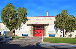 Veterans Memorial School |
April 4, 1995 (#93000690) |
1200 Locust St. 39°30′48″N 119°47′53″W |
Reno | |
| 74 | Veterans of Foreign Wars Building | 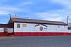 Veterans of Foreign Wars Building |
June 10, 2008 (#08000511) |
301 Burris Ln. 39°29′21″N 119°47′57″W |
Reno | |
| 75 | Virginia Street Bridge | 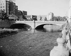 Virginia Street Bridge |
December 10, 1980 (#80002471) |
Spans the Truckee River 39°31′30″N 119°48′42″W |
Reno | |
| 76 | Wadsworth Union Church | 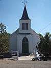 Wadsworth Union Church |
April 15, 2004 (#04000298) |
Junction of Lincoln Highway and Railroad Ave. 39°38′00″N 119°17′01″W |
Wadsworth | |
| 77 | Washoe County Courthouse | 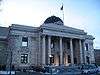 Washoe County Courthouse |
August 6, 1986 (#86002254) |
117 S. Virginia St. 39°31′25″N 119°48′24″W |
Reno | |
| 78 | Washoe County Library | 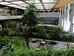 Washoe County Library |
February 13, 2013 (#13000011) |
301 S. Center St. 39°31′20″N 119°48′37″W |
Reno | |
| 79 | Washoe County Library-Sparks Branch |  Washoe County Library-Sparks Branch |
March 9, 1992 (#92000116) |
814 Victorian St. 39°32′07″N 119°45′08″W |
Sparks | |
| 80 | Whittell Estate | 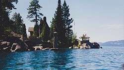 Whittell Estate |
October 27, 2000 (#00001207) |
5000 State Route 28 39°10′29″N 119°55′55″W |
Incline Village | Also known as Thunderbird Lodge |
| 81 | Withers Log House | April 6, 2000 (#00000341) |
344 Wassou 39°14′11″N 120°00′04″W |
Crystal Bay |
Former listings
| [3] | Name on the Register | Image | Date listed | Date removed | Location | City or town | Summary |
|---|---|---|---|---|---|---|---|
| 1 | Bell Telephone of Nevada | August 6, 1986 (#86002260) | October 13, 2000 | 100 N. Center |
Reno | Demolished in 1994.[7] | |
| 2 | Mapes Hotel and Casino | May 4, 1984 (#84002081) | October 13, 2000 | 10 N. Virginia St. |
Reno | Imploded January 20, 2000.[8] | |
| 3 | Odd Fellows Building | November 27, 1978 (#78001730) | October 13, 2000 | 133 N. Sierra St. |
Reno | Demolished in 1992.[9] | |
| 4 | Riverside Mill Company Flourmill | August 18, 1982 (#82003259) | October 13, 2000 | 345 E. 2nd St. |
Reno | Demolished sometime in the 1980s.[10] | |
| 5 | George Wingfield House | July 15, 1982 (#82003260) | July 22, 2002 | 219 Court Street |
Reno |
gollark: Well, calculators are triangular anyway.
gollark: I'm only missing advanced features like "lists".
gollark: I've managed to get somewhat sort of working markdown to virtual DOM conversion by using the parsing half of an existing Markdown library and a hacky renderer thingy running on the input tokens.
gollark: Integrated circuit.
gollark: Your first step should probably be duckduckgoing for relevant information on your wätch model.
See also
| Wikimedia Commons has media related to National Register of Historic Places in Washoe County, Nevada. |
References
- The latitude and longitude information provided in this table was derived originally from the National Register Information System, which has been found to be fairly accurate for about 99% of listings. Some locations in this table may have been corrected to current GPS standards.
- "National Register of Historic Places: Weekly List Actions". National Park Service, United States Department of the Interior. Retrieved on August 14, 2020.
- Numbers represent an ordering by significant words. Various colorings, defined here, differentiate National Historic Landmarks and historic districts from other NRHP buildings, structures, sites or objects.
- The eight-digit number below each date is the number assigned to each location in the National Register Information System database, which can be viewed by clicking the number.
- Walpole, Jeanne Lauf (2007). Insiders Guide to Reno and Lake Tahoe. Guilford, CT: Morris Book Publishing. p. 148. ISBN 978-0-7627-4190-8. Retrieved April 9, 2014.
- See photo showing street address
| Topics | |
|---|---|
| Lists by state |
|
| Lists by insular areas | |
| Lists by associated state | |
| Other areas | |
| Related | |
| |
This article is issued from Wikipedia. The text is licensed under Creative Commons - Attribution - Sharealike. Additional terms may apply for the media files.