National Register of Historic Places listings in Randolph County, Illinois
This is a list of the National Register of Historic Places listings in Randolph County, Illinois.
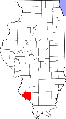
Location of Randolph County in Illinois
This is intended to be a complete list of the properties and districts on the National Register of Historic Places in Randolph County, Illinois, United States. Latitude and longitude coordinates are provided for many National Register properties and districts; these locations may be seen together in a map.[1]
There are 18 properties and districts listed on the National Register in the county, including 3 National Historic Landmarks.
- This National Park Service list is complete through NPS recent listings posted August 14, 2020.[2]
Current listings
| [3] | Name on the Register[4] | Image | Date listed[5] | Location | City or town | Description |
|---|---|---|---|---|---|---|
| 1 | Charter Oak Schoolhouse | 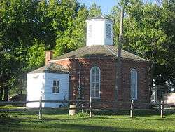 Charter Oak Schoolhouse |
October 11, 1978 (#78001181) |
West of Schuline 38°05′21″N 89°47′39″W |
Schuline | |
| 2 | Creole House | 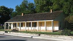 Creole House |
April 3, 1973 (#73000717) |
Market St. 38°05′08″N 90°05′50″W |
Prairie du Rocher | |
| 3 | Fort de Chartres | Fort de Chartres |
October 15, 1966 (#66000329) |
Terminus of Illinois Route 155, west of Prairie du Rocher 38°05′04″N 90°09′28″W |
Prairie du Rocher | |
| 4 | French Colonial Historic District | 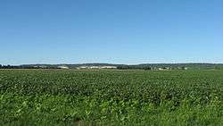 French Colonial Historic District |
April 3, 1974 (#74000772) |
From Fort Chartres State Park to Kaskaskia Island 38°04′48″N 90°07′48″W |
Prairie du Rocher | Extends into Monroe County |
| 5 | Kolmer Site | 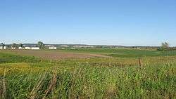 Kolmer Site |
May 1, 1974 (#74000773) |
Levee Rd., west of Fort Chartres State Park[6] 38°05′30″N 90°10′51″W |
Prairie du Rocher | |
| 6 | Mary's River Covered Bridge | 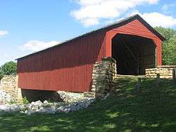 Mary's River Covered Bridge |
December 31, 1974 (#74000771) |
About 4 miles northeast of Chester on Illinois Route 150 37°56′54″N 89°45′57″W |
Chester | |
| 7 | Pierre Menard House | 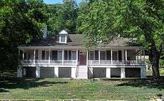 Pierre Menard House |
April 15, 1970 (#70000245) |
Fort Kaskaskia State Park 37°57′41″N 89°54′24″W |
Ellis Grove | |
| 8 | Modoc Rock Shelter | 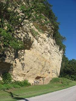 Modoc Rock Shelter |
October 15, 1966 (#66000328) |
Northeastern side of County Road 7 southeast of Roscow Hollow Rd.[7] 38°03′46″N 90°03′50″W |
Modoc | |
| 9 | Old Fire Station | .jpg) Old Fire Station |
June 15, 2018 (#100002571) |
822 Swanwick 37°54′41″N 89°49′31″W |
Chester | |
| 10 | Piney Creek Site | 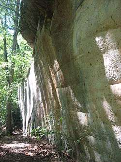 Piney Creek Site |
May 31, 2001 (#01000601) |
North of Piney Creek in Piney Creek Ravine Nature Preserve[8] 37°53′49″N 89°38′10″W |
Campbell Hill | |
| 11 | Piney Creek South Site | 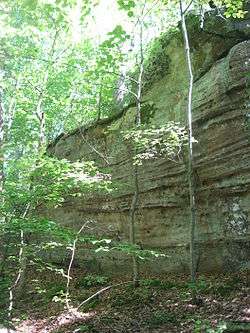 Piney Creek South Site |
May 31, 2001 (#01000602) |
South of Piney Creek in Piney Creek Ravine Nature Preserve[9] 37°53′47″N 89°38′09″W |
Campbell Hill | |
| 12 | Piney Creek West Site | 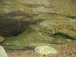 Piney Creek West Site |
May 31, 2001 (#01000600) |
North of Piney Creek in Piney Creek Ravine Nature Preserve[10] 37°53′49″N 89°38′14″W |
Campbell Hill | |
| 13 | Red Bud Historic District | 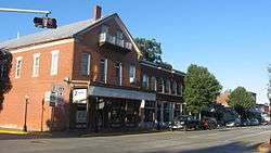 Red Bud Historic District |
December 29, 1979 (#79000865) |
Irregular pattern along Main and Market Sts. 38°12′33″N 89°59′37″W |
Red Bud | |
| 14 | Shiloh College | 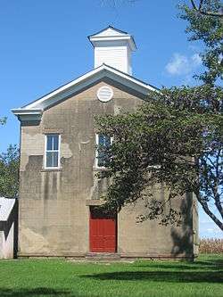 Shiloh College |
November 15, 2005 (#05001251) |
13043 Walnut St. 37°55′36″N 89°37′12″W |
Shiloh Hill | |
| 15 | Sparta Historic District | 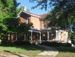 Sparta Historic District |
June 3, 1982 (#82002595) |
S. St. Louis, W. 3rd, and S. James Sts. 38°07′11″N 89°42′15″W |
Sparta | |
| 16 | Tegtmeyer Site | 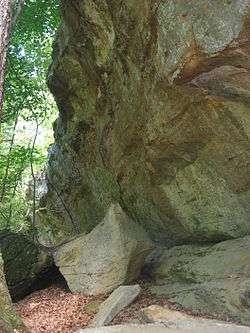 Tegtmeyer Site |
May 31, 2001 (#01000599) |
North of Piney Creek in Piney Creek Ravine Nature Preserve[11] 37°53′51″N 89°38′16″W |
Campbell Hill | |
| 17 | Christian F. Weinrich House | 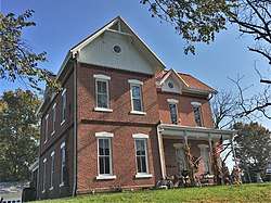 Christian F. Weinrich House |
June 20, 2018 (#100002572) |
217 Opdyke St. 37°54′39″N 89°49′18″W |
Chester | |
| 18 | Frederick Weistar House | 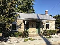 Frederick Weistar House |
June 15, 2018 (#100002573) |
515 Chestnut St. 37°54′15″N 89°49′44″W |
Chester | Misspelled Frederick Weister House in its listing |
gollark: Who are you talking to here?
gollark: I don't agree with violence against people with different beliefs. I definitely don't agree with killing them.
gollark: It's not like organizations actually have to do what their name implies/what they claim to do, in general.
gollark: Not really.
gollark: Probably some are.
See also
| Wikimedia Commons has media related to National Register of Historic Places in Randolph County, Illinois. |
References
- The latitude and longitude information provided in this table was derived originally from the National Register Information System, which has been found to be fairly accurate for about 99% of listings. Some locations in this table may have been corrected to current GPS standards.
- "National Register of Historic Places: Weekly List Actions". National Park Service, United States Department of the Interior. Retrieved on August 14, 2020.
- Numbers represent an ordering by significant words. Various colorings, defined here, differentiate National Historic Landmarks and historic districts from other NRHP buildings, structures, sites or objects.
- "National Register Information System". National Register of Historic Places. National Park Service. March 13, 2009.
- The eight-digit number below each date is the number assigned to each location in the National Register Information System database, which can be viewed by clicking the number.
- Brown, Margaret Kimball. National Register of Historic Places Inventory/Nomination: Kolmer Site. National Park Service, n.d., 4.
- Styles, Bonnie W. National Register of Historic Places Inventory/Nomination: Modoc Rock Shelter. National Park Service, 1985-01-29, 1.
- Wagner, Mark J. National Register of Historic Places Inventory/Nomination: Piney Creek Site. National Park Service, 2000-05-15, 34.
- Wagner, Mark J. National Register of Historic Places Inventory/Nomination: Piney Creek South Site. National Park Service, 2000-05-15, 21.
- Wagner, Mark J. National Register of Historic Places Inventory/Nomination: Piney Creek West Site. National Park Service, 2000-05-15, 19.
- Wagner, Mark J. National Register of Historic Places Inventory/Nomination: Tegtmeyer Site. National Park Service, 2000-05-15, 19.
| Topics | |
|---|---|
| Lists by state |
|
| Lists by insular areas | |
| Lists by associated state | |
| Other areas | |
| Related | |
| |
Municipalities and communities of Randolph County, Illinois, United States | ||
|---|---|---|
| Cities | Map of Illinois highlighting Randolph County | |
| Villages | ||
| Precincts | ||
| Unincorporated communities | ||
This article is issued from Wikipedia. The text is licensed under Creative Commons - Attribution - Sharealike. Additional terms may apply for the media files.