National Register of Historic Places listings in Pennington County, South Dakota
This is a list of the National Register of Historic Places listings in Pennington County, South Dakota.
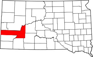
Location of Pennington County in South Dakota
This is intended to be a complete list of the properties and districts on the National Register of Historic Places in Pennington County, South Dakota, United States. The locations of National Register properties and districts for which the latitude and longitude coordinates are included below, may be seen in a map.[1]
There are 60 properties and districts listed on the National Register in the county. One property was once listed but has since been delisted.
- This National Park Service list is complete through NPS recent listings posted August 14, 2020.[2]
Current listings
| [3] | Name on the Register[4] | Image | Date listed[5] | Location | City or town | Description |
|---|---|---|---|---|---|---|
| 1 | Archeological Site No. 39PN376 |  Archeological Site No. 39PN376 |
October 25, 1993 (#93001072) |
Address Restricted |
Custer | |
| 2 | Black Hills Model Home | 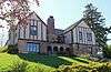 Black Hills Model Home |
December 15, 2004 (#04001366) |
2101 West Boulevard 44°03′54″N 103°14′07″W |
Rapid City | |
| 3 | Burlington and Quincy High Line Hill City to Keystone Branch | 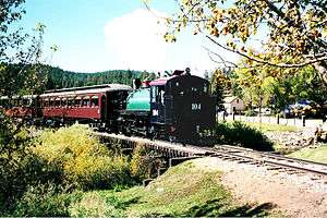 Burlington and Quincy High Line Hill City to Keystone Branch |
February 5, 2003 (#02001768) |
Along the railroad right of way from 222 Railroad Ave to Keystone Depot 43°54′51″N 103°30′06″W |
Hill City | |
| 4 | Lewis Byron House |  Lewis Byron House |
June 17, 1982 (#82003935) |
Cemetery Rd. 43°53′10″N 103°25′13″W |
Keystone | Rustic log house built in 1927 above Rapid Creek, designed by A.I. Johnson with chimney stonework by a mason named Nystrom. Byron ran the Holy Terror mine.[6] |
| 5 | Calumet Hotel | Calumet Hotel |
January 7, 2000 (#99001659) |
Ash and B Ave. 44°04′04″N 102°26′47″W |
Wasta | |
| 6 | Casper Supply Company of SD | 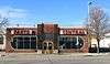 Casper Supply Company of SD |
August 16, 2000 (#00000996) |
415 Main St. 44°04′50″N 103°13′26″W |
Rapid City | |
| 7 | Cassidy House | .JPG) Cassidy House |
December 2, 1998 (#98001407) |
4121 Canyon Lake Rd. 44°03′53″N 103°17′16″W |
Rapid City | |
| 8 | Chapel in the Hills | 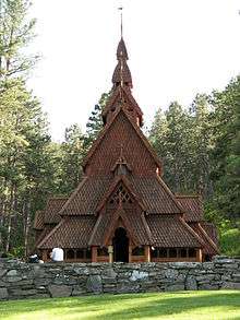 Chapel in the Hills |
August 7, 2012 (#12000487) |
3788 Chapel Ln. 44°02′57″N 103°17′59″W |
Rapid City | |
| 9 | Church of the Immaculate Conception | .JPG) Church of the Immaculate Conception |
June 5, 1975 (#75001721) |
918 5th St. 44°04′33″N 103°13′31″W |
Rapid City | |
| 10 | Civilian Conservation Corp Camp F-10 | January 28, 2004 (#03001531) |
13381 Silver Mountain Rd. 43°56′56″N 103°22′53″W |
Rapid City | ||
| 11 | Dean Motor Company | 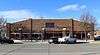 Dean Motor Company |
June 23, 1995 (#95000768) |
329 Main St. 44°04′49″N 103°13′21″W |
Rapid City | |
| 12 | Dinosaur Park | 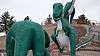 Dinosaur Park |
June 21, 1990 (#90000956) |
Skyline Dr. southwest of Lincoln School 44°04′40″N 103°14′42″W |
Rapid City | |
| 13 | Emmanuel Episcopal Church | .JPG) Emmanuel Episcopal Church |
May 29, 1975 (#75001722) |
717 Quincy St. 44°04′41″N 103°13′50″W |
Rapid City | |
| 14 | Fairmont Creamery Company Building | 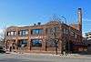 Fairmont Creamery Company Building |
February 14, 2006 (#06000048) |
201 Main St. 44°04′55″N 103°13′18″W |
Rapid City | |
| 15 | Feigel House | 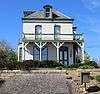 Feigel House |
March 3, 1997 (#97000145) |
328 E. New York St. 44°05′05″N 103°12′21″W |
Rapid City | |
| 16 | First Congregational Church | .JPG) First Congregational Church |
February 23, 1984 (#84003372) |
715 Kansas City St. 44°04′45″N 103°13′47″W |
Rapid City | |
| 17 | Gambrill Storage Building | 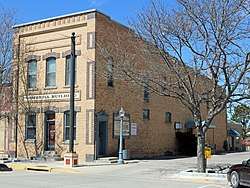 Gambrill Storage Building |
February 23, 1984 (#84003379) |
822 Main St. 44°04′55″N 103°13′52″W |
Rapid City | |
| 18 | Golden Summit Mine Foreman's Cabin |  Golden Summit Mine Foreman's Cabin |
August 7, 2012 (#12000488) |
24085 Palmer Gulch Rd. 43°54′57″N 103°32′03″W |
Hill City | |
| 19 | Gramberg Ranch | December 17, 1999 (#99001584) |
14895 Lower Spring Rd. 43°54′30″N 103°05′02″W |
Hermosa | ||
| 20 | Harney Peak Hotel | .jpg) Harney Peak Hotel |
April 11, 1977 (#77001252) |
U.S. Route 16 43°55′58″N 103°34′30″W |
Hill City | |
| 21 | Harney Peak Lookout Tower, Dam, Pumphouse and Stairway | 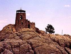 Harney Peak Lookout Tower, Dam, Pumphouse and Stairway |
March 10, 1983 (#83003019) |
Northeast of Custer 43°51′57″N 103°31′55″W |
Custer | |
| 22 | Harney Peak Tin Mining Company Buildings |  Harney Peak Tin Mining Company Buildings |
July 21, 1977 (#77001251) |
U.S. Route 16 43°56′08″N 103°33′53″W |
Hill City | |
| 23 | Zack Holmes House | 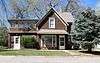 Zack Holmes House |
June 17, 1982 (#82003937) |
818 St. James St. 44°04′22″N 103°13′57″W |
Rapid City | |
| 24 | House and Sawmill Johnson Siding | June 17, 1982 (#82003938) |
Rimrock Highway 44°04′50″N 103°26′26″W |
Rapid City | ||
| 25 | Keystone School | 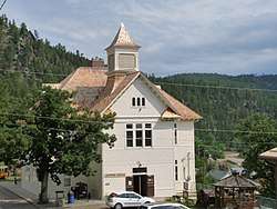 Keystone School |
February 22, 1981 (#81000577) |
3rd St. 43°53′43″N 103°25′11″W |
Keystone | Large rural school built 1897-1900 by Eli Shomaker, with roof of wood shingles.[7] Now the Keystone Historical Museum. |
| 26 | Keystone Trading Company Store |  Keystone Trading Company Store |
June 17, 1982 (#82003936) |
Highway 40 43°53′47″N 103°25′07″W |
Keystone | |
| 27 | Josef and Marie Kudrna Homestead and Ranch | January 21, 2015 (#14001185) |
18100 E. SD 44 43°45′16″N 102°26′27″W |
Scenic | ||
| 28 | Madison Ranch | August 14, 2003 (#03000767) |
8800 Nemo Rd. 44°07′11″N 103°21′48″W |
Rapid City | ||
| 29 | C.E. McEachron General Merchandise | 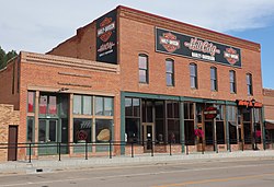 C.E. McEachron General Merchandise |
June 3, 1994 (#94000565) |
349 Main St. 43°55′52″N 103°34′31″W |
Hill City | |
| 30 | Milwaukee Road Freight House | 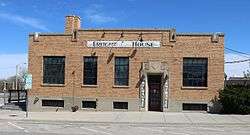 Milwaukee Road Freight House |
January 19, 1989 (#88003200) |
306 7th St. 44°04′47″N 103°13′38″W |
Rapid City | |
| 31 | Motor Service Company | 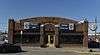 Motor Service Company |
June 23, 1995 (#95000766) |
402 St. Joseph St. 44°04′47″N 103°13′24″W |
Rapid City | |
| 32 | Mount Rushmore National Memorial | 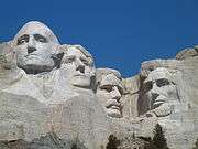 Mount Rushmore National Memorial |
October 15, 1966 (#66000718) |
3 miles west of Keystone off U.S. Route 16A 43°52′40″N 103°27′20″W |
Keystone | |
| 33 | Mystic Townsite Historic District | Mystic Townsite Historic District |
August 1, 1986 (#86002093) |
Address Restricted |
Mystic | |
| 34 | Maurice Nelson House |  Maurice Nelson House |
December 2, 1998 (#98001403) |
101 E. Quincy St. 44°04′35″N 103°12′51″W |
Rapid City | |
| 35 | Nichols Funeral Home Building | 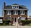 Nichols Funeral Home Building |
January 28, 2004 (#03001532) |
832 St. Joseph 44°04′59″N 103°13′57″W |
Rapid City | |
| 36 | Otho Mining District |  Otho Mining District |
December 15, 2004 (#04001365) |
13380 Greyhound Gulch 43°51′15″N 103°23′04″W |
Otho | |
| 37 | Pennington County Courthouse | 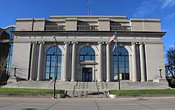 Pennington County Courthouse |
May 28, 1976 (#76001751) |
301 St. Joseph St. 44°04′44″N 103°13′21″W |
Rapid City | |
| 38 | Quinn Methodist Church | 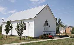 Quinn Methodist Church |
January 23, 2007 (#06001308) |
Junction of Elm and Main Streets 43°59′22″N 102°07′40″W |
Quinn | |
| 39 | Michael Quinn House | 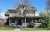 Michael Quinn House |
August 5, 1993 (#93000782) |
728 6th St. 44°04′40″N 103°13′36″W |
Rapid City | |
| 40 | Rapid City Carnegie Library | 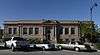 Rapid City Carnegie Library |
February 17, 1981 (#81000578) |
604 Kansas City St. 44°04′46″N 103°13′39″W |
Rapid City | |
| 41 | Rapid City Fruit Company | 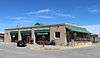 Rapid City Fruit Company |
December 9, 1993 (#93001340) |
320 7th St. 44°05′30″N 103°13′39″W |
Rapid City | |
| 42 | Rapid City Garage | 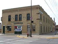 Rapid City Garage |
August 1, 1984 (#84003381) |
827-829 Main St. 44°04′54″N 103°13′53″W |
Rapid City | |
| 43 | Rapid City High School |  Rapid City High School |
June 28, 2010 (#10000409) |
615 Columbus St. 44°04′37″N 103°13′43″W |
Rapid City | |
| 44 | Rapid City Historic Commercial District | 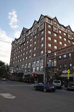 Rapid City Historic Commercial District |
October 1, 1974 (#74001897) |
Bounded by both sides of Main, St. Joseph, 7th, and 6th Sts. • Boundary increase (listed July 9, 1998, refnum 98000841): Roughly along St. Joseph and Main Sts. from Mt. Rushmore and 5th Sts. 44°04′51″N 103°13′39″W |
Rapid City | |
| 45 | Rapid City Historical Museum | 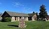 Rapid City Historical Museum |
December 20, 1988 (#88002837) |
515 West Boulevard 44°08′09″N 103°14′00″W |
Rapid City | |
| 46 | Rapid City Laundry | 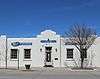 Rapid City Laundry |
June 23, 1995 (#95000767) |
312 Main St. 44°04′50″N 103°13′16″W |
Rapid City | |
| 47 | Rapid City Masonic Temple | 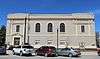 Rapid City Masonic Temple |
December 6, 2016 (#16000828) |
618 Kansas City St. 44°04′45″N 103°13′43″W |
Rapid City | |
| 48 | Rapid City West Boulevard Historic District | 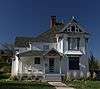 Rapid City West Boulevard Historic District |
December 31, 1974 (#74001898) |
Bordered by Kansas City, Fairview, 11th, 7th, and 8th Sts. • Boundary increase (listed July 7, 1995, refnum 95000770): Roughly the area surrounding 9th, 10th, and 11th Sts. from Kansas City St. to St. Andrews St. 44°04′38″N 103°14′00″W |
Rapid City | |
| 49 | Glenn W. Shaw House | 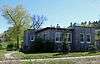 Glenn W. Shaw House |
June 27, 2002 (#02000706) |
803 West St. 44°04′47″N 103°14′27″W |
Rapid City | |
| 50 | Site No. 39 PN 57 | Site No. 39 PN 57 |
May 20, 1982 (#82004778) |
Address Restricted |
City restricted | |
| 51 | Site No. 39 PN 108 | Site No. 39 PN 108 |
May 20, 1982 (#82004775) |
Address Restricted |
City restricted | |
| 52 | Site No. 39 PN 438 | Site No. 39 PN 438 |
May 20, 1982 (#82004776) |
Address Restricted |
City restricted | |
| 53 | Site No. 39 PN 439 | Site No. 39 PN 439 |
May 20, 1982 (#82004777) |
Address Restricted |
City restricted | |
| 54 | Sitting Bull Crystal Cavern Dance Pavilion | December 14, 1995 (#95001475) |
U.S. Route 16 northeast of Rockerville 43°58′21″N 103°18′45″W |
Rockerville | ||
| 55 | South Dakota Department of Transportation Bridge No. 52-575-383 | South Dakota Department of Transportation Bridge No. 52-575-383 |
December 17, 1999 (#99001586) |
Local road over Rapid Creek 43°58′01″N 102°54′31″W |
Caputa | |
| 56 | South Dakota Department of Transportation Bridge No. 52-824-300 | South Dakota Department of Transportation Bridge No. 52-824-300 |
December 17, 1999 (#99001585) |
Local road over the Cheyenne River 44°04′52″N 102°24′04″W |
Wasta | |
| 57 | Swander Bakery Building | 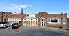 Swander Bakery Building |
February 9, 2001 (#01000099) |
601 12th St. 44°04′53″N 103°14′17″W |
Rapid City | |
| 58 | Von Woehrmann Building | 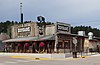 Von Woehrmann Building |
April 13, 1977 (#77001253) |
U.S. Route 16 43°55′44″N 103°34′33″W |
Hill City | |
| 59 | Wasta Rest Stop Tipi-Eastbound | 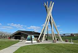 Wasta Rest Stop Tipi-Eastbound |
January 20, 2015 (#14001186) |
Mi. 98.6 on I-90 44°03′47″N 102°26′23″W |
Wasta | |
| 60 | Wasta Rest Stop Tipi-Westbound | 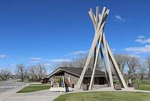 Wasta Rest Stop Tipi-Westbound |
January 20, 2015 (#14001187) |
Mi. 98.6 on I-90 44°03′54″N 102°26′04″W |
Wasta |
Former listing
| [3] | Name on the Register | Image | Date listed | Date removed | Location | City or town | Summary |
|---|---|---|---|---|---|---|---|
| 1 | Pap Madison Cabin | 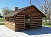 Pap Madison Cabin |
February 19, 2008 (#08000054) | December 12, 2017 | Bounded by W. Main St., St. Joseph St., and West Boulevard 44°05′02″N 103°14′17″W |
Rapid City | Moved to The Journey Museum & Learning Center at 222 New York St. in 2012.[8] |
gollark: Or nature in general.
gollark: I mean, maybe.
gollark: Mostly.
gollark: In modern countries we mostly don't have it, happily.
gollark: More of a thing which happens a lot in some types of society, I guess.
See also
| Wikimedia Commons has media related to National Register of Historic Places in Pennington County, South Dakota. |
References
- The latitude and longitude information provided in this table was derived originally from the National Register Information System, which has been found to be fairly accurate for about 99% of listings. Some locations in this table may have been corrected to current GPS standards.
- "National Register of Historic Places: Weekly List Actions". National Park Service, United States Department of the Interior. Retrieved on August 14, 2020.
- Numbers represent an ordering by significant words. Various colorings, defined here, differentiate National Historic Landmarks and historic districts from other NRHP buildings, structures, sites or objects.
- "National Register Information System". National Register of Historic Places. National Park Service. April 24, 2008.
- The eight-digit number below each date is the number assigned to each location in the National Register Information System database, which can be viewed by clicking the number.
- Dolores McDermand; Carolyn Torma (1982-01-28). "NRHP Inventory/Nomination: Byron, Lewis, House". National Park Service. Retrieved 2017-08-11. With six photos.
- Orville Creighton; Carolyn Torma; John Burrows (1980-11-06). "NRHP Inventory/Nomination: Keystone School". National Park Service. Retrieved 2017-08-11. With four photos.
- Rusch, Emilie (2012-04-09). "'Pap' Madison cabin moving day coming". Rapid City Journal. Retrieved 2017-05-05.
| Topics | |
|---|---|
| Lists by state |
|
| Lists by insular areas | |
| Lists by associated state | |
| Other areas | |
| Related | |
| |
Municipalities and communities of Pennington County, South Dakota, United States | ||
|---|---|---|
| Cities | | |
| Towns | ||
| CDPs | ||
| Former CDP | ||
| Unincorporated communities | ||
| Ghost towns | ||
| Footnotes | ‡This populated place also has portions in an adjacent county or counties | |
This article is issued from Wikipedia. The text is licensed under Creative Commons - Attribution - Sharealike. Additional terms may apply for the media files.