National Register of Historic Places listings in Knox County, Maine
This is a list of the National Register of Historic Places listings in Knox County, Maine.
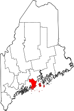
Location of Knox County in Maine.
This is intended to be a complete list of the properties and districts on the National Register of Historic Places in Knox County, Maine, United States. Latitude and longitude coordinates are provided for many National Register properties and districts; these locations may be seen together in a map.[1]
There are 94 properties and districts listed on the National Register in the county; 10 of the properties are National Historic Landmarks. One property was once listed, but has since been removed.
- This National Park Service list is complete through NPS recent listings posted August 14, 2020.[2]
| Androscoggin - Aroostook - Cumberland - Franklin - Hancock - Kennebec - Knox - Lincoln - Oxford - Penobscot - Piscataquis - Sagadahoc - Somerset - Waldo - Washington - York |
Current listings
| [3] | Name on the Register[4] | Image | Date listed[5] | Location | City or town | Description |
|---|---|---|---|---|---|---|
| 1 | Ebenezer Alden House | 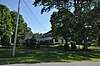 Ebenezer Alden House |
April 28, 1975 (#75000100) |
Off State Route 131 44°12′44″N 69°16′03″W |
Union | |
| 2 | Allen's Island | December 15, 1983 (#83003646) |
In Muscongus Bay[6] 43°52′16″N 69°18′42″W |
St. George | ||
| 3 | American Boathouse | February 19, 1982 (#82000761) |
Atlantic Ave. 44°12′40″N 69°03′48″W |
Camden | ||
| 4 | American Eagle (schooner) |  American Eagle (schooner) |
December 4, 1991 (#91002064) |
Rockland Harbor 44°06′32″N 69°06′32″W |
Rockland | National Historic Landmark |
| 5 | Joe Amesbury Place | March 11, 1982 (#82000760) |
Address Restricted |
North Haven | ||
| 6 | Beechnut Hut Historic District | 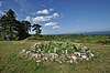 Beechnut Hut Historic District |
July 10, 2003 (#03000617) |
316 Beech Hill Rd. 44°10′07″N 69°06′15″W |
Rockport | |
| 7 | Bortz-Lewis Site | March 11, 1982 (#82000762) |
Address Restricted |
North Haven | ||
| 8 | Browns Head Light Station | 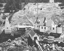 Browns Head Light Station |
January 27, 1983 (#83000460) |
Browns Head 44°06′42″N 68°54′35″W |
Vinalhaven | |
| 9 | Bull Rock | March 11, 1982 (#82000763) |
Address Restricted |
North Haven | ||
| 10 | Benjamin Burton Garrison Site | September 9, 1983 (#83000461) |
Address Restricted |
Cushing | ||
| 11 | Cabot I Site | March 11, 1982 (#82000764) |
Address Restricted |
North Haven | ||
| 12 | Camden Great Fire Historic District |  Camden Great Fire Historic District |
January 9, 2007 (#06001221) |
Elm and Main Sts. 44°12′35″N 69°03′57″W |
Camden | |
| 13 | Camden Opera House Block |  Camden Opera House Block |
December 29, 1986 (#86003539) |
Off U.S. Route 1 44°12′32″N 69°04′01″W |
Camden | |
| 14 | Camden Amphitheater and Public Library | 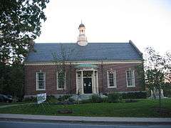 Camden Amphitheater and Public Library |
February 27, 2013 (#13000285) |
55 Main St. 44°12′41″N 69°03′51″W |
Camden | |
| 15 | Camden Yacht Club | 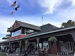 Camden Yacht Club |
January 11, 1980 (#80000378) |
Bay View St. 44°12′26″N 69°03′43″W |
Camden | |
| 16 | Chestnut Street Historic District | 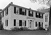 Chestnut Street Historic District |
March 22, 1991 (#91000325) |
Chestnut St. from Elm to Beacon Ave., including parts of Penobscot, Pleasant and Wood Sts., and Dillingham Pt. 44°12′13″N 69°03′43″W |
Camden | |
| 17 | The Common | 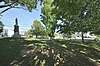 The Common |
November 7, 2007 (#07001151) |
Between Common and Burkett Rds. 44°12′41″N 69°16′30″W |
Union | |
| 18 | Conway House | 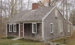 Conway House |
December 23, 1969 (#69000010) |
Conway Rd. 44°12′01″N 69°04′52″W |
Camden | |
| 19 | Crocker Site | March 11, 1982 (#82000765) |
Address Restricted |
North Haven | ||
| 20 | Curtis Island Light | 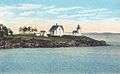 Curtis Island Light |
May 17, 1973 (#73000263) |
3.8 miles from Camden Harbor in Penobscot Bay 44°12′07″N 69°03′03″W |
Camden | |
| 21 | Dunn & Elliot Sail Loft | March 13, 2020 (#100005096) |
54 Water St. 44°04′26″N 69°11′08″W |
Thomaston | ||
| 22 | Farnsworth Homestead | 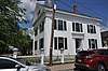 Farnsworth Homestead |
May 25, 1973 (#73000241) |
21 Elm St. 44°06′11″N 69°06′39″W |
Rockland | |
| 23 | Finnish Congregational Church and Parsonage | 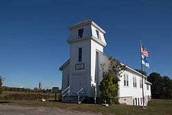 Finnish Congregational Church and Parsonage |
June 24, 1994 (#94000639) |
Eastern side of State Route 131, 0.9 miles south of its junction with U.S. Route 1 44°04′18″N 69°09′43″W |
South Thomaston | |
| 24 | Gaunt Neck Site Complex | December 28, 2005 (#05001467) |
Address Restricted 43°58′59″N 69°18′20″W |
Cushing | ||
| 25 | Georges River Canal | 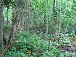 Georges River Canal |
March 5, 1970 (#70000048) |
Upper Falls of the Georges River in Warren to the Union town line, extending to Quantabacook Pond in Searsmont 44°15′N 69°15′W |
Appleton, Union, and Warren | |
| 26 | Goose Rocks Light Station | 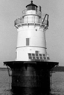 Goose Rocks Light Station |
January 21, 1988 (#87002267) |
East Entrance to the Fox Islands Thorofare 44°08′07″N 68°49′52″W |
North Haven | |
| 27 | Grace Bailey (two-masted schooner) | 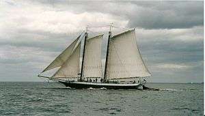 Grace Bailey (two-masted schooner) |
October 1, 1990 (#90001466) |
Camden Harbor 44°12′36″N 69°03′50″W |
Camden | National Historic Landmark |
| 28 | Gooden Grant House | December 18, 2013 (#13000926) |
1 Head Harbor 44°01′27″N 68°37′07″W |
Isle au Haut | ||
| 29 | Gushee Family House | October 8, 1998 (#98001235) |
2868 Sennebec Rd. 44°17′13″N 69°14′54″W |
Appleton | ||
| 30 | Heron Neck Light Station | 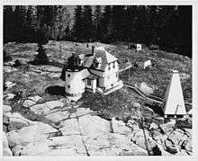 Heron Neck Light Station |
January 21, 1988 (#87002266) |
Heron Neck on Greens Island 44°01′31″N 68°51′45″W |
Vinalhaven | |
| 31 | High Street Historic District | 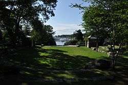 High Street Historic District |
January 5, 1989 (#88001843) |
Roughly High St. between Main St. and Sherman Point Rd.; also the junction of Main St. and Atlantic Ave. 44°12′58″N 69°03′40″W |
Camden | Main and Atlantic intersection represents a boundary increase September 24, 1999 |
| 32 | Indian Island Light Station | 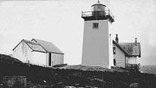 Indian Island Light Station |
March 23, 1988 (#87002539) |
Indian Island in Rockport Harbor 44°09′55″N 69°03′42″W |
Rockport | |
| 33 | Isaac H. Evans (schooner) |  Isaac H. Evans (schooner) |
December 4, 1991 (#91002061) |
Rockland Harbor 44°06′32″N 69°06′32″W |
Rockland | National Historic Landmark |
| 34 | Isle Au Haut Light Station | 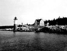 Isle Au Haut Light Station |
January 21, 1988 (#87002265) |
Robinson Point 44°03′53″N 68°39′07″W |
Isle Au Haut | |
| 35 | J. & E. Riggin (schooner) | 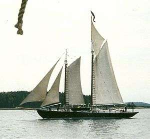 J. & E. Riggin (schooner) |
December 4, 1991 (#91002062) |
Rockland Harbor 44°06′26″N 69°06′23″W |
Rockland | National Historic Landmark |
| 36 | Thomas King Inscription | May 7, 1979 (#79000152) |
Address Restricted |
Cushing | ||
| 37 | Knox County Courthouse | 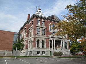 Knox County Courthouse |
April 18, 1977 (#77000075) |
62 Union St. 44°06′14″N 69°06′43″W |
Rockland | |
| 38 | Land's End Historic District |  Land's End Historic District |
September 8, 2011 (#11000633) |
Marshall Point & Cottage Rds., Lentine & Land's End Lns. 43°55′16″N 69°15′19″W |
Saint George | |
| 39 | Lermond Mill | 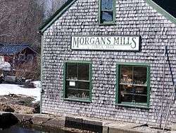 Lermond Mill |
December 27, 1984 (#84000499) |
Payson Rd. 44°12′51″N 69°13′28″W |
Union | |
| 40 | Lewis R. French (schooner) | 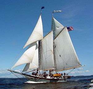 Lewis R. French (schooner) |
December 4, 1991 (#82005263) |
Camden Harbor 44°12′37″N 69°03′46″W |
Camden | National Historic Landmark |
| 41 | Main Street Historic District | 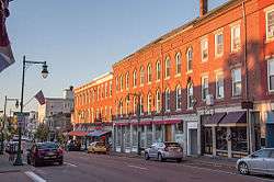 Main Street Historic District |
June 7, 1978 (#78000182) |
Main St. from Limerock to Winter Sts.; also 428-497 Main St. 44°06′14″N 69°06′34″W |
Rockland | Second set of addresses represents a boundary increase, listed January 4, 2012 |
| 42 | Marshall Point Light Station | 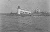 Marshall Point Light Station |
March 23, 1988 (#87002262) |
Marshall Point in Port Clyde Harbor 43°55′02″N 69°15′42″W |
Port Clyde | |
| 43 | Matinicus Rock Light Station | 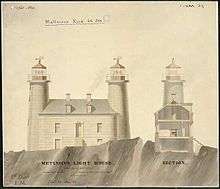 Matinicus Rock Light Station |
March 14, 1988 (#88000149) |
Matinicus Rock 43°47′06″N 68°51′16″W |
Matinicus Isle | |
| 44 | Joseph and Hannah Maxcy Homestead | 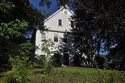 Joseph and Hannah Maxcy Homestead |
July 28, 2004 (#04000743) |
630 S. Union Rd. 44°11′47″N 69°15′50″W |
Union | |
| 45 | Megunticook Golf Club | 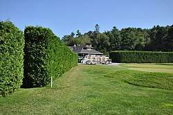 Megunticook Golf Club |
July 22, 1993 (#93000636) |
212 Calderwood Ln. 44°11′03″N 69°03′49″W |
Rockport | Misspelled "Mequnticook" in the National Register listing. |
| 46 | Mercantile (schooner) | 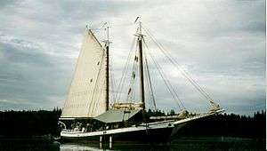 Mercantile (schooner) |
December 4, 1991 (#82005265) |
Camden Harbor 44°12′38″N 69°03′46″W |
Camden | |
| 47 | Mt. Battie Tower | December 31, 2018 (#100003259) |
At summit loop of Mt. Battie Rd. 44°13′23″N 69°04′08″W |
Camden | ||
| 48 | Mosquito Island House | 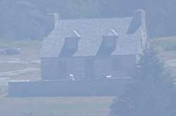 Mosquito Island House |
September 29, 1983 (#83000462) |
South of St. George on Mosquito Island 43°55′21″N 69°13′22″W |
St. George | |
| 49 | Mullen's Cove | March 30, 1984 (#84001382) |
Address Restricted |
North Haven | ||
| 50 | Murch Family House | March 25, 1993 (#93000205) |
Southeastern side of Calderwood Neck, 2 miles northeast of North Haven Rd. 44°06′00″N 68°49′05″W |
Vinalhaven | ||
| 51 | Norumbega | 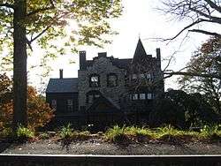 Norumbega |
July 12, 1974 (#74000174) |
High St. 44°13′04″N 69°03′26″W |
Camden | |
| 52 | Norumbega Carriage House | February 19, 1982 (#82000766) |
High St. 44°13′00″N 69°03′25″W |
Camden | ||
| 53 | Olson House | 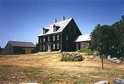 Olson House |
August 31, 1995 (#93001114) |
Eastern side of Hathorn Point Rd. 43°58′54″N 69°16′09″W |
South Cushing vicinity | Andrew Wyeth spent 30 summers at the house and is buried on the grounds. National Historic Landmark designation June 23, 2011. |
| 54 | Owls Head Light Station | 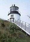 Owls Head Light Station |
January 18, 1978 (#78000183) |
Northeast of Owls Head on W. Penobscot Bay 44°05′30″N 69°02′41″W |
Owls Head | |
| 55 | Pleasant River Grange No. 492 | October 8, 1999 (#99001190) |
Round Island Rd., 0.15 miles east of its junction with N. Haven Rd. 44°04′33″N 68°50′20″W |
Vinalhaven | ||
| 56 | Rankin Block | 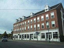 Rankin Block |
November 7, 1978 (#78000184) |
600-610 Main St. 44°06′32″N 69°06′38″W |
Rockland | |
| 57 | Rockland Breakwater | 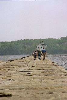 Rockland Breakwater |
April 11, 2003 (#03000203) |
South of Jameson Point 44°06′14″N 69°04′41″W |
Rockland | |
| 58 | Rockland Breakwater Lighthouse | 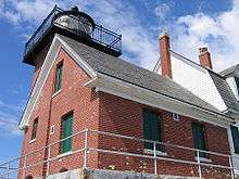 Rockland Breakwater Lighthouse |
March 20, 1981 (#81000067) |
Rockland Harbor 44°06′14″N 69°04′40″W |
Rockland | |
| 59 | Rockland Public Library | 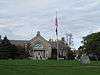 Rockland Public Library |
July 10, 1979 (#79000153) |
Union St. 44°06′19″N 69°06′45″W |
Rockland | |
| 60 | Rockland Railroad Station | 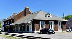 Rockland Railroad Station |
February 7, 1978 (#78000327) |
Union St. 44°06′03″N 69°06′41″W |
Rockland | |
| 61 | Rockland Residential Historic District | 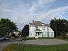 Rockland Residential Historic District |
April 15, 1987 (#86003513) |
Roughly bounded by Granite, Union, Masonic, Broad, Limerock, and Broadway Sts. 44°06′18″N 69°06′53″W |
Rockland | |
| 62 | Rockland Turntable and Engine House | 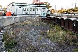 Rockland Turntable and Engine House |
June 24, 1993 (#90001953) |
Park St. west of the Rockland railroad station 44°06′04″N 69°07′23″W |
Rockland | |
| 63 | Rockport Historic District | 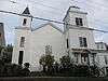 Rockport Historic District |
May 28, 1976 (#76000099) |
Irregular pattern along Pascal Ave. from Russell, Union, and Winter Sts. on the north to School St. on the south 44°11′08″N 69°04′28″W |
Rockport | |
| 64 | Rockport Historic Kiln Area | 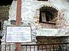 Rockport Historic Kiln Area |
January 26, 1970 (#70000090) |
On the western side of the mouth of the Goose River at its confluence with Rockport Harbor 44°11′11″N 69°04′27″W |
Rockport | |
| 65 | Saddleback Ledge Light Station | 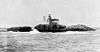 Saddleback Ledge Light Station |
March 14, 1988 (#88000158) |
Saddleback Ledge at Isle Au Haut Bay 44°00′51″N 68°43′36″W |
Vinalhaven | |
| 66 | Sail Loft | 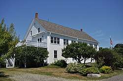 Sail Loft |
October 28, 1977 (#77000076) |
Off State Route 131 43°57′55″N 69°12′36″W |
Tenants Harbor | |
| 67 | Security Trust Building | 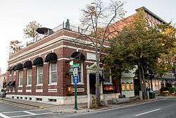 Security Trust Building |
January 20, 1978 (#78000185) |
Elm and Main Sts. 44°06′13″N 69°06′35″W |
Rockland | |
| 68 | Singhi Double House | March 28, 2019 (#100003589) |
198-200 Broadway 44°06′17″N 69°07′04″W |
Rockland | Apparently incorrectly listed in Rockport. | |
| 69 | Spite House | 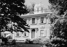 Spite House |
August 13, 1974 (#74000175) |
Deadman's Point 44°10′31″N 69°03′18″W |
Rockport | |
| 70 | Star of Hope Lodge | February 19, 1982 (#82000767) |
Maine St. 44°02′52″N 68°49′59″W |
Vinalhaven | ||
| 71 | Stephen Taber (schooner) | 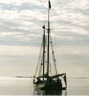 Stephen Taber (schooner) |
July 30, 1984 (#84001386) |
Rockland Harbor 44°06′20″N 69°06′27″W |
Rockland | National Historic Landmark |
| 72 | Strand Theatre | 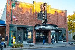 Strand Theatre |
December 2, 2004 (#04001284) |
345 Main St. 44°06′10″N 69°06′33″W |
Rockland | |
| 73 | Surprise (schooner) | 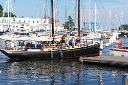 Surprise (schooner) |
June 14, 1991 (#91000771) |
Camden Harbor 44°12′38″N 69°03′48″W |
Camden | |
| 74 | Tenants Harbor Light Station | 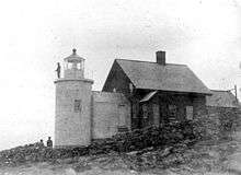 Tenants Harbor Light Station |
November 20, 1987 (#87002026) |
Southern Island 43°57′43″N 69°11′18″W |
Tenants Harbor | |
| 75 | Thomaston Historic District | 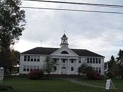 Thomaston Historic District |
May 2, 1974 (#74000176) |
Runs along US 1 between Wadsworth St. and State Route 131 44°04′38″N 69°10′54″W |
Thomaston | |
| 76 | George Thorndike House | 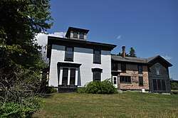 George Thorndike House |
January 11, 1983 (#83000463) |
State Route 73 44°03′21″N 69°07′23″W |
South Thomaston | |
| 77 | Tillson Farm Barn | 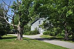 Tillson Farm Barn |
December 18, 1990 (#90001902) |
Warrenton Rd. southeast of its junction with Commercial St. 44°07′49″N 69°05′23″W |
Glen Cove | |
| 78 | Gen. Davis Tillson House | 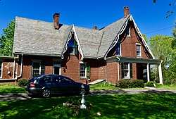 Gen. Davis Tillson House |
January 11, 1983 (#83000464) |
157 Talbot Ave. 44°06′34″N 69°07′19″W |
Rockland | |
| 79 | Tolman Cemetery | 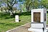 Tolman Cemetery |
October 12, 2017 (#100001741) |
39 Lake Ave. 44°07′33″N 69°07′14″W |
Rockland | |
| 80 | Turner Farm II | March 11, 1982 (#82000768) |
Address Restricted |
North Haven | ||
| 81 | Turner Farm Site | March 26, 1976 (#76000100) |
Address Restricted |
North Haven | ||
| 82 | Union Church of Vinalhaven | July 19, 1984 (#84001388) |
E. Main St. 44°02′54″N 68°49′52″W |
Vinalhaven | ||
| 83 | Union Meeting House (Appleton) | October 8, 2014 (#14000836) |
2875 Sennebec Rd. 44°17′15″N 69°14′51″W |
Appleton | ||
| 84 | Union Town House (Former) | 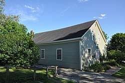 Union Town House (Former) |
December 31, 2001 (#01001419) |
128 Town House Rd. 44°12′47″N 69°16′30″W |
Union | |
| 85 | US Post Office-Camden Main | 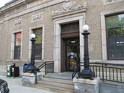 US Post Office-Camden Main |
September 25, 1986 (#86002960) |
Chestnut St. 44°12′31″N 69°03′53″W |
Camden | |
| 86 | Victory Chimes (Schooner) | 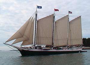 Victory Chimes (Schooner) |
June 24, 1996 (#93000637) |
North End Shipyard, Rockland Harbor 44°06′41″N 69°06′14″W |
Rockland | National Historic Landmark |
| 87 | The Vinalhaven Galamander | July 1, 1970 (#70000049) |
Bandstand Park 44°02′53″N 68°49′53″W |
Vinalhaven | ||
| 88 | Vinalhaven Public Library | January 5, 1989 (#88003014) |
Carver St. 44°02′55″N 68°49′55″W |
Vinalhaven | ||
| 89 | Moses Webster House | 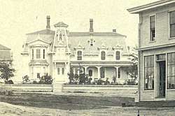 Moses Webster House |
April 1, 1998 (#98000309) |
Atlantic Ave., 0.05 miles east of the junction of Main St. and Atlantic Ave. 44°02′51″N 68°49′53″W |
Vinalhaven | |
| 90 | Wharf House | October 16, 1991 (#91001508) |
Southeast of the junction of Main and Smith Sts. 44°07′37″N 68°52′16″W |
North Haven | ||
| 91 | Whitehead Lifesaving Station | October 12, 1988 (#88001839) |
Southern side of Whitehead Island 43°58′43″N 69°07′57″W |
Sprucehead | ||
| 92 | Whitehead Light Station | 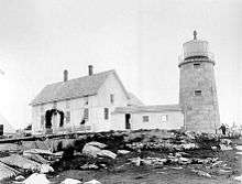 Whitehead Light Station |
March 14, 1988 (#88000154) |
Eastern side of Whitehead Island 43°58′47″N 69°07′30″W |
Tenants Harbor | |
| 93 | Whitney Farm |  Whitney Farm |
March 17, 2015 (#15000087) |
215 Whitney Rd. 44°19′44″N 69°13′50″W |
Appleton | Extends into Searsmont in Waldo County |
| 94 | Timothy and Jane Williams House | 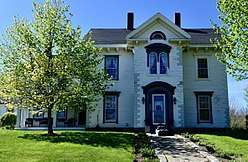 Timothy and Jane Williams House |
December 21, 2005 (#05001441) |
34 Old County Rd. 44°06′09″N 69°08′34″W |
Rockland |
Former and moved listings
| [3] | Name on the Register | Image | Date listed | Date removed | Location | City or town | Summary |
|---|---|---|---|---|---|---|---|
| 1 | Knott Crockett House | October 14, 1993 (#93001112) | July 14, 2015 | 750 Main St. 44°06′43″N 69°06′26″W |
Rockland | ||
| 2 | Timberwind (Schooner) | 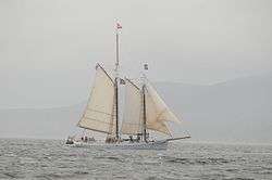 Timberwind (Schooner) |
March 26, 1992 (#92000274) | moved to Belfast in 2015 and Portland in 2018[7] | Thompson's Wharf Coordinates missing |
Rockport | |
| 3 | Wendameen (Yacht) | .jpg) Wendameen (Yacht) |
March 26, 1992 (#92000273) | moved to Portland[8] | Maine State Pier, Commercial St. Coordinates missing |
Camden |
gollark: What if matrix *addition*?
gollark: Deadline in 6 minutes.
gollark: I guess I could restart the phase thing and make it a phase.
gollark: Interesting idea.
gollark: Anyway, we've actually stopped executing phases now. It was unnecessary.
See also
| Wikimedia Commons has media related to National Register of Historic Places in Knox County, Maine. |
References
- The latitude and longitude information provided in this table was derived originally from the National Register Information System, which has been found to be fairly accurate for about 99% of listings. Some locations in this table may have been corrected to current GPS standards.
- "National Register of Historic Places: Weekly List Actions". National Park Service, United States Department of the Interior. Retrieved on August 14, 2020.
- Numbers represent an ordering by significant words. Various colorings, defined here, differentiate National Historic Landmarks and historic districts from other NRHP buildings, structures, sites or objects.
- "National Register Information System". National Register of Historic Places. National Park Service. April 24, 2008.
- The eight-digit number below each date is the number assigned to each location in the National Register Information System database, which can be viewed by clicking the number.
- Coordinates derived from its entry in the GNIS; the NRIS provides no coordinates
- Historic Belfast-based schooner sold, moving to Portland
- "Archived copy". Archived from the original on 2015-07-15. Retrieved 2016-04-12.CS1 maint: archived copy as title (link)
| Topics | |
|---|---|
| Lists by state |
|
| Lists by insular areas | |
| Lists by associated state | |
| Other areas | |
| Related | |
| |
Municipalities and communities of Knox County, Maine, United States | ||
|---|---|---|
| City | Knox County map | |
| Towns | ||
| Plantation | ||
| Unorganized territories | ||
| CDPs | ||
| Other villages | ||
This article is issued from Wikipedia. The text is licensed under Creative Commons - Attribution - Sharealike. Additional terms may apply for the media files.