National Register of Historic Places listings in Kings County, California
This is a list of the National Register of Historic Places listings in Kings County, California.
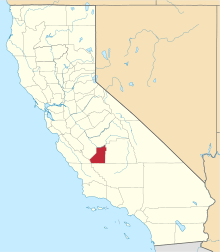
Location of Kings County in California
This is intended to be a complete list of the properties and districts on the National Register of Historic Places in Kings County, California, United States. Latitude and longitude coordinates are provided for many National Register properties and districts; these locations may be seen together in a Google map.[1]
There are 4 properties and districts listed on the National Register in the county.
- This National Park Service list is complete through NPS recent listings posted August 14, 2020.[2]
Current listings
| [3] | Name on the Register[4] | Image | Date listed[5] | Location | City or town | Description |
|---|---|---|---|---|---|---|
| 1 | Hanford Carnegie Library | 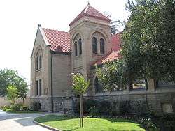 Hanford Carnegie Library |
December 17, 1981 (#81000152) |
109 E. 8th St. 36°19′39″N 119°38′39″W |
Hanford | |
| 2 | Kings County Courthouse | 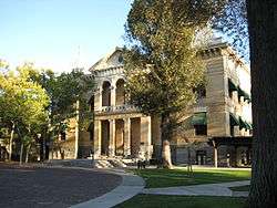 Kings County Courthouse |
September 21, 1978 (#78003063) |
114 W. 8th St. 36°19′40″N 119°38′45″W |
Hanford | |
| 3 | Taoist Temple | 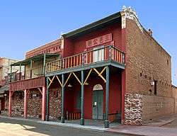 Taoist Temple |
June 13, 1972 (#72000226) |
No. 12 China Alley 36°19′41″N 119°38′16″W |
Hanford | |
| 4 | Witt Site | May 6, 1971 (#71000141) |
Address Restricted |
Kettleman City |
gollark: Time zones bad, UTC good.
gollark: Macs are definitely not that good. MacBooks have horrendous thermal throttling issues because they add moar coar and stuff without improving already inadequate fanless cooling.
gollark: You could use base64 with - and _ instead of + and /.
gollark: Just name your variables random 10-char alphabetical character sequences.
gollark: I would do a line as three blitable strings.
See also
| Wikimedia Commons has media related to National Register of Historic Places in Kings County, California. |
- List of National Historic Landmarks in California
- National Register of Historic Places listings in California
- California Historical Landmarks in Kings County, California
References
- The latitude and longitude information provided in this table was derived originally from the National Register Information System, which has been found to be fairly accurate for about 99% of listings. Some locations in this table may have been corrected to current GPS standards.
- "National Register of Historic Places: Weekly List Actions". National Park Service, United States Department of the Interior. Retrieved on August 14, 2020.
- Numbers represent an ordering by significant words. Various colorings, defined here, differentiate National Historic Landmarks and historic districts from other NRHP buildings, structures, sites or objects.
- "National Register Information System". National Register of Historic Places. National Park Service. July 9, 2010.
- The eight-digit number below each date is the number assigned to each location in the National Register Information System database, which can be viewed by clicking the number.
| Topics | |
|---|---|
| Lists by state |
|
| Lists by insular areas | |
| Lists by associated state | |
| Other areas | |
| Related | |
| |
Municipalities and communities of Kings County, California, United States | ||
|---|---|---|
| Cities | Kings County map | |
| CDPs | ||
| Unincorporated communities | ||
| Ghost towns | ||
This article is issued from Wikipedia. The text is licensed under Creative Commons - Attribution - Sharealike. Additional terms may apply for the media files.