National Register of Historic Places listings in Hanson County, South Dakota
This is a list of the National Register of Historic Places listings in Hanson County, South Dakota.

Location of Hanson County in South Dakota
This is intended to be a complete list of the properties on the National Register of Historic Places in Hanson County, South Dakota, United States. The locations of National Register properties for which the latitude and longitude coordinates are included below, may be seen in a map.[1]
There are 6 properties listed on the National Register in the county, including 1 National Historic Landmark. Another property was once listed but has since been removed.
- This National Park Service list is complete through NPS recent listings posted August 14, 2020.[2]
Current listings
| [3] | Name on the Register[4] | Image | Date listed[5] | Location | City or town | Description |
|---|---|---|---|---|---|---|
| 1 | Bloom Site | 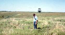 Bloom Site |
October 15, 1966 (#66000714) |
Address Restricted |
Bloom | |
| 2 | Fort James (39HS48) |  Fort James (39HS48) |
March 15, 1984 (#84003290) |
Address Restricted |
Rosedale Colony | |
| 3 | Old Rockport Hutterite Colony | June 30, 1982 (#82003929) |
Off the James River 43°34′55″N 97°50′27″W |
Alexandria | ||
| 4 | Sheldon Reese Site (39HS23) | Sheldon Reese Site (39HS23) |
March 15, 1984 (#84003292) |
Address Restricted |
Mitchell | |
| 5 | Saint Peter's Grotto | 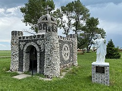 Saint Peter's Grotto |
November 5, 2001 (#01000686) |
0.5 miles north of the former Chicago and North Western railroad tracks 43°43′33″N 97°41′14″W |
Farmer | |
| 6 | Site 39HS3 | Site 39HS3 |
January 31, 1984 (#84003294) |
Address Restricted |
Mitchell |
Former listing
| [3] | Name on the Register | Image | Date listed | Date removed | Location | City or town | Summary |
|---|---|---|---|---|---|---|---|
| 1 | South Dakota Department of Transportation Bridge No. 31-115-110 | December 9, 1993 (#93001294) | March 26, 2008 | Local road over Pierre Creek |
Fulton |
gollark: Imagine typing slowly.
gollark: That would be "very fast", yes.
gollark: I simply type very fast.
gollark: An alternative to using CD or USB images for installation is to use the static version of the package manager Pacman, from within another Linux-based operating system. The user can mount their newly formatted drive partition, and use pacstrap (or Pacman with the appropriate command-line switch) to install base and additional packages with the mountpoint of the destination device as the root for its operations. This method is useful when installing Arch Linux onto USB flash drives, or onto a temporarily mounted device which belongs to another system. Regardless of the selected installation type, further actions need to be taken before the new system is ready for use, most notably by installing a bootloader and configuring the new system with a system name, network connection, language settings, and graphical user interface. The installation images come packaged with an experimental command line installer, archinstall, which can assist with installing Arch Linux.
gollark: Arch is largely based on binary packages. Packages target x86-64 microprocessors to assist performance on modern hardware. A ports/ebuild-like system is also provided for automated source compilation, known as the Arch Build System. Arch Linux focuses on simplicity of design, meaning that the main focus involves creating an environment that is straightforward and relatively easy for the user to understand directly, rather than providing polished point-and-click style management tools — the package manager, for example, does not have an official graphical front-end. This is largely achieved by encouraging the use of succinctly commented, clean configuration files that are arranged for quick access and editing. This has earned it a reputation as a distribution for "advanced users" who are willing to use the command line. The Arch Linux website supplies ISO images that can be run from CD or USB. After a user partitions and formats their drive, a simple command line script (pacstrap) is used to install the base system. The installation of additional packages which are not part of the base system (for example, desktop environments), can be done with either pacstrap, or Pacman after booting (or chrooting) into the new installation.
See also
References
- The latitude and longitude information provided in this table was derived originally from the National Register Information System, which has been found to be fairly accurate for about 99% of listings. Some locations in this table may have been corrected to current GPS standards.
- "National Register of Historic Places: Weekly List Actions". National Park Service, United States Department of the Interior. Retrieved on August 14, 2020.
- Numbers represent an ordering by significant words. Various colorings, defined here, differentiate National Historic Landmarks and historic districts from other NRHP buildings, structures, sites or objects.
- "National Register Information System". National Register of Historic Places. National Park Service. April 24, 2008.
- The eight-digit number below each date is the number assigned to each location in the National Register Information System database, which can be viewed by clicking the number.
| Topics | |
|---|---|
| Lists by state |
|
| Lists by insular areas | |
| Lists by associated state | |
| Other areas | |
| Related | |
| |
Municipalities and communities of Hanson County, South Dakota, United States | ||
|---|---|---|
| Cities | | |
| Towns | ||
| Unincorporated communities | ||
This article is issued from Wikipedia. The text is licensed under Creative Commons - Attribution - Sharealike. Additional terms may apply for the media files.