National Register of Historic Places listings in Hand County, South Dakota
This is a list of the National Register of Historic Places listings in Hand County, South Dakota.
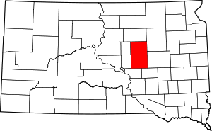
Location of Hand County in South Dakota
This is intended to be a complete list of the properties on the National Register of Historic Places in Hand County, South Dakota, United States. The locations of National Register properties for which the latitude and longitude coordinates are included below, may be seen in a map.[1]
There are 7 properties listed on the National Register in the county.
- This National Park Service list is complete through NPS recent listings posted August 14, 2020.[2]
Current listings
| [3] | Name on the Register[4] | Image | Date listed[5] | Location | City or town | Description |
|---|---|---|---|---|---|---|
| 1 | Archeological Site 39HD22 |  Archeological Site 39HD22 |
February 23, 1984 (#84003296) |
Address Restricted |
Danforth | |
| 2 | Hand County Courthouse and Jail | March 17, 1994 (#94000193) |
415 West First Avenue 44°31′23″N 98°59′41″W |
Miller | ||
| 3 | Mack Jones House | November 19, 2007 (#07001211) |
315 East Third Avenue 44°31′15″N 98°59′02″W |
Miller | ||
| 4 | Port and Helen McWhorter House | July 31, 2017 (#100001400) |
426 North Broadway 44°31′14″N 98°59′18″W |
Miller | Currently the Hand County Historic Society | |
| 5 | Miller Ree Creek Bridge | August 25, 1988 (#88001314) |
Western edge of Miller 44°31′02″N 98°59′54″W |
Miller | ||
| 6 | St. Mary's Church, School and Convent | July 19, 1982 (#82003928) |
U.S. Route 212 44°53′44″N 98°43′41″W |
Zell | ||
| 7 | South Dakota Dept. of Transportation Bridge No. 30-257-400 | December 9, 1993 (#93001293) |
Local road over Sand Creek 44°18′17″N 98°47′08″W |
Miller |
gollark: It uses custom highly advanced þøŧæŧøŧe¢ħ.
gollark: Anyway, I updated the blasphemy detector wordlist and will install the new version before 2023.
gollark: It works ingame, too!
gollark: Ah no, I did, good.
gollark: Don't tell me I forgot to add *that* too...
See also
References
- The latitude and longitude information provided in this table was derived originally from the National Register Information System, which has been found to be fairly accurate for about 99% of listings. Some locations in this table may have been corrected to current GPS standards.
- "National Register of Historic Places: Weekly List Actions". National Park Service, United States Department of the Interior. Retrieved on August 14, 2020.
- Numbers represent an ordering by significant words. Various colorings, defined here, differentiate National Historic Landmarks and historic districts from other NRHP buildings, structures, sites or objects.
- "National Register Information System". National Register of Historic Places. National Park Service. April 24, 2008.
- The eight-digit number below each date is the number assigned to each location in the National Register Information System database, which can be viewed by clicking the number.
| Topics | |
|---|---|
| Lists by state |
|
| Lists by insular areas | |
| Lists by associated state | |
| Other areas | |
| Related | |
| |
Municipalities and communities of Hand County, South Dakota, United States | ||
|---|---|---|
| Cities | | |
| Towns | ||
| Townships | ||
| Unincorporated community | ||
| Footnotes | ‡This populated place also has portions in an adjacent county or counties | |
This article is issued from Wikipedia. The text is licensed under Creative Commons - Attribution - Sharealike. Additional terms may apply for the media files.