National Register of Historic Places listings in Coles County, Illinois
This is a list of the National Register of Historic Places listings in Coles County, Illinois.
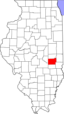
Location of Coles County in Illinois
This is intended to be a complete list of the properties and districts on the National Register of Historic Places in Coles County, Illinois, United States. Latitude and longitude coordinates are provided for many National Register properties and districts; these locations may be seen together in a map.[1]
There are 21 properties and districts listed on the National Register in the county. Another three properties were once listed but have been removed.
- This National Park Service list is complete through NPS recent listings posted August 14, 2020.[2]
Current listings
| [3] | Name on the Register[4] | Image | Date listed[5] | Location | City or town | Description |
|---|---|---|---|---|---|---|
| 1 | Airtight Bridge | 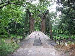 Airtight Bridge |
November 30, 1981 (#81000211) |
Northeast of Charleston 39°33′18″N 88°05′22″W |
Charleston | |
| 2 | Blakeman Bridge | 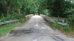 Blakeman Bridge |
November 30, 1981 (#81000212) |
Southeast of Charleston 39°27′25″N 88°08′49″W |
Charleston | |
| 3 | Alexander Briggs House | 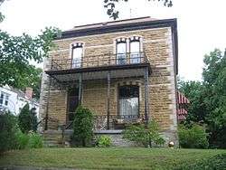 Alexander Briggs House |
May 31, 1980 (#80001341) |
210 Jackson St. 39°29′38″N 88°10′45″W |
Charleston | |
| 4 | Burgess-Osborne Memorial Auditorium | 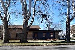 Burgess-Osborne Memorial Auditorium |
March 5, 2018 (#100002149) |
1701 Wabash Ave. 39°28′50″N 88°22′32″W |
Mattoon | |
| 5 | Civilian Conservation Corps Camp Shiloh Encampment Site |  Civilian Conservation Corps Camp Shiloh Encampment Site |
January 22, 2014 (#13001110) |
Northwestern quarter of the northeastern quarter of the southwestern quarter of Section 21, Township 11 North, Range 9 East, of the Illinois Third Principal Meridian 39°22′52″N 88°12′34″W |
Pleasant Grove Township | |
| 6 | Coles County Courthouse |  Coles County Courthouse |
November 28, 1978 (#78001118) |
Charleston Public Sq. 39°29′42″N 88°10′30″W |
Charleston | |
| 7 | Fifteenth Street and Oklahoma Avenue Brick Street | 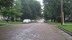 Fifteenth Street and Oklahoma Avenue Brick Street |
November 22, 1999 (#99001357) |
500 through 1217 15th St. and 1500 through 1521 Oklahoma Ave. 39°28′30″N 88°22′21″W |
Mattoon | |
| 8 | Health Education Building |  Health Education Building |
August 9, 1995 (#95000993) |
1611 4th St. 39°28′54″N 88°10′35″W |
Charleston | |
| 9 | Illinois Central Railroad Depot | 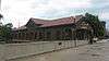 Illinois Central Railroad Depot |
March 1, 2002 (#02000098) |
1718 Broadway Ave. 39°28′59″N 88°22′33″W |
Mattoon | |
| 10 | Lumpkin Heights and Elm Ridge Subdivision Historic District | 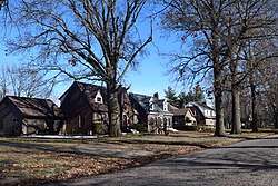 Lumpkin Heights and Elm Ridge Subdivision Historic District |
December 26, 2017 (#100001921) |
Roughly bounded by Logan & 6th Sts., Lafayette & Charleston Aves., & Elm Ridge Subdivision 39°28′49″N 88°21′22″W |
Mattoon | |
| 11 | McFarland House | 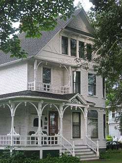 McFarland House |
November 14, 1991 (#91001690) |
895 7th St. 39°29′25″N 88°10′25″W |
Charleston | |
| 12 | Old Main | 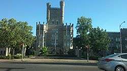 Old Main |
June 16, 1981 (#81000214) |
Lincoln Ave. and 7th St. 39°29′03″N 88°10′31″W |
Charleston | |
| 13 | Pemberton Hall and Gymnasium | 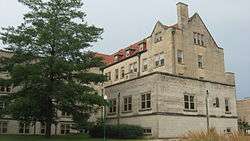 Pemberton Hall and Gymnasium |
August 26, 1982 (#82002521) |
Lincoln Ave. and 4th St. 39°29′01″N 88°10′35″W |
Charleston | |
| 14 | Richard Roytek House | 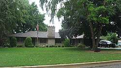 Richard Roytek House |
February 22, 2011 (#11000030) |
3420 Richmond Ave. 39°29′08″N 88°24′00″W |
Mattoon | |
| 15 | Dr. Hiram Rutherford House and Office | 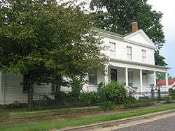 Dr. Hiram Rutherford House and Office |
June 3, 1982 (#82002523) |
14 S. Pike St. 39°39′15″N 88°01′38″W |
Oakland | |
| 16 | Sixth, Seventh, and Tenth Street Stone Arch Bridges | 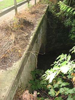 Sixth, Seventh, and Tenth Street Stone Arch Bridges |
August 8, 2001 (#01000869) |
700 blocks of 6th, 7th, and 10th Sts. 39°29′33″N 88°10′27″W |
Charleston | |
| 17 | Starr Hotel | 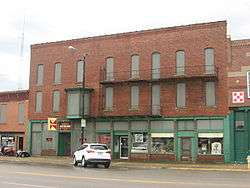 Starr Hotel |
August 16, 1994 (#94000975) |
1913-1923 Western Ave. 39°28′59″N 88°22′44″W |
Mattoon | |
| 18 | Stone Quarry Bridge | 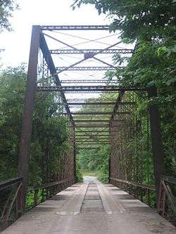 Stone Quarry Bridge |
November 30, 1981 (#81000215) |
Northeast of Charleston 39°31′16″N 88°06′36″W |
Charleston | |
| 19 | U.S. Post Office | 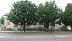 U.S. Post Office |
December 6, 1979 (#79000818) |
1701 Charleston Ave. 39°28′53″N 88°22′32″W |
Mattoon | |
| 20 | Unity Church | 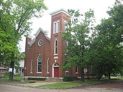 Unity Church |
March 19, 1982 (#82002522) |
2200 Western Ave. 39°29′00″N 88°22′55″W |
Mattoon | |
| 21 | Will Rogers Theatre and Commercial Block | 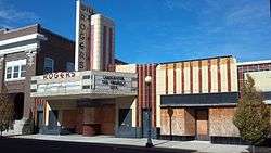 Will Rogers Theatre and Commercial Block |
January 12, 1984 (#84001066) |
705-715 Monroe Ave. 39°29′43″N 88°10′28″W |
Charleston |
Former listing
| [3] | Name on the Register | Image | Date listed | Date removed | Location | City or town | Summary |
|---|---|---|---|---|---|---|---|
| 1 | Cleveland, Cincinnati, Chicago and St. Louis Railroad Station | January 30, 1986 (#86000135) | August 14, 2004 | 1632 Broadway Ave. |
Mattoon | ||
| 2 | Harrison St. Bridge | 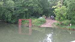 Harrison St. Bridge |
November 30, 1981 (#81000213) | January 6, 2020 | East of Charleston 39°29′21″N 88°06′48″W |
Charleston | Demolished in 2011.[6] |
| 3 | Railway Express Agency Building | 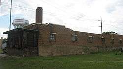 Railway Express Agency Building |
August 16, 1994 (#94000974) | January 2, 2020 | 1804 Western Ave. 39°28′59″N 88°22′36″W |
Mattoon | Demolished in 2013.[7] |
gollark: It also has a few volume buttons, Scroll Lock, and a weird thing which is labelled with a square with horizontal lines in it.
gollark: øĸ tħen
gollark: æ nørmæl uĸ ĸeybøærð
gollark: There are Piefon libraries for it.
gollark: æßðđ ł→ŧħ æłŧŋ¶ ħełð ðøłµ¡
See also
| Wikimedia Commons has media related to National Register of Historic Places in Coles County, Illinois. |
References
- The latitude and longitude information provided in this table was derived originally from the National Register Information System, which has been found to be fairly accurate for about 99% of listings. Some locations in this table may have been corrected to current GPS standards.
- "National Register of Historic Places: Weekly List Actions". National Park Service, United States Department of the Interior. Retrieved on August 14, 2020.
- Numbers represent an ordering by significant words. Various colorings, defined here, differentiate National Historic Landmarks and historic districts from other NRHP buildings, structures, sites or objects.
- "National Register Information System". National Register of Historic Places. National Park Service. March 13, 2009.
- The eight-digit number below each date is the number assigned to each location in the National Register Information System database, which can be viewed by clicking the number.
- "Archived copy" (PDF). Archived from the original (PDF) on 2013-12-24. Retrieved 2014-01-12.CS1 maint: archived copy as title (link)
- http://jg-tc.com/news/once-very-busy-freight-site-torn-down-near-midtown-mattoon/article_eb07d272-f98a-11e2-9d8b-0019bb2963f4.html
| Topics | |
|---|---|
| Lists by state |
|
| Lists by insular areas | |
| Lists by associated state | |
| Other areas | |
| Related | |
| |
Municipalities and communities of Coles County, Illinois, United States | ||
|---|---|---|
| Cities | Map of Illinois highlighting Coles County | |
| Villages | ||
| Townships | ||
| Unincorporated communities | ||
| Extinct communities |
| |
| Footnotes | ‡This populated place also has portions in an adjacent county or counties | |
This article is issued from Wikipedia. The text is licensed under Creative Commons - Attribution - Sharealike. Additional terms may apply for the media files.