National Register of Historic Places listings in Anchorage, Kentucky
This is a list of properties and historic districts on the National Register of Historic Places in Anchorage, Kentucky. Latitude and longitude coordinates of the 35 sites listed on this page may be displayed in a map or exported in several formats by clicking on one of the links in the adjacent box.[1]
National Register sites elsewhere in Jefferson County are listed separately.
- This National Park Service list is complete through NPS recent listings posted August 14, 2020.[2]
Current listings
| [3] | Name on the Register | Image | Date listed[4] | Location | Description |
|---|---|---|---|---|---|
| 1 | Anchorage Historic District | 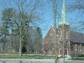 Anchorage Historic District |
December 5, 1980 (#80001554) |
Kentucky Route 146 38°16′02″N 85°32′33″W |
|
| 2 | The Anchorage | 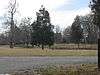 The Anchorage |
December 5, 1980 (#80001555) |
804 Evergreen Rd. 38°15′24″N 85°32′17″W |
|
| 3 | Bayless House | 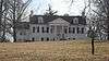 Bayless House |
December 5, 1980 (#80001556) |
1116 Bellewood Rd. 38°15′45″N 85°32′48″W |
|
| 4 | Bonavita-Weller House | 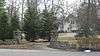 Bonavita-Weller House |
July 12, 1983 (#83002637) |
12006 Ridge Rd. 38°15′42″N 85°31′54″W |
|
| 5 | Bonnycot | 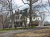 Bonnycot |
July 12, 1983 (#83002638) |
1111 Bellewood Rd. 38°15′42″N 85°32′38″W |
|
| 6 | Central Kentucky Lunatic Asylum | July 12, 1983 (#83002646) |
2201 Lakeland Rd. 38°16′41″N 85°33′18″W |
||
| 7 | Citizens National Life Insurance Building | 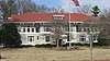 Citizens National Life Insurance Building |
November 11, 1977 (#77000622) |
11405 Park Rd. 38°16′00″N 85°32′30″W |
|
| 8 | Coldeway House | 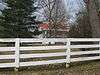 Coldeway House |
December 5, 1980 (#80001557) |
12005 E. Osage Rd. 38°16′11″N 85°31′59″W |
|
| 9 | James Courteney House | 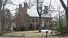 James Courteney House |
December 5, 1980 (#80001558) |
12006 Hazelwood Rd. 38°16′01″N 85°31′54″W |
|
| 10 | Otto F. Eitel House |  Otto F. Eitel House |
December 10, 1998 (#98001488) |
12004 La Grange Rd. 38°16′40″N 85°31′03″W |
|
| 11 | Forrester House |  Forrester House |
April 9, 1984 (#84001559) |
1103 Evergreen Rd. 38°15′40″N 85°32′12″W |
|
| 12 | Garr House | July 12, 1983 (#83002669) |
2100 Evergreen Rd. 38°16′30″N 85°32′44″W |
||
| 13 | Richard Gwathmey House |  Richard Gwathmey House |
July 12, 1983 (#83002676) |
1205 Elm Rd. 38°15′49″N 85°32′04″W |
|
| 14 | Hannah House |  Hannah House |
December 5, 1980 (#80001559) |
1306 Evergreen Rd. 38°15′53″N 85°32′23″W |
|
| 15 | Hausgen House | 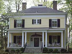 Hausgen House |
July 12, 1983 (#83002677) |
1404 Walnut Lane 38°15′58″N 85°32′49″W |
|
| 16 | Hillcrest |  Hillcrest |
December 5, 1980 (#80001560) |
11600 Owl Creek Rd. 38°15′38″N 85°32′28″W |
|
| 17 | Hite-Foree Log House |  Hite-Foree Log House |
July 30, 1976 (#76000899) |
12401 Lucas Lane 38°16′42″N 85°31′28″W |
|
| 18 | Jones Estate |  Jones Estate |
December 5, 1980 (#80001561) |
1905 Stonegate Rd. 38°16′16″N 85°32′04″W |
|
| 19 | John Marshall, Sr., House | 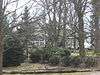 John Marshall, Sr., House |
December 5, 1980 (#80001562) |
12106 Osage Rd. 38°16′11″N 85°31′44″W |
|
| 20 | Robert May House | 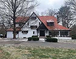 Robert May House |
July 12, 1983 (#83002702) |
11104 Owl Creek Lane 38°15′46″N 85°32′54″W |
|
| 21 | Nash-McDonald House | 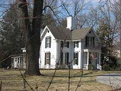 Nash-McDonald House |
December 5, 1980 (#80001564) |
1306 Bellewood Rd. 38°15′52″N 85°32′39″W |
|
| 22 | Newland Log House | 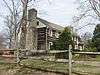 Newland Log House |
July 12, 1983 (#83002713) |
12007 Log Cabin Lane 38°15′28″N 85°31′57″W |
|
| 23 | Nock House | 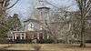 Nock House |
December 5, 1980 (#80001565) |
1401 Elm Rd. 38°15′54″N 85°32′04″W |
|
| 24 | Presbyterian Manse | 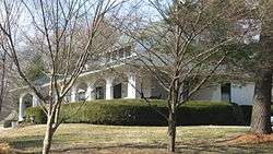 Presbyterian Manse |
July 12, 1983 (#83002724) |
1302 Bellewood Rd. 38°15′51″N 85°32′41″W |
|
| 25 | Railway Depot | 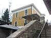 Railway Depot |
December 5, 1980 (#80001566) |
1500 Evergreen Rd. 38°15′56″N 85°32′25″W |
|
| 26 | St. Lukes Church | 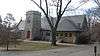 St. Lukes Church |
December 5, 1980 (#80001569) |
1204 Maple Lane 38°15′46″N 85°32′25″W |
|
| 27 | Shallcross | 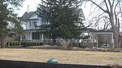 Shallcross |
December 5, 1980 (#80001567) |
11804 Ridge Rd. 38°15′43″N 85°32′06″W |
|
| 28 | Sherley Mansion | July 12, 1983 (#83002732) |
2018 Homewood Dr. 38°16′36″N 85°32′10″W |
||
| 29 | Simrall-Warfield House | 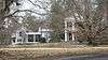 Simrall-Warfield House |
December 5, 1980 (#80001568) |
1509 Cold Spring Rd. 38°16′04″N 85°31′42″W |
|
| 30 | James Thompson House | 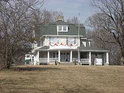 James Thompson House |
December 5, 1980 (#80001570) |
1400 Walnut Lane 38°15′54″N 85°32′49″W |
|
| 31 | Twin Gates Carriage House | July 14, 1983 (#83002743) |
11801 Osage Rd. 38°16′09″N 85°32′11″W |
||
| 32 | James Walker House | 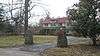 James Walker House |
July 12, 1983 (#83002745) |
1902 Evergreen Rd. 38°16′19″N 85°32′35″W |
|
| 33 | John Webb House | 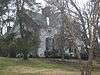 John Webb House |
December 5, 1980 (#80001571) |
12200 Lucas Lane 38°16′36″N 85°31′41″W |
|
| 34 | Eustace Williams House | 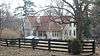 Eustace Williams House |
July 12, 1983 (#83002750) |
11705 Owl Creek Lane 38°15′43″N 85°32′17″W |
|
| 35 | Dr. Winston's House | 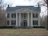 Dr. Winston's House |
December 5, 1980 (#80001572) |
11906 Ridge Rd. 38°15′42″N 85°32′02″W |
Former listing
| [3] | Name on the Register | Image | Date listed | Date removed | Location | Summary |
|---|---|---|---|---|---|---|
| 1 | Dorsey-O'Bannon'Hebel House | September 25, 1979 (#79000996) | February 5, 1991 | East of Anchorage at 13204 Factory Lane |
gollark: ` _______________________________________ / Klingon function calls do not have \| 'parameters' -- they have 'arguments' |\ -- and they ALWAYS WIN THEM. / --------------------------------------- \ ^__^ \ (oo)\_______ (__)\ )\/\ ||----w | || ||`
gollark: Gollark's Random Post of The Arbitrary Unit of Time.
gollark: ` assert is_alive([ [0, 0, 0], [0, 0, 0], [0, 0, 0] ], 1, 1) == False (Java, obviously.)`
gollark: That's hard, and someone else will take a lot of it.
gollark: Factorio logic: 3.3MW of power (basically all the factory's consumption) goes through this one switch. The blue arcy stuff there is totally fine.
See also
| Wikimedia Commons has media related to National Register of Historic Places in Jefferson County, Kentucky. |
References
- The latitude and longitude information provided in this table was derived originally from the National Register Information System, which has been found to be fairly accurate for about 99% of listings. Some locations in this table may have been corrected to current GPS standards.
- "National Register of Historic Places: Weekly List Actions". National Park Service, United States Department of the Interior. Retrieved on August 14, 2020.
- Numbers represent an ordering by significant words. Various colorings, defined here, differentiate National Historic Landmarks and historic districts from other NRHP buildings, structures, sites or objects.
- The eight-digit number below each date is the number assigned to each location in the National Register Information System database, which can be viewed by clicking the number.
| Topics | |
|---|---|
| Lists by state |
|
| Lists by insular areas | |
| Lists by associated state | |
| Other areas | |
| Related | |
| |

This article is issued from Wikipedia. The text is licensed under Creative Commons - Attribution - Sharealike. Additional terms may apply for the media files.