Nanduri Dam
Nanduri Dam, is an earthfill and gravity dam on Tapti river near Ama Local Nallaher, Nashik district in the state of Maharashtra in India.
| Nanduri Dam | |
|---|---|
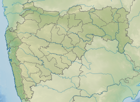 Location of Nanduri Dam in Maharashtra | |
| Official name | Nanduri Dam |
| Location | Ama Local Nallaher |
| Coordinates | 20.4214678°N 73.8945204°E |
| Demolition date | N/A |
| Owner(s) | Government of Maharashtra, India |
| Dam and spillways | |
| Type of dam | Earthfill Gravity |
| Impounds | Tapti river |
| Height | 20 m (66 ft) |
| Length | 2,186 m (7,172 ft) |
| Dam volume | 1,381.25 km3 (331.38 cu mi) |
| Reservoir | |
| Total capacity | 35,780 km3 (8,580 cu mi) |
| Surface area | 575.36 km2 (222.15 sq mi) |
Specifications
The height of the dam above lowest foundation is 20 m (66 ft) while the length is 2,186 m (7,172 ft). The volume content is 1,381.25 km3 (331.38 cu mi) and gross storage capacity is 42,056.00 km3 (10,089.77 cu mi).[1]
Purpose
- Irrigation
- Water supply
gollark: Cat Dog Mammal Frog
gollark: I have 2000 invisiprizes, each of which has a different gender.
gollark: <:smh:399440841401303040>
gollark: Yes, exactly.
gollark: I think the stair/spiral thing would basically just involve breeding a 2G PB prize then passing it off to someone with a CB prize and so on.
See also
- Dams in Maharashtra
- List of reservoirs and dams in India
References
- "Specifications of large dams in India" (PDF). Archived from the original (PDF) on 2018-02-19. Retrieved 2010-10-25.
This article is issued from Wikipedia. The text is licensed under Creative Commons - Attribution - Sharealike. Additional terms may apply for the media files.