Nanadiya
Nanadiya is a small village in Gujarat, India within the Manavadar taluka of Junagadh district. It is located between Junagadh and Porbandar, around 25 km from the Arabian Sea.[1] It has an average elevation of 24 metres (78 feet) above mean sea level.
Nanadiya | |
|---|---|
town | |
 Nanadiya Location in Gujarat, India  Nanadiya Nanadiya (India) | |
| Coordinates: 21.48°N 70.07°E | |
| Country | |
| State | Gujarat |
| Languages | |
| • Official | Gujarati, Hindi |
| Time zone | UTC+5:30 (IST) |
| Vehicle registration | GJ |
| Website | gujaratindia |
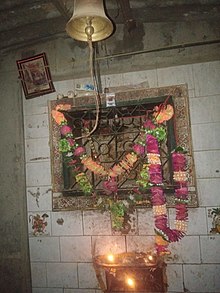
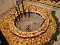
The village population is approximately 3,000 with farming the most common occupation. The village contains the Dayaram Ashram and temples to Rama, Mahadev, Hanuman and Shrinathji. The famous Dada Kotadiya ancient madh(Shrine) is also located in this village. This madh is one of the three madhas of Dada. The village has a school and a high school[2] as well as an anganwadi childcare centre.[3]
Until the Independence of India in 1947 the village was ruled by a nawab. Since 1977 it is within Porbandar parliamentary constituency.
Nanadiya is close to the villages of Sitana, Nakra, Vadala, Bantwa, Manavadar, Kahkhavi, Mitadi and Matiyana and to the town of Bantwa. The major crop is groundnuts but cotton, maize, millet (bajra), sorghum (juwar) and cumin are also cultivated.
 Dayaram Ashram
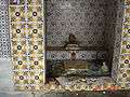 Dayaram Ashram
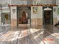 Dayaram Ashram
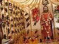 Dayaram Ashram
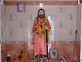 Dayaram Ashram