Nærøysundet
Nærøysundet is a strait in the municipalities of Nærøysund in Trøndelag county, Norway. The village of Rørvik, is located along the Nærøysundet, on the northwestern side. The 20-kilometre (12 mi) strait is crossed by the Nærøysund Bridge which connects the mainland and the island of Inner-Vikna. The shipping lane along the Norwegian coast passes through the strait, and the ship traffic is guided by the Nærøysund Lighthouse.[1][2][3]
| Nærøysundet | |
|---|---|
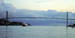 View of the Nærøysundet with the crossing Nærøysund Bridge | |
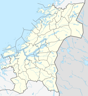 Nærøysundet Location of the fjord  Nærøysundet Nærøysundet (Norway) | |
| Location | Trøndelag county, Norway |
| Coordinates | 64.842°N 11.200°E |
| Type | Strait |
| Primary inflows | Folda |
| Basin countries | Norway |
| Max. length | 20 kilometres (12 mi) |
References
- Godal, Anne Marit (ed.). "Nærøysundet". Store norske leksikon (in Norwegian). Oslo: Norsk nettleksikon. Retrieved 3 March 2015.
- Evensen, Knut Harald, ed. (2010). NAF Veibok 2010–2012 (in Norwegian) (29 ed.). Oslo: Norges Automobil-Forbund. pp. 86, 480.
- Lauritzen, Per Roger, ed. (2013). NAF Veibok 2014-2016 (in Norwegian) (30 ed.). Oslo: Norges Automobil-Forbund. pp. 110, 391–392. ISBN 978-82-7167-124-2.
This article is issued from Wikipedia. The text is licensed under Creative Commons - Attribution - Sharealike. Additional terms may apply for the media files.