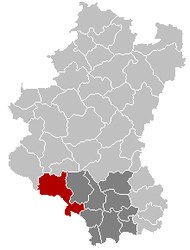
Muno, Belgium
Muno is a village forming part of the municipality of Florenville in Belgium. It lies in the country's Walloon Region and in the province of Luxembourg.
Muno | |
|---|---|
 Muno Location in Belgium
Location of Muno in Belgium  | |
| Coordinates: 49°43′N 05°10.5′E | |
| Country | Belgium |
| Community | French Community |
| Region | Wallonia |
| Province | Luxembourg |
| Arrondissement | Arrondissement of Virton |
| Area | |
| • Total | 146.91 km2 (56.72 sq mi) |
| Postal codes | 6820 |
| Area codes | 061 |
| Website | Muno |
A 6-km-long section of the former (line 163A) railway between Muno and Sainte-Cécile, dismantled in 1972, has been converted into a bicycle trail.
Geography
The village is limited on its south-western side by the border with France.
gollark: Minecraft arguably does have four spatial dimensions if you treat the nether/end/overworld as stacked.
gollark: That would be wise.
gollark: No, I meant what format would the chat boxes be able to transmit to chat?
gollark: Joke's on you, I run Minecraft in Qubes OS.
gollark: Will the chatboxes send markdown or weird MC formatting or tellraw?
References
This article is issued from Wikipedia. The text is licensed under Creative Commons - Attribution - Sharealike. Additional terms may apply for the media files.