Mulla Mulla, New South Wales
Mulla Mulla is a rural locality in Hay Shire Council and a civil parish of Nicholson County in New South Wales,[1][2] and is located at 33°48′54″S 145°05′04″E.
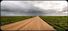
Landscape around Mulla Mulla
Geography
The parish, located 750 km (460 mi) from Sydney on the Lachlan River, is flat, semi-arid and the main economic activity is agriculture. There are no towns in the parish though the town and river crossing of Booligal, New South Wales is nearby to the south west.
gollark: Why are those superior to epicbot?
gollark: Thus it is additionally cursed.
gollark: Technically, Epicbot is in JS, not Python.
gollark: Apiobee you, it's the users.
gollark: !ban <@432069474858958848>
References
- Map of the County of Nicholson, New South Wales. Department of Lands, 1932.
- The New atlas of Australia (John Sands 1886) map 21.
This article is issued from Wikipedia. The text is licensed under Creative Commons - Attribution - Sharealike. Additional terms may apply for the media files.