Muir Pass
Muir Pass is a mountain pass in the Sierra Nevada of California, United States, in Kings Canyon National Park. It is named for John Muir.[1]
| Muir Pass | |
|---|---|
 | |
| Elevation | 11,955 ft (3,644 m) |
| Traversed by | John Muir Trail, Pacific Crest Trail |
| Location | Fresno County, California, United States |
| Range | Sierra Nevada |
| Coordinates | 37°06′42″N 118°40′14″W [1] |
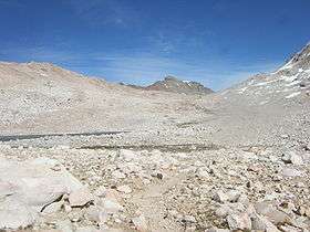
The pass is near the midway point of the John Muir Trail and around mile 841 of the Pacific Crest Trail. It crosses the Goddard Divide between Mount Solomons and Mount Warlow,[1] at an elevation of 11,955 feet (3,644 m). The Muir Hut, built by the Sierra Club, is at the summit of the pass. Although the grade is gentle from both directions, snow can persist well into the summer, obscuring the trail for miles.
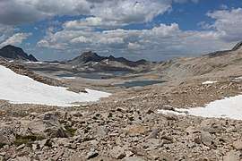 View of Lake McDermand and Wanda Lake, ascending the pass
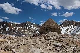 The Muir Hut
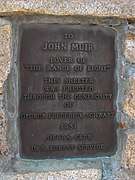 Commemorative on the Hut
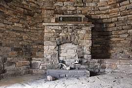 Inside the hut
Notes
- "Muir Pass". Geographic Names Information System. United States Geological Survey. Retrieved 2008-09-12.
gollark: ~~that doesn't work ingame~~
gollark: Also, floppy disks are useful as keycards still.
gollark: There are *always* reasons to not have a feature, such as opportunity cost and additional developer burden.
gollark: <@160279332454006795> CC Tweaks actually did have a feature for custom BIOSes. But nobody used it so it was not added to cC: Tweaked.
gollark: You can do either!
This article is issued from Wikipedia. The text is licensed under Creative Commons - Attribution - Sharealike. Additional terms may apply for the media files.