Mthatha River
Mthatha River or Umtata River (Xhosa: 'mtathe Bawo) is a river in the Eastern Cape Province in South Africa. The river flows into the Indian Ocean in an estuary located near Coffee Bay. The Mthatha river flows in a southeastern direction and is approximately 250 km long with a catchment area of 2,600 km². It is named after Mthatha Town (Umtata).[2][3]
| Mthatha River Umtata River | |
|---|---|
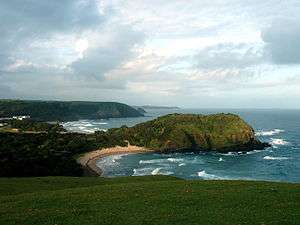 close to where the Mthatha River meets the Indian Ocean | |
 Location of the Mthatha River mouth | |
| Etymology | Referring in the Xhosa language to the Sneeze-wood trees (Ptaeroxylon obliquum) growing on the banks of the river[1] |
| Native name | 'mtathe Bawo |
| Location | |
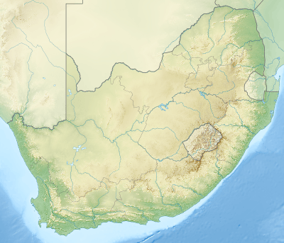
| Country | South Africa |
| Province | Eastern Cape Province |
| Physical characteristics | |
| Source | |
| • location | Baziya Range, Eastern Cape, South Africa |
| • elevation | 1,500 m (4,900 ft) |
| Mouth | Indian Ocean |
• location | Coffee Bay, South Africa |
• coordinates | 31°56′S 29°11′E |
• elevation | 0 m (0 ft) |
| Length | 250 km (160 mi) |
| Basin size | 2,600 km2 (1,000 sq mi) |
Its main tributaries are the Ngqungqu River and the Cicira River.[4]
The Mthatha River marks the southern limit of the Pondoland region.[5]
Dams
Presently this river is part of the Mzimvubu to Keiskamma Water Management Area.[6]
- Mthatha Dam
- Mabeleni Dam
gollark: If they behaved *really* differently, stuff like weather balloons and satellites would fail in bizarre ways.
gollark: That would be very impractical.
gollark: What? No.
gollark: no.
gollark: I don't think that technology exists yet, and also no.
See also
- List of rivers of South Africa
- List of estuaries of South Africa
- List of dams and reservoirs in South Africa
References
- Dictionary of Southern African Place Names
- Mthatha River System - 2008 Archived 2016-04-07 at the Wayback Machine
- Niba, AS; Mafereka, SP (2015-04-03). "Benthic macroinvertebrate assemblage composition and distribution pattern in the upper Mthatha River, Eastern Cape, South Africa". African Journal of Aquatic Science. 40 (2): 133–142. doi:10.2989/16085914.2015.1028323. ISSN 1608-5914.
- Mzimbuvu to Keiskamma WMA 12
- Contributions to the ecology of Maputaland, Southern Africa
- Is there a role for traditional governance systems in South Africa's new water management regime?
External links
- The Ecological Health of the Mthatha River
- 180° view of Mthatha River Mouth
- Invasive alien plants along Mthatha river
This article is issued from Wikipedia. The text is licensed under Creative Commons - Attribution - Sharealike. Additional terms may apply for the media files.