Mount Ogden
Mount Ogden is a peak in Weber County, Utah, United States in the northern Wasatch Range.
| Mount Ogden | |
|---|---|
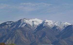 Mt. Ogden from the west | |
| Highest point | |
| Elevation | 9,579 ft (2,920 m) NAVD 88[1] |
| Prominence | 3,810 feet (1,161 m) [2] |
| Coordinates | 41°12′00″N 111°52′55″W [1] |
| Geography | |
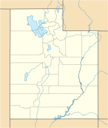 Mount Ogden Location in Utah | |
| Location | Weber County, Utah, U.S. |
| Parent range | Wasatch Range |
| Topo map | USGS Ogden |
Mount Ogden has an elevation of 9,579 feet (2,920 m). The peak is popular with hikers and can be accessed via trails in three nearby canyons: Beus, Waterfall, and Taylor Canyons. The summit's eastern face also has technical crack and face climbing routes. The summit accommodates several large radio towers and a helipad.
Mount Ogden's eastern slope is home to Snowbasin Ski Resort, where the 2002 Olympics downhill ski races were held. The resort also provides private road access to the peak.
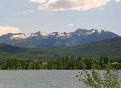
Mount Ogden from the east, with Pineview Reservoir in the foreground
References
- "Ogden Peak". NGS data sheet. U.S. National Geodetic Survey. Retrieved 2016-04-22.
- "Mount Ogden, Utah". Peakbagger.com. Retrieved 2016-04-22.
External links
![]()
- "Mount Ogden". Geographic Names Information System. United States Geological Survey.
- "Mount Ogden". SummitPost.org.
This article is issued from Wikipedia. The text is licensed under Creative Commons - Attribution - Sharealike. Additional terms may apply for the media files.