Mount Moturau
Mount Moturau is a mountain at height 1,497 m, rising south west of the Hope Arm of Lake Manapouri and clearly visible from Manapouri township. Note: Topographic map C44, Hunter Mountains, GR 2080950E 5497500N. Not named on official mapping pre 10 May 2001.
| Mt Moturau | |
|---|---|
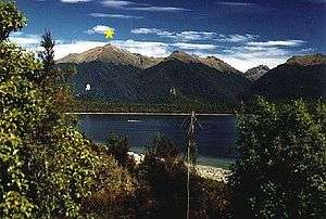 Mount Moturau, Lake Manapouri | |
| Highest point | |
| Elevation | 1,497 m (4,911 ft) |
| Prominence | 215 m (705 ft) |
| Coordinates | 45°35′0.4″S 167°28′26″E |
| Geography | |
| Location | South Island, New Zealand |
| Topo map | 260-C44 |
| Climbing | |
| First ascent | J Calder |
| Easiest route | Bicycle Spur Trail |
History
The name Moturau was originally the Maori name for the summer village of what is now known as Manapouri. It is also the name of a tourist vessel on Lake Manapouri as well as a hut on the Kepler Track and was said to be an older name for Lake Manapouri itself.
gollark: Apparently in a few billion years various feedback loops and an increasingly warm sun will cause the oceans to boil, and a few billion after that the Sun will swell into a red giant and destroy anything remaining.
gollark: At worst it would probably severely damage it.
gollark: A giant space rock would be very hard-pressed to destroy the Earth.
gollark: Depends on what you consider "die", but it will probably involve the sun doing things.
gollark: I mean, outside-view-ishly, life on Earth has existed for several billion years, so the probability (without knowing anything else) of it randomly stopping over the course of some arbitrary thousand or so is... not high.
This article is issued from Wikipedia. The text is licensed under Creative Commons - Attribution - Sharealike. Additional terms may apply for the media files.