Mount Iwakura
Mount Iwakura (岩倉山, Iwakura-yama) is a 488.4-metre-high (1,602 ft) mountain in Takarazuka, Hyōgo Prefecture, Japan.
| Mount Iwakura | |
|---|---|
| 岩倉山 | |
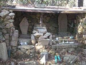 The Shrine on the Top of the Mount Iwakura | |
| Highest point | |
| Elevation | 488.4 m (1,602 ft) |
| Coordinates | 34°48′N 135°19′E |
| Naming | |
| Language of name | Japanese |
| Pronunciation | [iɰakɯɾajama] |
| Geography | |
| Location | Takarazuka, Hyōgo, Japan |
| Parent range | Rokko Mountains |
Outline
Mount Iwakura is a part of Setonaikai National Park. The mountain is a peak on the eastern ridge of the Rokko Mountains. It is said that the mountain received its name because of the stone shrine (Iwakura) on the top of the mountain.
Access
- Takarazuka Station of the JR Fukuchiyama Line (JR Takarazuka Line)
- Takarazuka Station of the Hankyu Takarazuka Line or the Hankyu Imazu Line
gollark: It depends.
gollark: But you don't want it to be that small or the brick can't see it.
gollark: Although many phones have weirdly high res displays too given their size.
gollark: Physical dimensions, not resolution.
gollark: The screens are excellently sized for it though.
References
- Shozo Tamaki, Rokkosan Hakubutsushi, Kobe Shimbun Shuppan Center
- Official Home Page of Setonaikai National Park
- Official Home Page of the Geographical Survey Institute in Japan
This article is issued from Wikipedia. The text is licensed under Creative Commons - Attribution - Sharealike. Additional terms may apply for the media files.