Mount Atago
Mount Atago is a very common name for peaks all over Japan.
| Mount Atago | |
|---|---|
| 愛宕山 | |
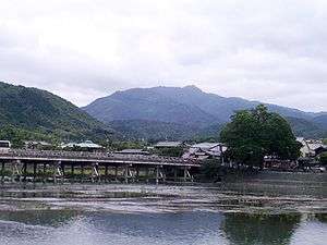 Mount Atago from Arashiyama, Kyoto | |
| Highest point | |
| Elevation | 924 m (3,031 ft) |
| Listing | List of mountains and hills of Japan by height |
| Coordinates | 35°3′36″N 135°38′3″E |
| Geography | |
| Location | Kyoto, Japan |
| Topo map | Geographical Survey Institute 25000:1 京都西北部, 50000:1 京都及大阪 |
Mount Atago (愛宕山, Atago-yama/san) is a 924m mountain in the northwestern part of Ukyo-ku, in the city of Kyoto, Kyoto Prefecture, Japan. The Atago Shrine is located on the top of the mountain.
Gallery
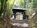 The Kuromon Gate of Mount Atago
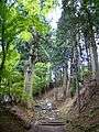 The way to the top of Mount Atago
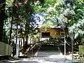 Atago Shrine on the top of Mount Atago
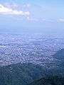 Katsura River from Mount Atago
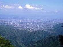 Kyoto City from Mount Atago
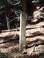 A guidepost in Mount Atago
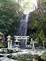 Fudo Waterfall in Mount Atago
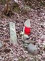 Religious objects in Mount Atago
gollark: Good news, my guesses are now provably optimal.
gollark: Actually, correlation is strongly causated with bees.
gollark: Oh, I should probably submit guesses.
gollark: You're filtering through some fixed number you interact with in some way.
gollark: Practically speaking, you're not actually sampling from the entire set by goodness though.
See also
- Japanese cruiser Atago
- Atago class destroyer
References
External links
| Wikimedia Commons has media related to Mount Atago (Kyoto). |
This article is issued from Wikipedia. The text is licensed under Creative Commons - Attribution - Sharealike. Additional terms may apply for the media files.