Monument Creek (Arkansas River tributary)
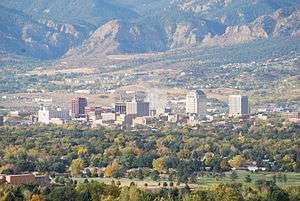
Monument Creek is an El Paso County, Colorado, stream on the Arkansas River water basin. It flows south from Mount Deception through Pikeview and Monument, and into Colorado Springs, where it meets up with Fountain Creek.[1] It is 27.2 miles (43.8 km) from its northernmost boundary with National Forest Lands to its confluence with Fountain Creek[2] near the intersection of Interstate 25 and U.S. Route 24.[3]
Monument Creek watershed
The Monument Creek watershed is bounded on the north by the Palmer Divide, which divides the Platte River and Arkansas River watersheds. It extends from Black Forest west to Rampart Range.[4]
| Sub-watershed | Source | Mouth | Size |
|---|---|---|---|
| North Monument Creek | Mount Deception | Palmer Lake | 8,177 hectares (20,210 acres) |
| Beaver Creek | Monument | Palmer Lake | 6,849 hectares (16,920 acres) |
| Jackson Creek | Monument | Monument | 12,986 hectares (32,090 acres) |
| West Monument Creek | Woodland Park | Pikeview | 5,847 hectares (14,450 acres) |
| Kettle Creek | Black Forest | Pikeview | 8,225 hectares (20,320 acres) |
| Pine Creek | Falcon | Pikeview | 3,654 hectares (9,030 acres) |
| Cottonwood Creek | Falcon | Pikeview | 5,716 hectares (14,120 acres) |
| Douglas Creek | Cascade | Pikeview | 5,728 hectares (14,150 acres) |
| Lower Monument Creek | 3,051 hectares (7,540 acres) | ||
Monument Valley Park

Monument Creek flows through the approximately 2 miles (3.2 km) long Monument Valley Park at the western edge of downtown Colorado Springs. The creek runs through the center of the park from West Monroe south to West Bijou.[7] Within the park, Monument Creek flows north to south and falls about 72 feet (22 m) in elevation. It is 5,988 feet (1,825 m) in elevation at its lowest point at the southwestern corner of the park; It is 6,060 feet (1,850 m) in elevation at the northern edge of the park, north of Boddington Field. The narrow Mesa Creek intersects with Monument Creek at the northwestern edge of the park.[7]
Flood of 1935
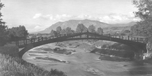
A significant flood of Monument Creek occurred on Memorial Day, 1935[8] when it overflowed from constant heavy rains over May 30 and 31. Within the Monument Valley Park, three bridges were lost, the swimming pool filled with mud, trees were uprooted, and meadows and walkways were covered with silt and debris. Shadow Lake was made into a puddle. The streets were filled with water.[9] The 3 natural springs were capped over with silt and debris as a result of the flood. Lakes in the park were washed away and pavilions were destroyed.[10] As a result, the park today looks very different than it did before the flood.[10]
The Works Progress Administration (WPA) was engaged to renovate the park as the result of the flood damage. They built creekside stone retaining walls, bridges, rock steps and benches using timber and native stone as part of a rustic, picturesque design. A grandstand was built for one of the baseball fields. Stone markers were established with bronze plaques in recognition of the renovation work performed by the WPA. Features that were not replaced include a lake, some of the gardens, and rustic bridges.[9]
Water quality mitigation
In 2004 and 2006 the creek was declared "impaired" for fish and wildlife due to the presence of selenium from an unknown source. In 2004 it was also said to have been subject to an unknown biologic stressor. Sufficient water quality was attained by May 6, 2008.[11][12]
See also
References
- "Monument Creek". US Geographic Names Information System, US Geological Survey, US Department of Labor. October 13, 1978. Retrieved January 11, 2015.

- "Search: Monument Creek". Watershed Assessment, Tracking & Environmental Results. US Environmental Protection Agency. Retrieved January 11, 2015.

- John Armstrong and Joe Stevens (2002). "Monument Creek Watershed Landscape Assessment" (PDF). Colorado State University, College of Natural Resources. p. 19. Retrieved January 12, 2015.
- John Armstrong and Joe Stevens (2002). "Monument Creek Watershed Landscape Assessment" (PDF). Colorado State University, College of Natural Resources. pp. 22–23. Retrieved January 12, 2015.
- "GNIS Feature Search: Query Creeks in El Paso County, Colorado". Geographic Names Information System, US Geological Survey, US Department of the Interior. Retrieved January 12, 2015.
- John Armstrong and Joe Stevens (2002). "Monument Creek Watershed Landscape Assessment" (PDF). Colorado State University, College of Natural Resources. pp. 23–24. Retrieved January 12, 2015.
- "Monument Valley Park - National Register of Historic Places Nomination Form" (PDF). Colorado Preservation Office. Retrieved May 22, 2013.
- "Monument Valley Park". City of Colorado Springs. Retrieved May 22, 2013.
- "History of Monument Valley Park". Friends of Monument Valley Park. Retrieved May 22, 2013.
- Brandon Fibbs (July 25, 2003). "Fun with the Founder - Move over, Columbus: Colorado Springs founder gets back his holiday". The Gazette (accessed via HighBeam Research). Colorado Springs, CO.
- "2004 Waterbody Report for Monument Creek". Watershed Assessment, Tracking & Environmental Results. US Environmental Protection Agency. Retrieved January 11, 2015.

- "2006 Waterbody Report for Monument Creek -NF boundry [sic] to Fountain Creek". Watershed Assessment, Tracking & Environmental Results. US Environmental Protection Agency. Retrieved January 11, 2015.

