Monteagle County

Monteagle County is one of the 141 Cadastral divisions of New South Wales.

Monteagle
New South Wales
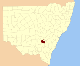
Location in New South Wales
Lands administrative divisions around Monteagle:
Bland Forbes Bathurst
Bland Monteagle King
Harden Harden King

Monteagle County was named in honour of Thomas Spring Rice, 1st Baron Monteagle of Brandon (1790-1866), a former Chancellor of the Exchequer.[1]

Parishes within this county

A full list of parishes found within this county; their current LGA and mapping coordinates to the approximate centre of each location is as follows:

ParishLGACoordinates
BaxterHilltops Council34°17′54″S 148°12′04″E
Bendick MurrellHilltops Council34°03′54″S 148°29′04″E
BribbareeHilltops Council34°13′05″S 148°04′45″E
BrundahWeddin Shire33°54′54″S 148°11′04″E
BumbaldryWeddin Shire33°54′54″S 148°30′04″E
BungalongWeddin Shire33°59′54″S 148°20′04″E
BungalongWeddin Shire34°00′54″S 148°20′04″E
BurramundaHilltops Council34°08′54″S 148°13′04″E
BurrangongHilltops Council34°14′54″S 148°15′04″E
CobaWeddin Shire33°59′54″S 148°15′04″E
CocominglaHilltops Council34°01′54″S 148°47′04″E
CongeraHilltops Council34°17′54″S 148°43′04″E
CoolegongHilltops Council34°05′54″S 148°14′04″E
CudgymaguntryWeddin Shire33°59′54″S 148°25′04″E
DananbillaHilltops Council34°14′54″S 148°27′04″E
GeegullalongHilltops Council34°23′54″S 148°38′04″E
GungewallaHilltops Council34°18′54″S 148°37′04″E
IandraWeddin Shire34°02′54″S 148°20′04″E
IllunieHilltops Council34°06′54″S 148°30′04″E
KikiamahHilltops Council34°04′54″S 148°04′04″E
MarinaHilltops Council34°19′54″S 148°24′04″E
Murringo NorthHilltops Council34°14′54″S 148°30′04″E
MurringoHilltops Council34°14′54″S 148°30′04″E
MurrungalHilltops Council34°22′54″S 148°46′04″E
NarrallenHilltops Council34°11′54″S 148°39′04″E
RossiHilltops Council34°06′54″S 148°43′04″E
ThuddungaraHilltops Council34°13′54″S 148°09′04″E
TyagongWeddin Shire34°02′54″S 148°15′04″E
WambanumbaHilltops Council34°10′54″S 148°28′04″E
WeddinWeddin Shire33°59′54″S 148°05′04″E
WillawongHilltops Council34°21′54″S 148°30′04″E
WiltonHilltops Council34°08′54″S 148°18′04″E
WoodongaHilltops Council34°14′54″S 148°22′04″E
YambiraWeddin Shire33°52′54″S 148°20′04″E
YoungHilltops Council34°18′54″S 148°17′04″E
YundooHilltops Council34°13′54″S 148°44′04″E
gollark: Oh yes, generally.
gollark: It's irritating that we ended up with such an awful software ecosystem on phones. You can typically get updates for *ages* on a desktop system, because they don't run stupid monolithic OSes with tons of hardware-specific garbage.
gollark: Custom ROMs are *mostly* available on popular Android phones, for a while, but it is not ideal...
gollark: Rather than having to download everything from the Apple walled garden.
gollark: Probably not hugely often, but it's important to *me* from a freedom perspective.

References

  1. "Monteagle County". Geographical Names Register (GNR) of NSW. Geographical Names Board of New South Wales.
This article is issued from Wikipedia. The text is licensed under Creative Commons - Attribution - Sharealike. Additional terms may apply for the media files.