Montana Highway 5
Montana Highway 5 (MT 5) is a 65.573-mile-long (105.530 km) state highway connecting with North Dakota's Highway 5, the 337 mile long ND highway. MT 5 runs from the ND border to Scobey, Montana. It was designated in 1939. However, the road closely follows the topographic contours of the land and, in the extreme winter climate of northeastern Montana, this often leads to road closures due to drifting snow.
| ||||
|---|---|---|---|---|
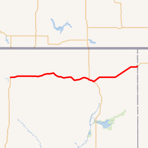
MT 5 highlighted in red | ||||
| Route information | ||||
| Maintained by MDT | ||||
| Length | 65.573 mi[1] (105.530 km) | |||
| Major junctions | ||||
| West end | ||||
| East end | ||||
| Location | ||||
| Counties | Daniels, Sheridan | |||
| Highway system | ||||
| ||||

Major intersections
| County | Location | mi[1] | km | Destinations | Notes |
|---|---|---|---|---|---|
| Daniels | Scobey | 0.000 | 0.000 | ||
| Flaxville | 11.404 | 18.353 | |||
| Sheridan | | 30.367 | 48.871 | ||
| Plentywood | 41.163 | 66.245 | West end of MT 16 overlap | ||
| 43.190 | 69.508 | East end of MT 16 overlap | |||
| Westby | 65.573 | 105.530 | Continuation into North Dakota | ||
1.000 mi = 1.609 km; 1.000 km = 0.621 mi
| |||||
gollark: If you want callback-driven, then I would do something like this:```lua-- table of event listeners for each programlocal listeners = {}-- make this available to each programlocal function addEventListener(event, handler) listeners[event] = handlerend-- run this when the close button is calledlocal function thingy() if listeners.close then listeners.close() actuallyCloseProgram() else actuallyCloseProgram() endend```
gollark: Ah yes, that may be a problem.
gollark: What?
gollark: Alternatively you can just... queue a `close` event for them, or something.
gollark: Give them an `addEventListener` function or something.
References
- "Montana Road Log" (PDF). Montana Department of Transportation. 2011. Retrieved July 5, 2012.
This article is issued from Wikipedia. The text is licensed under Creative Commons - Attribution - Sharealike. Additional terms may apply for the media files.