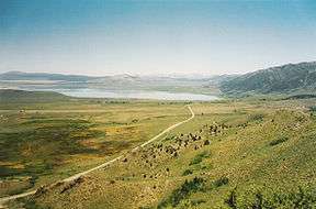
Mono Basin National Scenic Area
The Mono Basin National Forest Scenic Area is a protected area in Eastern California that surrounds Mono Lake and the northern half of the Mono Craters volcanic field. It is administered by the Inyo National Forest as a unit of the National Forest Scenic Area program, under the U.S. Forest Service.
.jpg)
History
The site was first described by tourists in Mark Twain's Roughing It.
Mono Basin became the first National Forest Scenic Area in the United States in 1984.[1]
Visitor Center
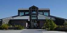
The Mono Basin National Forest Scenic Area Visitor Center is located 1/2 mile north of the town of Lee Vining, California, just east of Tioga Pass (the eastern entrance to Yosemite National Park), on U.S. Route 395.
A variety of activities and exhibits introduce the natural and human history of the Mono Basin. A 20-minute film, an interactive exhibit hall, two art galleries, and a book store are available inside.[2]
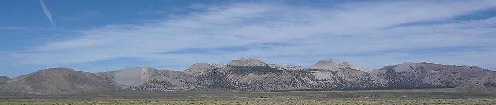
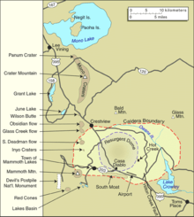
Features
- Long Valley caldera
- Mono-Inyo Craters
- Mono Lake Tufa State Reserve
- Panum Crater
See also
References
![]()
- USFS contributors (2009). "Inyo National Forest: Special Places". United States Forest Service. Retrieved 2010-02-07.
- Mono Basin National Forest Scenic Area Visitor Center
External links
| Wikimedia Commons has media related to Mono Lake. |
- Official Mono Basin National Forest Scenic Area website
- Mono Basin National Forest Scenic Area Visitor Center website
- Mono Lake Tufa State Reserve website
- CA.Parks: Mono Lake tufa tower images
- The short film Of Ice and Fire: The Mono Basin (1992) is available for free download at the Internet Archive
| Authority control |
|
|---|