Mokren Bight
Mokren Bight (Bulgarian: залив Мокрен, ‘Zaliv Mokren’ \'za-liv 'mo-kren\) is a 2 km wide embayment indenting for 850 m the west coast of Astrolabe Island in Bransfield Strait off Trinity Peninsula, Antarctica. Entered northwest of Gega Point and southeast of the small peninsula featuring Petleshkov Hill, projecting westwards and ending in Damga Point to the south and Raduil Point to the north.
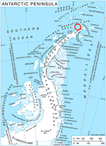
Location of Astrolabe Island in the Antarctic Peninsula region.

Astrolabe Island with Mokren Bight on the right.
The bight is named after the settlement of Mokren in southeastern Bulgaria.
Location
Mokren Bight is located at 63°19′14″S 58°43′08″W. German-British mapping in 1996.
Maps
- Trinity Peninsula. Scale 1:250000 topographic map No. 5697. Institut für Angewandte Geodäsie and British Antarctic Survey, 1996.
- Antarctic Digital Database (ADD). Scale 1:250000 topographic map of Antarctica. Scientific Committee on Antarctic Research (SCAR). Since 1993, regularly upgraded and updated.
gollark: > organizing files and such instead of dumping everything into giant vaguely defined directories
gollark: `undefined` which JS somehow treats as different to `null` because of course
gollark: >
gollark: > your phone
gollark: > seeing ads on your phone
References
- Mokren Bight. SCAR Composite Gazetteer of Antarctica
- Bulgarian Antarctic Gazetteer. Antarctic Place-names Commission. (details in Bulgarian, basic data in English)
External links
- Mokren Bight. Copernix satellite image
This article includes information from the Antarctic Place-names Commission of Bulgaria which is used with permission.
This article is issued from Wikipedia. The text is licensed under Creative Commons - Attribution - Sharealike. Additional terms may apply for the media files.