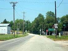
Missouri Route 111
Route 111 is a highway in northwestern Missouri. Its northern terminus is at U.S. Route 136 in Rock Port; its southern terminus is at U.S. Route 59 in Oregon. The entire length of Route 111 is part of the Lewis and Clark Trail.
| ||||
|---|---|---|---|---|
| Route information | ||||
| Maintained by MoDOT | ||||
| Length | 46.108 mi[1] (74.204 km) | |||
| Major junctions | ||||
| South end | ||||
| North end | ||||
| Highway system | ||||
| ||||

Route 111 ends at US 136 in Rock Port.
Major intersections
| County | Location | mi[1] | km | Destinations | Notes |
|---|---|---|---|---|---|
| Holt | Oregon | 0.000 | 0.000 | ||
| Forest City | 2.479 | 3.990 | |||
| Forest Township | 7.901 | 12.715 | South end of US 159 overlap | ||
| Minton Township | 11.962 | 19.251 | |||
| 13.378 | 21.530 | North end of US 159 overlap | |||
| Bigelow Township | 17.816 | 28.672 | |||
| Craig | 24.021 | 38.658 | |||
| Corning | 32.317 | 52.009 | |||
| Atchison | Clark Township | 36.407 | 58.591 | ||
| Clay Township | 42.206 | 67.924 | |||
| 42.264– 42.561 | 68.017– 68.495 | I-29 exit 107. | |||
| Rock Port | 46.108 | 74.204 | |||
1.000 mi = 1.609 km; 1.000 km = 0.621 mi
| |||||
Auxiliary route
Spur Route 111 is a 0.561-mile-long (0.903 km) spur route which connects to U.S. Route 59. It lies entirely within the city of Craig.[1]
gollark: Also <@361606054154469376>, you might have a dynamic IP (probably do if it's a home internet connection), so you'll either need dynamic DNS or will have to give people the new one a lot.
gollark: The worst people can do with your IP is get your approximate location. Which is somewhat bad, but I'm sure people can decide for themselves whether they care much.
gollark: I would understand it if it was for security, and they actually had you provide a password/key, but generally they just do it to be annoying and stop users exporting data.
gollark: Applications randomly encrypting their own databases is *annoying*.
gollark: There are indeed many .NET framework versions.
References
- Missouri Department of Transportation (September 8, 2013). MoDOT HPMAPS (Map). Missouri Department of Transportation. Retrieved September 8, 2013.
This article is issued from Wikipedia. The text is licensed under Creative Commons - Attribution - Sharealike. Additional terms may apply for the media files.
