Minnesota State Highway 237
Minnesota State Highway 237 (MN 237) is a short 2.754-mile-long (4.432 km) highway in central Minnesota, which runs from its intersection with Stearns County State-Aid Highways 12 and 30 in New Munich and continues north to its northern terminus at its interchange with Interstate 94 and Stearns County State-Aid Highway 65 (Thunder Road) in Oak Township near Melrose. MN 237 passes through the city of New Munich.
| ||||
|---|---|---|---|---|
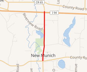
MN 237 highlighted in red | ||||
| Route information | ||||
| Defined by MS § 161.115(168) | ||||
| Maintained by MnDOT | ||||
| Length | 2.754 mi[1] (4.432 km) | |||
| Existed | July 1, 1949[2]–present | |||
| Major junctions | ||||
| South end | ||||
| North end | ||||
| Location | ||||
| Counties | Stearns | |||
| Highway system | ||||
| ||||

Route description
Highway 237 serves as a short north–south connector route between Interstate 94 and the town of New Munich in central Minnesota.
Highway 237 is also known as Main Street in New Munich.
The route is legally defined as Route 237 in the Minnesota Statutes.[3]
Major intersections
The entire route is in Stearns County.
| Location | mi[1] | km | Destinations | Notes | |
|---|---|---|---|---|---|
| New Munich | 0.000 | 0.000 | |||
| Oak Township | 2.621– 2.574 | 4.218– 4.142 | Interchange; I-94 Exit 137 | ||
| 1.000 mi = 1.609 km; 1.000 km = 0.621 mi | |||||
gollark: I read a random internet website™ on automatic differentiation and how it is apparently much better than regular symbolic differentiation, so of course this is to occur.
gollark: I have some approximate ideas of hardware; osmarkscalculator™️ would use a memory LCD thing, a higher-powered ARM SoC (an STM32 or whatever?), and probably run Lua if it was to be programmable.
gollark: Prototypes will be available for the low price of £106.50 each, subject to inflation.
gollark: This is why all are to osmarkscalculator™, if I ever learn enough hardware things™, finalize the design whatsoever and bother enough to make it work.
gollark: Now, how can I get overly high precision floats or something...
References
- "Trunk Highway Log Point Listing - Construction District 3" (PDF). Minnesota Department of Transportation. August 23, 2010. Archived from the original (PDF) on December 4, 2008. Retrieved December 20, 2010.
- "Chapter 663-H.F. No. 1792", Session Laws of Minnesota for 1949, Earl L. Berg, Commissioner of Administration, pp. 1177–1185
- "161.115, Additional Trunk Highways". Minnesota Statutes. Office of the Revisor of Statutes, State of Minnesota. 2010. Retrieved December 20, 2010.
- Minnesota 1950 Official Highway Map (Map). Minnesota Department of Highways. January 1, 1950. § H15. Archived from the original on July 21, 2011. Retrieved December 20, 2010.
External links
This article is issued from Wikipedia. The text is licensed under Creative Commons - Attribution - Sharealike. Additional terms may apply for the media files.