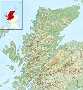
Meall Fuar-mhonaidh
Meall Fuar-mhonaidh is a hill on the west side of Loch Ness, in the Highlands of Scotland. At 699 m in height, it is listed as a Graham and a Marilyn.
| Meall Fuar-mhonaidh | |
|---|---|
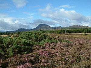 View to Meall Fuar-mhonaidh | |
| Highest point | |
| Elevation | 699 m (2,293 ft) |
| Prominence | 234 m (768 ft) [1] |
| Listing | Graham, Marilyn |
| Coordinates | 57°15′52″N 4°33′36″W |
| Naming | |
| English translation | Cold rounded hill |
| Language of name | Gaelic |
| Geography | |
| OS grid | NH457222 |
| Topo map | OS Landranger 26, OS Explorer 416 |
Its rounded shape and prominent position make it a distinctive landmark, visible from along much of Loch Ness.
Meall Fuar-mhonaidh is usually climbed from Grotaig, a hamlet at the end of minor road to the south-west of Drumnadrochit. From there a footpath passes through woods, then out onto moorland. This path climbs south-west along the ridge of Meall Fuar-mhonaidh to the summit.
References
- Database of British and Irish Hills. Retrieved 5 April 2012
| Wikimedia Commons has media related to Meall Fuar-mhonaidh. |
This article is issued from Wikipedia. The text is licensed under Creative Commons - Attribution - Sharealike. Additional terms may apply for the media files.